- National Park of American Samoa
-
National Park of American Samoa IUCN Category II (National Park)
Location American Samoa, USA Nearest city Pago Pago Coordinates 14°15′30″S 170°41′0″W / 14.25833°S 170.683333°WCoordinates: 14°15′30″S 170°41′0″W / 14.25833°S 170.683333°W Area 10,500 acres (4,200 ha) Established 1988-10-31 Visitors 3,006 (in 2010)[1] Governing body National Park Service Official website The National Park of American Samoa is a national park on the American territory of American Samoa, distributed across three separate islands: Tutuila, Ofu-Olosega, and Ta‘ū. The park includes coral reefs and rain forest and is popular for hiking, snorkeling, and scuba diving, although the primary purpose of the park is that of preservation of Samoa's unique natural resources. Of the park's 10,500 acres (4,200 ha), 7,970 acres (3,230 ha) is land and 2,550 acres (1,030 ha) is water.[2] It is the only American national park south of the equator.
Contents
Tutuila
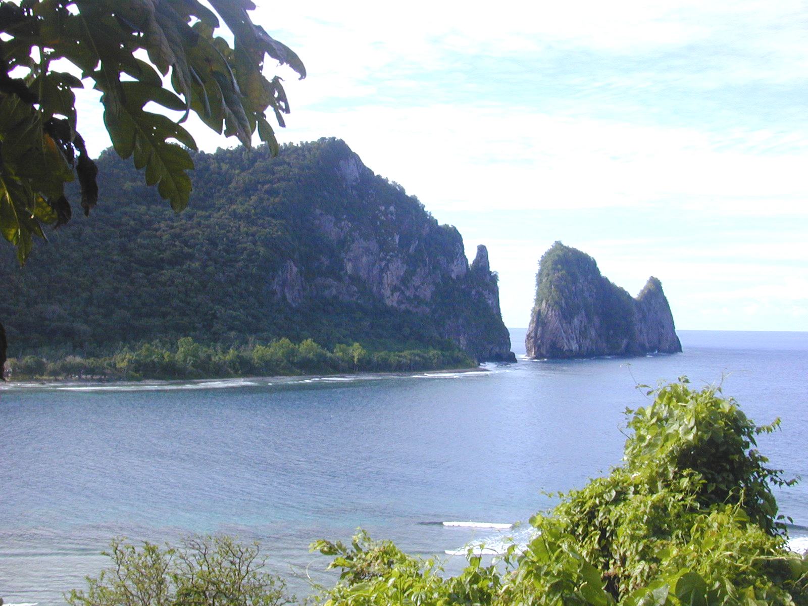
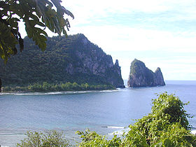 Pola Tai (Cock's comb) off Vatia Bay, National Park of American Samoa, Tutuila.
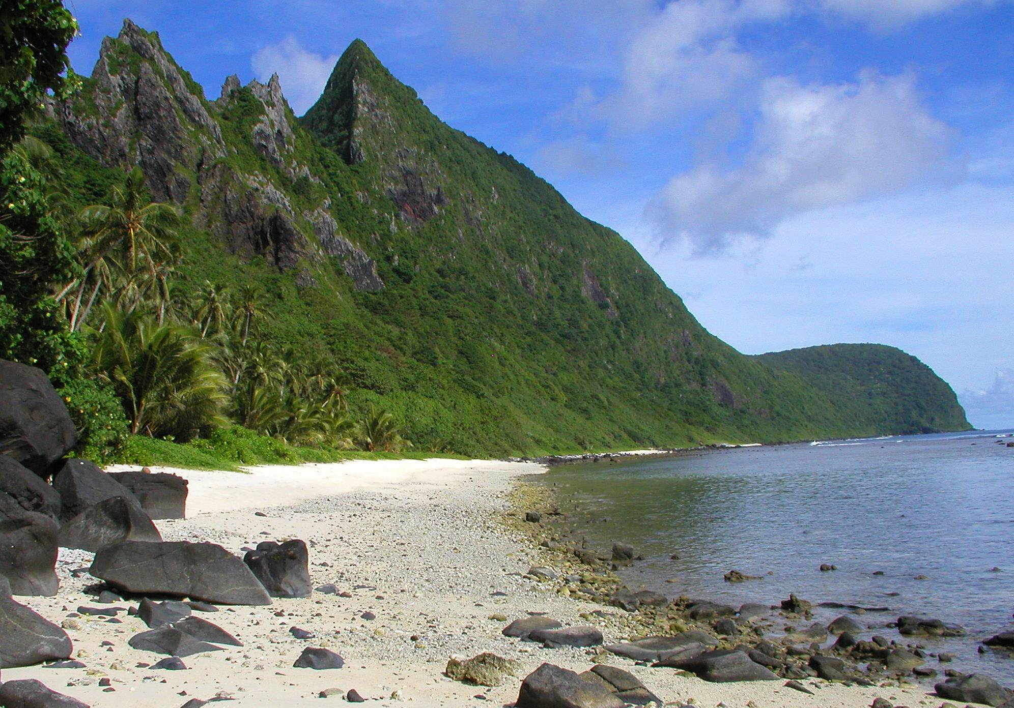
 Beach at Ofu.
The Tutuila unit of the park is on the north end of the island near Pago Pago. It is separated by Mount Alava (1,610 feet (490 m)) and the Maugaloa Ridge and includes the Amalau Valley, Craggy Point, Tafeu Cove, and the islands of Pola and Manofa. It is the only part of the park accessible by car and attracts the vast majority of people. The park lands include a trail to the top of Mount Alava and historic World War II gun emplacement sites at Breakers Point and Blunt's Point.[3] The trail runs along the ridge in dense forest, north of which the land slopes steeply away to the ocean.[4]
Manua Island group
Ofu and Olosega
Ofu and Olosega can be accessed by small plane from the airport on Tutuila to Ofu. Accommodations are available on Ofu at the airport and at Asaga.
Ta‘ū
Ta‘ū can be reached by a flight from Tutuila to Fiti‘uta on Ta‘ū. Accommodations are available on Ta‘ū. A trail runs from Saua around Si’u Point to the southern coastline and stairs to the 3,000-foot (910 m) summit of Lata Mountain.
Biodiversity
Because of its remote location, diversity among the terrestrial species is low. Approximately 30% of the plants and one bird species (the Samoan Starling) are endemic to the archipelago.[5]
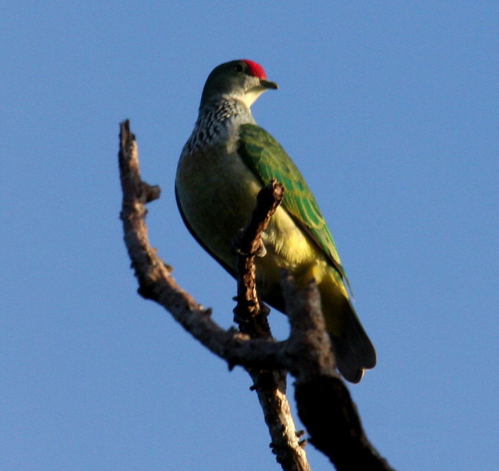
 The Many-coloured Fruit-dove has been found in the park.
Fauna
Three species of bat are the only native mammals: two large fruit bats (Samoa Flying-fox and Insular Flying-fox) and a small insectivore, the Pacific Sheath-Tailed Bat. They serve an important role in pollinating the island's plants. The sheath-tailed bat was nearly eliminated by Cyclone Val in 1991. Native reptiles include the Pelagic Gecko, Polynesian Gecko, Mourning gecko, Stump-toed Gecko, Pacific Boa and seven skink species.[6] A major role for the park is to control and eradicate invasive plant and animal species such as feral pigs and rats, which threaten the park's ecosystem. There are several bird species, the most predominant being the Wattled Honeyeater, Samoan Starling, and Pacific Imperial-pigeon.[7] Other unusual birds include the Tahiti Petrel, the Spotless Crake, and the rare (in this locality) Many-coloured Fruit-dove.[5]
Flora
The islands are mostly covered by tropical rainforest, including cloud forest on Tau and lowland ridge forest on Tutuila. Most plants arrived by chance from Southeast Asia. There are 487 native flowering plants and ferns and over 100 endemic plant species.[5]
Marine
The surrounding waters are filled with a diversity of marine life, including sea turtles, humpback whales, about 890 species of fish, and 200 coral species.[5] Some of the largest living coral colonies (Porites) in the world are at Tau Island.[citation needed]
History
The National Park of American Samoa was established on October 31, 1988 by Public Law 100-571[8] but the NPS could not buy the land because of traditional communal land system. This was resolved on September 9, 1993, when the National Park Service entered into a 50-year lease for the park land from the Samoan village councils. In 2002, Congress approved a thirty percent expansion on Olosega and Ofu islands.[9]
In 2009 an earthquake and tsunami produced several large waves, resulting in 32 confirmed deaths, more than a hundred injuries and the destruction of about 200 homes and businesses. The park encountered major damage. The visitor center and main office were destroyed but there was only one reported injury among the NPS staff and volunteers.[10]
Threats
The coral reefs are under significant threat due to rising ocean temperatures and carbon dioxide concentration, as well as sea level rise. As a result of these and other stresses, the corals that form the reefs are projected to be lost by mid-century if carbon dioxide concentrations continue to rise at their current rate.[11]
See also
- Samoan plant names
- List of birds of Samoa
References
- ^ "Five Year Annual Recreation Visits Report". Public Use Statistic Office, National Park Service. http://www.nature.nps.gov/stats/viewReport.cfm?selectedReport=SystemComparisonReport.cfm. Retrieved 2011-08-27.
- ^ US National Park Service: General Management Plan 1997, retrieved 2009-10-01
- ^ "Hiking and Beachwalking". National Park Service. http://www.nps.gov/npsa/planyourvisit/hiking.htm. Retrieved 2009-01-30.
- ^ National Geographic Guide to the National Parks of the United States. National Geographic Society. 2006. ISBN 0-7922-5322-1.
- ^ a b c d Hart, Risé (2005-02-14). "Pacific Island Network Vital Signs Monitoring Plan--Appendix A: National Park of American Samoa Resource Overview". National Park Service. http://www.nature.nps.gov/im/units/pacn/monitoring/plan/PACN_MP_AppendixA_NPSA.pdf. Retrieved 2009-01-30.
- ^ National Park home page, retrieved 2009-10-01
- ^ Craig, P.. "Natural History Guide to American Samoa". National Park of American Samoa, Department Marine and Wildlife Resources, American Samoa Community College. http://www.botany.hawaii.edu/basch/uhnpscesu/pdfs/NatHistGuideAS09op.pdf. Retrieved 2009-08-16.
- ^ "Public Law No: 100-571". Library of Congress: THOMAS. 1988-10-31. http://www.thomas.gov/cgi-bin/bdquery/z?d100:H.R.4818:. Retrieved 2009-01-30.
- ^ "Public Law No: 107-336". Library of Congress: THOMAS. 2002-12-16. http://www.thomas.gov/cgi-bin/bdquery/z?d107:H.R.1712:. Retrieved 2009-01-30.
- ^ "American Samoa Earthquake and Tsunami Damage". Department of the Interior. http://www.doi.gov/emergency/docs/10-13-09%20DOI%20American%20Samoa%20roundup%20fq.pdf. Retrieved 2011-08-27.
- ^ Report to the Congress Global Climate Change Impacts in the United States, 2009
Bibliography
- The National Parks: Index 2001–2003. Washington: U.S. Department of the Interior.
External links
- National Park of American Samoa travel guide from Wikitravel
- National Park Service: National Park of American Samoa
- National Park Service map of the Manu‘a Islands showing the present park boundaries (pdf).
- Seacology National Park of American Samoa projects Seacology
- Birds of the National Park of American Samoa
National parks of the United States Acadia • American Samoa • Arches • Badlands • Big Bend • Biscayne • Black Canyon of the Gunnison • Bryce Canyon • Canyonlands • Capitol Reef • Carlsbad Caverns • Channel Islands • Congaree • Crater Lake • Cuyahoga Valley • Death Valley • Denali • Dry Tortugas • Everglades • Gates of the Arctic • Glacier • Glacier Bay • Grand Canyon • Grand Teton • Great Basin • Great Sand Dunes • Great Smoky Mountains • Guadalupe Mountains • Haleakalā • Hawaiʻi Volcanoes • Hot Springs • Isle Royale • Joshua Tree • Katmai • Kenai Fjords • Kings Canyon • Kobuk Valley • Lake Clark • Lassen Volcanic • Mammoth Cave • Mesa Verde • Mount Rainier • North Cascades • Olympic • Petrified Forest • Redwood • Rocky Mountain • Saguaro • Sequoia • Shenandoah • Theodore Roosevelt • Virgin Islands • Voyageurs • Wind Cave • Wrangell-St. Elias • Yellowstone • Yosemite • Zion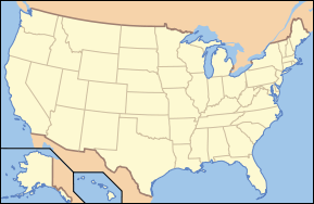
List of National Parks of the United States (by elevation) Federal National ParksNational Park of American SamoaNational Wildlife RefugesRose Atoll Marine National MonumentCategories:- IUCN Category II
- National parks of the United States
- Protected areas of American Samoa
- Geography of American Samoa
- Protected areas established in 1988
- Conservation in Samoa
- Biota of Samoa
- Flora of Samoa

Wikimedia Foundation. 2010.