- Dothan, Alabama metropolitan area
-
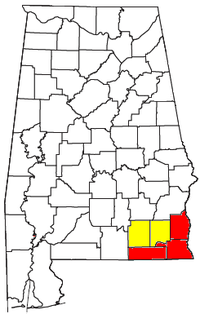 Location of the Dothan-Enterprise-Ozark CSA, with the Dothan Metropolitan Statistical Area highlighted in red
The Dothan Metropolitan Statistical Area, as defined by the United States Census Bureau, is an area consisting of three counties in southeastern Alabama, anchored by the city of Dothan. As of the 2000 census, the MSA had a population of 130,861 (though a July 1, 2009 estimate placed the population at 142,693).[1]
Contents
Counties
Communities
Places with more than 50,000 inhabitants
Places with 2,000 to 10,000 inhabitants
Places with 1,000 to 2,000 inhabitants
Places with less than 1,000 inhabitants
Demographics
As of the census[3] of 2000, there were 130,861 people, 52,836 households, and 37,308 families residing within the MSA. The racial makeup of the MSA was 74.92% White, 22.81% African American, 0.43% Native American, 0.45% Asian, 0.02% Pacific Islander, 0.51% from other races, and 0.86 % from two or more races. Hispanic or Latino of any race were 1.39% of the population.
The median income for a household in the MSA was $30,411, and the median income for a family was $37,185. Males had a median income of $29,100 versus $20,226 for females. The per capita income for the MSA was $16,353.
Combined Statistical Area
The Dothan Metropolitan Statistical Area is a significant part of the Dothan-Enterprise-Ozark Combined Statistical Area, which is composed of the Dothan metropolitan area and the Enterprise-Ozark micropolitan area. As of the 2000 census, the CSA had a population of 223,605 (though a July 1, 2009 estimate placed the population at 239,475).[4]
See also
References
- ^ "Table 1. Annual Estimates of the Population of Metropolitan and Micropolitan Statistical Areas: April 1, 2000 to July 1, 2009 (CBSA-EST2009-01)" (CSV). 2009 Population Estimates. United States Census Bureau, Population Division. 2010-03-23. http://www.census.gov/popest/metro/tables/2009/CBSA-EST2009-01.csv. Retrieved 2010-03-24.
- ^ Dothan lies in three counties – Houston, Henry, and Dale. Most of the city is in Houston County with small portions extending into the neighboring counties. The small portion of Dothan in Dale County is considered part of the Enterprise-Ozark Micropolitan Statistical Area, while the Houston and Henry County portions are part of the Dothan Metropolitan Statistical Area.
- ^ "American FactFinder". United States Census Bureau. http://factfinder.census.gov. Retrieved 2008-01-31.
- ^ "Table 2. Annual Estimates of the Population of Combined Statistical Areas: April 1, 2000 to July 1, 2009 (CBSA-EST2009-02)" (CSV). 2009 Population Estimates. United States Census Bureau, Population Division. 2010-03-23. http://www.census.gov/popest/metro/tables/2009/CBSA-EST2009-02.csv. Retrieved 2010-03-24.
 State of Alabama
Topics - Index
- History
- Geography
- People
- Delegations
- Government
- Governors
- Lieutenant Governors
- Metropolitan Areas
- Visitor Attractions
- National Historic Landmarks
Regions Metros - Greater Birmingham
- Montgomery Metro Area
- Mobile Metro Area
- Huntsville Metro Area
Larger cities Counties - Autauga
- Baldwin
- Barbour
- Bibb
- Blount
- Bullock
- Butler
- Calhoun
- Chambers
- Cherokee
- Chilton
- Choctaw
- Clarke
- Clay
- Cleburne
- Coffee
- Colbert
- Conecuh
- Coosa
- Covington
- Crenshaw
- Cullman
- Dale
- Dallas
- DeKalb
- Elmore
- Escambia
- Etowah
- Fayette
- Franklin
- Geneva
- Greene
- Hale
- Henry
- Houston
- Jackson
- Jefferson
- Lamar
- Lauderdale
- Lawrence
- Lee
- Limestone
- Lowndes
- Macon
- Madison
- Marengo
- Marion
- Marshall
- Mobile
- Monroe
- Montgomery
- Morgan
- Perry
- Pickens
- Pike
- Randolph
- Russell
- Shelby
- St. Clair
- Sumter
- Talladega
- Tallapoosa
- Tuscaloosa
- Walker
- Washington
- Wilcox
- Winston
Categories:- Dothan metropolitan area
- Geography of Houston County, Alabama
- Geography of Henry County, Alabama
- Geography of Geneva County, Alabama

Wikimedia Foundation. 2010.