- Eunola, Alabama
Infobox Settlement
official_name = Eunola, Alabama
settlement_type =Town
imagesize =
image_caption =
image_
imagesize =
image_caption =
image_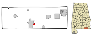
mapsize = 250px
map_caption = Location in Geneva County and the state ofAlabama
mapsize1 =
map_caption1 =
subdivision_type = Country
subdivision_type1 = State
subdivision_type2 = County
subdivision_name =United States
subdivision_name1 =Alabama
subdivision_name2 = Geneva
government_type =
leader_title =
leader_name =
established_date =
area_magnitude =
area_total_km2 = 2.4
area_total_sq_mi = 0.9
area_land_km2 = 2.4
area_land_sq_mi = 0.9
area_water_km2 = 0
area_water_sq_mi = 0
elevation_ft = 138
elevation_m = 42
population_as_of = 2000
population_footnotes =
population_total = 182
population_metro =
population_density_km2 = 75.8
population_density_sq_mi = 202.2
timezone = Central (CST)
utc_offset = -6
latd = 31 |latm = 2 |lats = 19 |latNS = N
longd = 85 |longm = 50 |longs = 43 |longEW = W
timezone_DST = CDT
utc_offset_DST = -5
postal_code_type =ZIP code
postal_code = 36340
area_code = 334
blank_name = FIPS code
blank_info = 01-24616
blank1_name = GNIS feature ID
blank1_info = 0118055
footnotes =
website =Eunola "was" a town in Geneva County,
Alabama ,United States . It is part of theDothan, Alabama Metropolitan Statistical Area. At the 2000 census the population was 182.Geography
Eunola is located at coor dms|31|2|20|N|85|50|43|W|city (31.038766, -85.845415)GR|1.
According to the
U.S. Census Bureau , the town has a total area of 1.0square mile s (2.5km² ), of which, 0.9 square miles (2.4 km²) of it is land and 0.04 square miles (0.1 km²) of it (2.08%) is water.Demographics
As of the
census GR|2 of 2000, there were 182 people, 87 households, and 56 families residing in the town. Thepopulation density was 192.8 people per square mile (74.8/km²). There were 97 housing units at an average density of 102.7/sq mi (39.8/km²). The racial makeup of the town was 89.56% White, 8.79% Black or African American, 0.55% Native American, and 1.10% from two or more races. 0.55% of the population were Hispanic or Latino of any race.There were 87 households out of which 28.7% had children under the age of 18 living with them, 44.8% were married couples living together, 12.6% had a female householder with no husband present, and 35.6% were non-families. 34.5% of all households were made up of individuals and 6.9% had someone living alone who was 65 years of age or older. The average household size was 2.09 and the average family size was 2.66.
In the town the population was spread out with 20.9% under the age of 18, 9.9% from 18 to 24, 24.2% from 25 to 44, 30.8% from 45 to 64, and 14.3% who were 65 years of age or older. The median age was 43 years. For every 100 females there were 109.2 males. For every 100 females age 18 and over, there were 97.3 males.
The median income for a household in the town was $26,250, and the median income for a family was $32,188. Males had a median income of $25,000 versus $16,250 for females. The
per capita income for the town was $15,120. About 10.2% of families and 14.6% of the population were below thepoverty line , including 16.0% of those under the age of eighteen and 15.8% of those sixty five or over.Loss of Charter
The Town of Eunola was dissolved by the probate and circuit court in 2007 for not holding elections for decades. Attorney Jeffery D. Hatcher of Geneva, AL filed suit after the town tried to enforce a property ordinance that was not within the towns limits on behalf of his client. The Alabama Attorney General dismissed a request for a new charter by the former leaders of the town.
References
External links
Wikimedia Foundation. 2010.