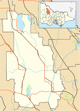
- Ninda, Victoria
-
Ninda
VictoriaPostcode: 3533 Coordinates: 35°27′15″S 142°45′30″E / 35.45417°S 142.75833°ECoordinates: 35°27′15″S 142°45′30″E / 35.45417°S 142.75833°E Location: LGA: Shire of Buloke Ninda is a locality in Victoria, Australia, located approximately 56km from Hopetoun, Victoria.
Ninda Post Office opened on 2 November 1914 when the railway arrived and closed in 1958. [2]
References
- ^ Travelmate
- ^ Premier Postal History, Post Office List, https://www.premierpostal.com/cgi-bin/wsProd.sh/Viewpocdwrapper.p?SortBy=VIC&country=, retrieved 2008-04-11
Towns in the Shire of Buloke Berriwillock · Bimbourie · Birchip · Boigbeat · Charlton · Culgoa · Donald · Dumosa · Glenloth · Glenloth East · Kalpienung · Lake Tyrrell · Nandaly · Ninda · Nullawil · Nyarrin · Sea Lake · Springfield · Watchem · Wycheproof ·
Categories:- Towns in Victoria (Australia)
- Victoria (Australia) geography stubs
Wikimedia Foundation. 2010.

