- Nichols Point, Victoria
-
Nichols Point
Victoria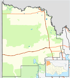
 Nichols Point
Population: 837[1] Postcode: 3501 Coordinates: 34°12′50″S 142°11′10″E / 34.21389°S 142.18611°ECoordinates: 34°12′50″S 142°11′10″E / 34.21389°S 142.18611°E Location: - 540 km (336 mi) from Melbourne
- 4 km (2 mi) from Mildura
- 98 km (61 mi) from Ouyen
- 14 km (9 mi) from Red Cliffs [2]
LGA: Rural City of Mildura State District: Mildura Federal Division: Mallee Nichols Point is a small township in Victoria, Australia, located approximately 4 km from Mildura, Victoria. The Post Office opened on 8 April 1908 although known as Nicholl's Point until around 1949.[3] The Post Office now includes a General Store, small supermarket and bottle shop. At the 2006 census, Nichols Point had a population of 837.[1]
The town has a Primary School with over 300 students. The Nichols Point School opened in May 1892, and classes were initially held in a "bough shelter" structure until the local Methodist Church was leased in July 1892 (on the corner of 5th Street and Koorlong Avenue). In 1907 the school moved into a brick building in Fifth Street. In 2007 a complete new school was opened in Koorlong Avenue.
The area is predominantly irrigated farmland.
Golfers play at the course of the Riverside Golf Club on Park Street.[4]
Nearby is the Kings Billabong Wildlife Reserve, managed by Parks Victoria. Bordered by a wide stretch of the Murray River, home to majestic River Red Gums and a fantastic variety of birdlife, Kings Billabong Reserve is an ideal place to discover nature and history within minutes of Nichols Point and Mildura.
Nichols Point is colloquially referred to by it's inhabitants, and people from surrounding areas, as 'The N.P'. Additionally, large amounts graffiti written by proud Nichols Pointians can be found around the township of Mildura and throughout Sunraysia, mainly consisting of 'N.P' and '3501' (The postcode of the area).
References
- ^ a b Australian Bureau of Statistics (25 October 2007). "Nichols Point (State Suburb)". 2006 Census QuickStats. http://www.censusdata.abs.gov.au/ABSNavigation/prenav/LocationSearch?collection=Census&period=2006&areacode=SSC26345&producttype=QuickStats&breadcrumb=PL&action=401. Retrieved 2 March 2010.
- ^ Travelmate
- ^ Premier Postal History, Post Office List, https://www.premierpostal.com/cgi-bin/wsProd.sh/Viewpocdwrapper.p?SortBy=VIC&country=, retrieved 2008-04-11
- ^ Golf Select, Riverside, http://www.golfselect.com.au/armchair/courseView.aspx?course_id=2119, retrieved 2009-05-11
http://internet.nicholspointps.vic.edu.au/ http://www.parkweb.vic.gov.au/1park_display.cfm
Towns in the Rural City of Mildura Big Desert • Birdwoodton • Boinka • Cabarita • Cardross • Carina • Carwarp • Colignan • Cowangie • Cullulleraine • Hattah • Iraak • Irymple • Koorlong • Kulwin • Lindsay Point • Linga • Merbein • Merbein South • Merbein West • Meringur • Merrinee • Mildura • Mittyack • Murrayville • Nangiloc • Neds Corner • Nichols Point • Ouyen • Panitya • Patchewollock • Red Cliffs • Tempy • Torrita • Tutye • Underbool • Walpeup • Wargan • Werrimull • Yelta •

This article about a location in the Mallee is a stub. You can help Wikipedia by expanding it.
