- Murnungin, Victoria
-
Murnungin
Victoria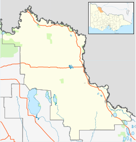
 Murnungin
Postcode: 3544 Coordinates: 35°37′S 143°14′E / 35.617°S 143.233°ECoordinates: 35°37′S 143°14′E / 35.617°S 143.233°E Location: - 334 km (208 mi) from Melbourne
- 49 km (30 mi) from Swan Hill
- 51 km (32 mi) from Quambatook
- 86 km (53 mi) from Kerang [1]
LGA: Rural City of Swan Hill Murnungin is a locality in Victoria, Australia, located approximately 49 km from Swan Hill, Victoria.
References
Towns in the Rural City of Swan Hill Annuello • Bannerton • Beverford • Bolton • Boundary Bend • Castle Donnington • Chillingollah • Chinangin • Chinkapook • Cocamba • Fish Point • Gerahmin • Goschen • Gowanford • Kooloonong • Kunat • Lake Boga • Lake Powell • Liparoo • Manangatang • Meatian • Murnungin • Natya • Nowie • Nyah • Nyah West • Nyrraby • Pental Island • Piangil • Pira • Robinvale • Speewa • Swan Hill • Tol Tol • Tresco • Tyntynder • Ultima • Vinifera • Waitchie • Wandown • Wemen • Winnambool • Woorinen South •

This article about a location in the Mallee is a stub. You can help Wikipedia by expanding it.
