- Meringur, Victoria
-
Meringur
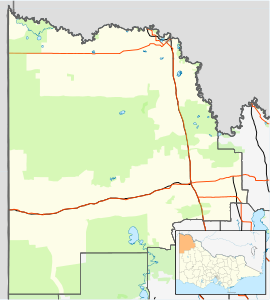
VictoriaPopulation: 147[1] Postcode: 3496 Location: LGA: Rural City of Mildura State District: Mildura Federal Division: Mallee Meringur is a farming settlement to the west of Mildura in northwestern Victoria, Australia. At the 2006 census, Meringur and the surrounding area had a population of 147.[1] It is located at the end of the Red Cliffs-Meringur Road towards the South Australian border.
The Post Office opened on 2 February 1926.[2]
Located in Meringur is the Millewa Pioneer Forest and Historical Village open air museum. [1]
Meringur has an Australian Rules football team competing in the Millewa Football League.
References
- ^ a b Australian Bureau of Statistics (25 October 2007). "Meringur (State Suburb)". 2006 Census QuickStats. http://www.censusdata.abs.gov.au/ABSNavigation/prenav/LocationSearch?collection=Census&period=2006&areacode=SSC26143&producttype=QuickStats&breadcrumb=PL&action=401. Retrieved 5 August 2007.
- ^ Premier Postal History, Post Office List, https://www.premierpostal.com/cgi-bin/wsProd.sh/Viewpocdwrapper.p?SortBy=VIC&country=, retrieved 11 April 2008
Towns in the Rural City of Mildura Big Desert • Birdwoodton • Boinka • Cabarita • Cardross • Carina • Carwarp • Colignan • Cowangie • Cullulleraine • Hattah • Iraak • Irymple • Koorlong • Kulwin • Lindsay Point • Linga • Merbein • Merbein South • Merbein West • Meringur • Merrinee • Mildura • Mittyack • Murrayville • Nangiloc • Neds Corner • Nichols Point • Ouyen • Panitya • Patchewollock • Red Cliffs • Tempy • Torrita • Tutye • Underbool • Walpeup • Wargan • Werrimull • Yelta •
Coordinates: 34°23′S 141°20′E / 34.383°S 141.333°E

This article about a location in the Mallee is a stub. You can help Wikipedia by expanding it.

