- Renmark, South Australia
Infobox Australian Place | type = town
name = Renmark
state = sa
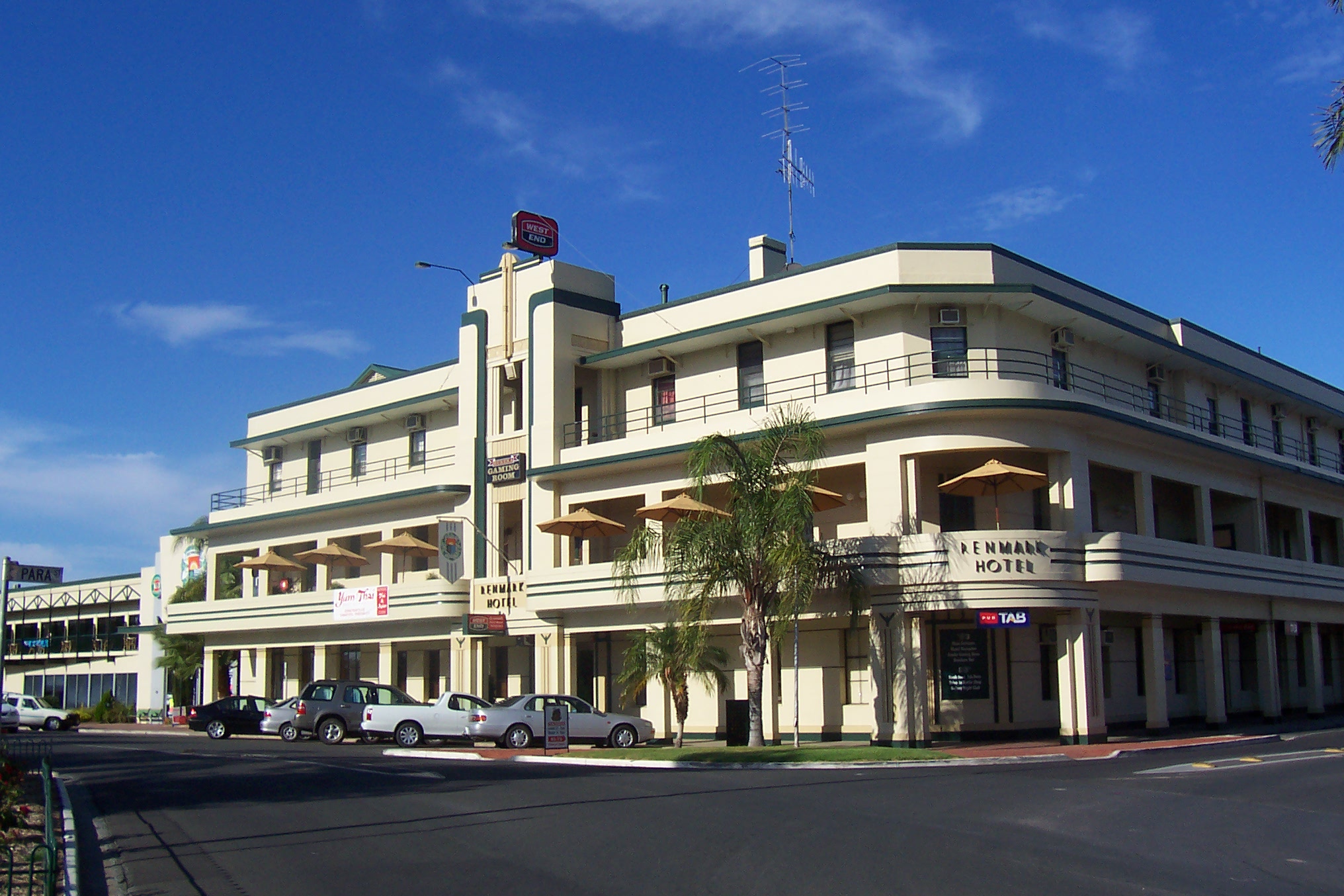
caption = Renmark Hotel was the first community-owned hotel in theBritish Empire
lga =District Council of Renmark Paringa
postcode = 5341
pop = 8,054
est = 1904
elevation= 31
maxtemp = 24.3
mintemp = 10.9
rainfall = 260.6
stategov = Chaffey
fedgov = Barker
dist1 = 254
location1= AdelaideRenmark is a
town inSouth Australia 's ruralRiverland area, and is located 254 km northeast ofAdelaide , on the banks of theRiver Murray . TheSturt Highway betweenAdelaide andSydney runs through the town; Renmark is the last major town encountered inSouth Australia when driving this route. It is 31 m abovesea level . As of 2000, the population of Renmark (combined with the neighbouring settlement ofLyrup ) was 8,054. It is the oldest European settlement on the River Murray.History
The name Renmark refers to an Aboriginal word meaning "Red Mud" - the original inhabitants of the area were the
Naralte tribe.Captain Charles Sturt was the first European to pass though the area in January 1830, as he navigated the length of the Murray from the
Great Dividing Range , eventually reaching Lake Alexandrina.A settlement began to grow in 1887, when the Renmark
Irrigation Settlement was established by George andWilliam Chaffey , who created a system of open drains using water from the Murray, to alloworchard s to be planted in the area. By pumping water onto the hot red sand they transformed it into a fruit growing area similar toCalifornia . Renmark was proclaimed a town in 1904 and a municipality in 1935.Bush poet and soldier
Breaker Morant worked locally, at theParinga Station in the1890s , before serving in the Boer War.Renmark is famous among Australian youth for being the closest town to the vineyard on which the concept of
box wine or goon was invented in 1965.Renmark was connected by rail on 31 January, 1927. ["Rails into Renmark" Shields, Brian Australian Railway Historical Society Bulletin, February, 1999 pp43-51]
Climate and geography
Renmark exists in a
semi-arid location, aboveGoyder's Line . Renmark is surrounded bymallee scrub. Renmark has a dryMediterranean climate with seasonal temperatures a few degrees aboveAdelaide 's temperatures. The average winter temperature is 16.2 °C and the average summer temperature is 32.5 °C. Average rainfall of Renmark is 260.6 millimetres. The weather patterns are similar to those of Adelaide.Renmark today
Renmark is a multicultural centre for the Riverland area. It consists of elegant wide streets. The river itself offers excellent spots for
fishing ,waterskiing andboating .The area is known for the cultivation of
grape s,citrus fruits ,tomato es,vegetable s,wheat andwool . Orange trees stretch for hectares as do vineyards andstone fruit orchards. Other industries includealmond growing andpistachio nut cultivation.Renmark is also home to a wildlife park, wine companies and the rose industry. Renmark hosts the Renmark Rose Festival every October.
In late
2007 , a shopping complex featuringBig W and Woolworths opened to the community of Renmark.Governance
The town falls within the boundaries of the
District Council of Renmark Paringa . It is in the State electorate of Chaffey and the federaldivision of Barker .ee also
*
1956 Murray River flood
*River Murray CrossingsReferences
External links and references
* [http://theage.com.au/news/South-Australia/Renmark/2005/02/17/1108500204654.html/ The Age travelguide - Renmark]
* [http://www.bom.gov.au/climate/averages/tables/cw_024016.shtml/ Bureau of Meteorology: Renmark Weather Statistics]
Wikimedia Foundation. 2010.