- Merrinee, Victoria
-
Merrinee
Victoria
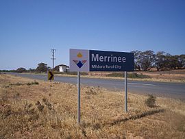
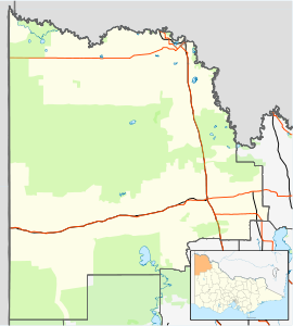
MerrineePostcode: 3496 Location: LGA: Rural City of Mildura Region: Sunraysia State District: Mildura Federal Division: Mallee Merrinee is a locality situated in the Sunraysia region. The place by road, is situated about 7 kilometres west from Pirlta and 11 kilometres east from Karawinna on the Red Cliffs-Meringur Road.
The Post Office opened on 30 May 1924.[2]
The area of the locality contains a number of previous localities which existed when the population was larger, namely Thurla 34°22′S 142°06′E / 34.367°S 142.1°E which had a post office open from 1925 until 1940, Benetook34°22′00″S 142°00′00″E / 34.3666667°S 142°E with a post office from 1925 until 1946 and Pirlta 34°21′55″S 141°53′59″E / 34.36528°S 141.89972°E with a post office from 1911 until 1961.[2]
References
- ^ Travelmate
- ^ a b Premier Postal History, Post Office List, https://www.premierpostal.com/cgi-bin/wsProd.sh/Viewpocdwrapper.p?SortBy=VIC&country=, retrieved 2008-04-11
Towns in the Rural City of Mildura Big Desert • Birdwoodton • Boinka • Cabarita • Cardross • Carina • Carwarp • Colignan • Cowangie • Cullulleraine • Hattah • Iraak • Irymple • Koorlong • Kulwin • Lindsay Point • Linga • Merbein • Merbein South • Merbein West • Meringur • Merrinee • Mildura • Mittyack • Murrayville • Nangiloc • Neds Corner • Nichols Point • Ouyen • Panitya • Patchewollock • Red Cliffs • Tempy • Torrita • Tutye • Underbool • Walpeup • Wargan • Werrimull • Yelta •
Coordinates: 34°22′17″S 141°48′03″E / 34.37139°S 141.80083°E

This article about a location in the Mallee is a stub. You can help Wikipedia by expanding it.


