- Eleventh Avenue (Manhattan)
-
Eleventh Avenue is a north-south thoroughfare on the far West Side of the borough of Manhattan in New York City, not far from the Hudson River. It carries downtown (southbound) traffic only, south of West 44th Street, and two-way traffic north of it.
Eleventh Avenue originates in the Meatpacking District in the West Village neighborhood, near the corner of West 14th Street, and runs uptown (northward) until its intersection with West 59th Street, where West End Avenue begins.
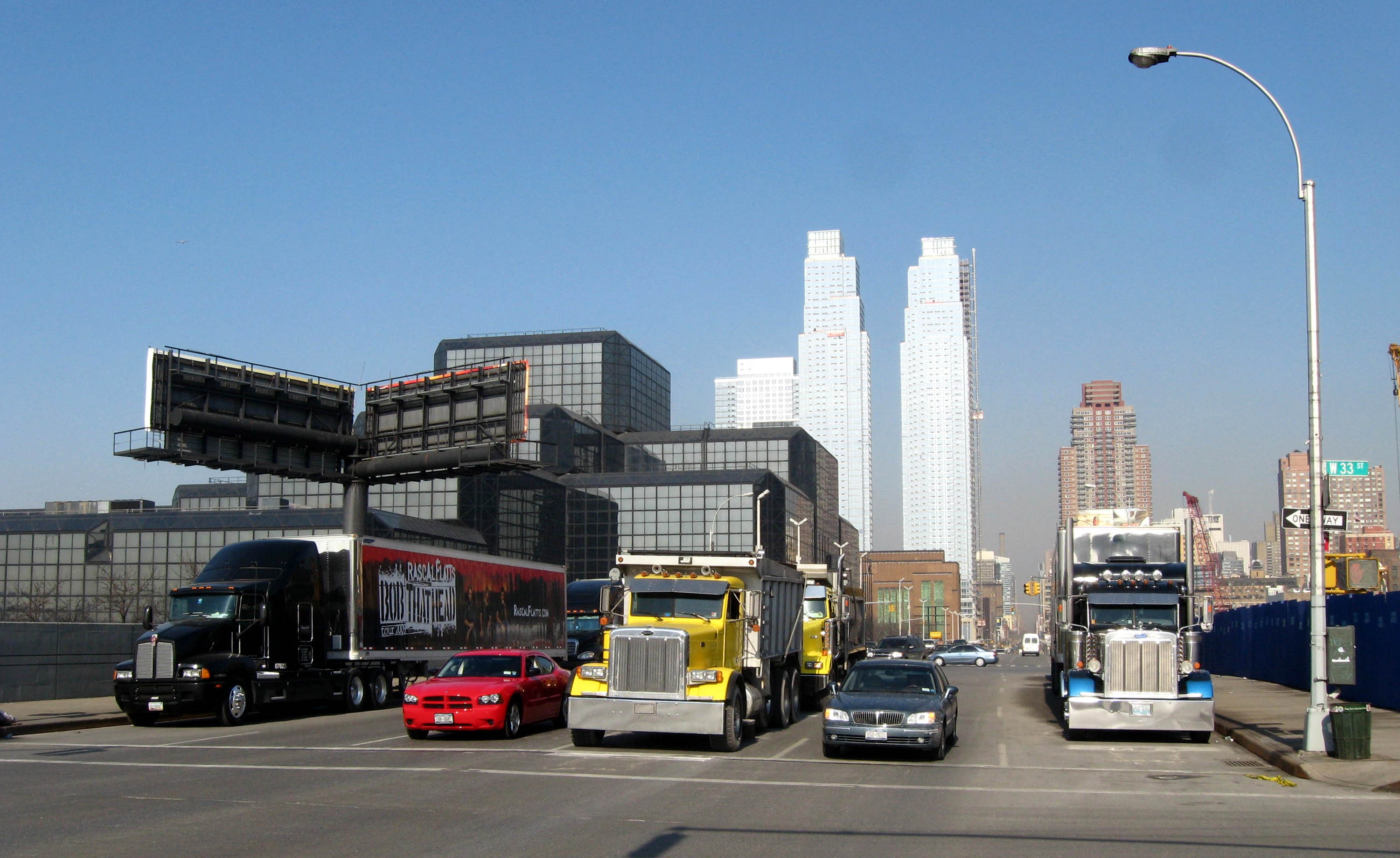
 Trucks passing Convention Center and Silver Towers

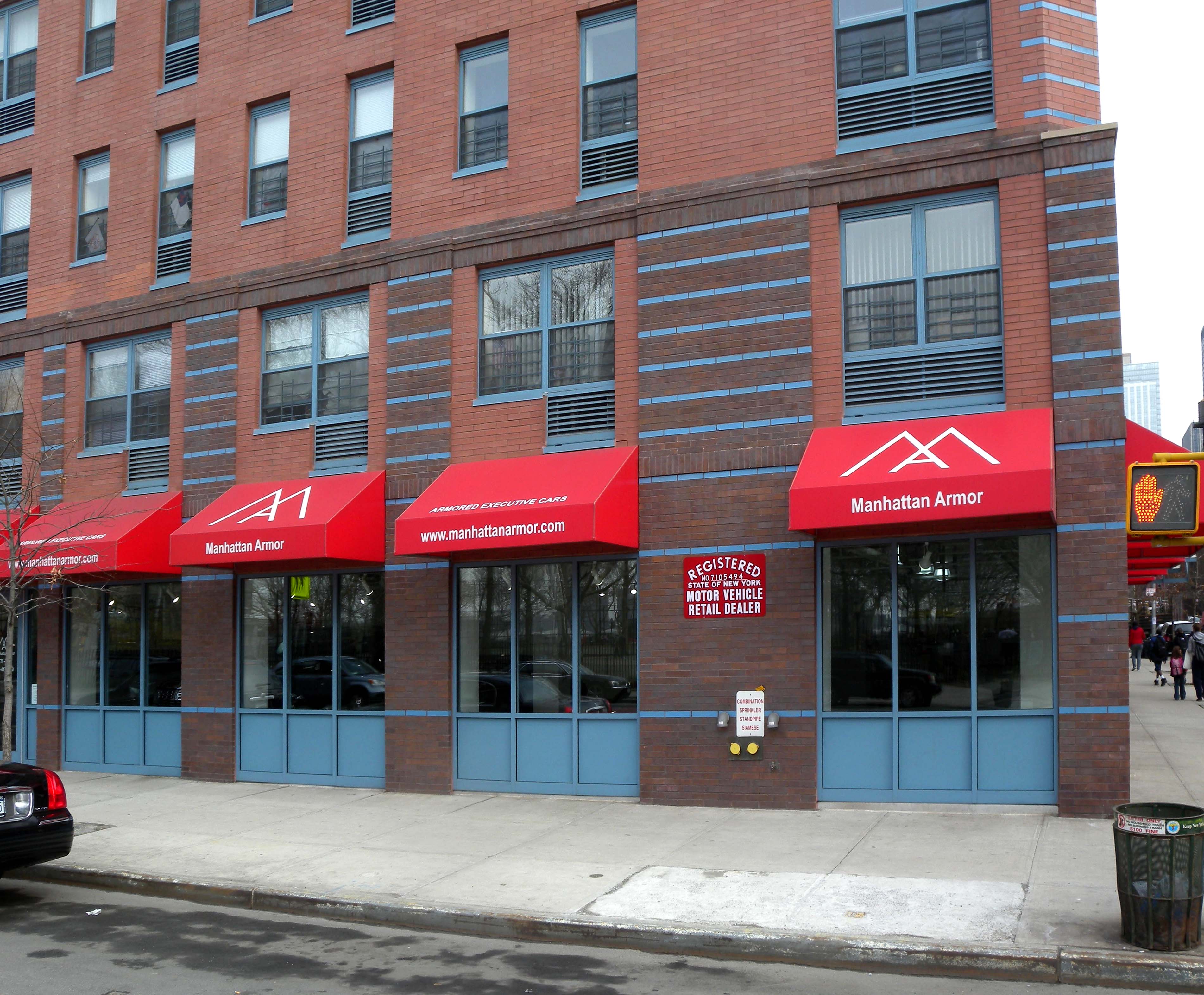
 Armored limousine dealer at 52nd Street
Between West 14th Street and West 23rd Street, Eleventh Avenue is part of the West Side Highway. At West 22nd Street, Twelfth Avenue/West Side Highway begins from a split with Eleventh Avenue.
The West Side Line of the New York Central Railroad once had on-street running along part of Eleventh Avenue, popularly called "Death Avenue".[1]
The segment between approximately West 39th Street and West 59th Street is home to the largest concentration of auto dealerships in Manhattan. Mercedes-Benz is located across from the westbound Lincoln Tunnel Portal, with BMW and Lexus at the intersection with West 57th Street. Manhattan Motorcars (located at 270 Eleventh Avenue) is New York City's official Lamborghini, Bentley, Rolls-Royce, Spyker Cars, Porsche, and Lotus dealership. As well, numerous vehicle service stations, car washes, and car rental lots are found along this stretch. This area has served the transport trade for more than a hundred years; most of the stables for New York's remaining horse cabs are located on its side streets, though many now store taxis and pedicabs.
West End Avenue in the 60s has mixed commercial and residential use, while the northern two miles (3 km) are a sedate residential street.
In 1934, a bill was passed for the Henry Hudson Parkway to be constructed, meant to be an alternative route to "Death Avenue".
Points of interest on or within one block of Eleventh Avenue
- CBS Broadcast Center (at 57th Street)
- Chelsea Market (between 15th and 16th Streets)
- Chelsea Piers (at 23rd Street and West Side Highway)
- Comedy Central studios of The Colbert Report (on 54th Street off Eleventh Avenue)
- Comedy Central studios of The Daily Show (at 51st Street)
- Copacabana Nightclub (at 34th Street)
- DeWitt Clinton Park (between 52nd Street and 54th Street)
- The High Line (roughly parallel to Eleventh Avenue from Gansevoort Street to 34th Street)
- The Jacob K. Javits Convention Center (between 34th and 39th Streets)
- Michael J. Quill Bus Depot of the MTA (at 41st Street)
References
- ^ Staff. "STATE MAY REGULATE TRACKS IN 11TH AVE.; Court Denies Right of City to Disturb New York Central in Use of the Street.", The New York Times, May 20, 1911. Accessed August 7, 2009. "...the way had been opened through the decision for settling the so-called 'Death Avenue' problem".
Coordinates: 40°44′54.6″N 74°0′26.2″W / 40.7485°N 74.007278°W
Categories:- Streets in Manhattan

Wikimedia Foundation. 2010.