- City of Footscray
-
This article is about a former local government area. For the suburb, see Footscray, Victoria.
City of Footscray
Victoria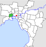
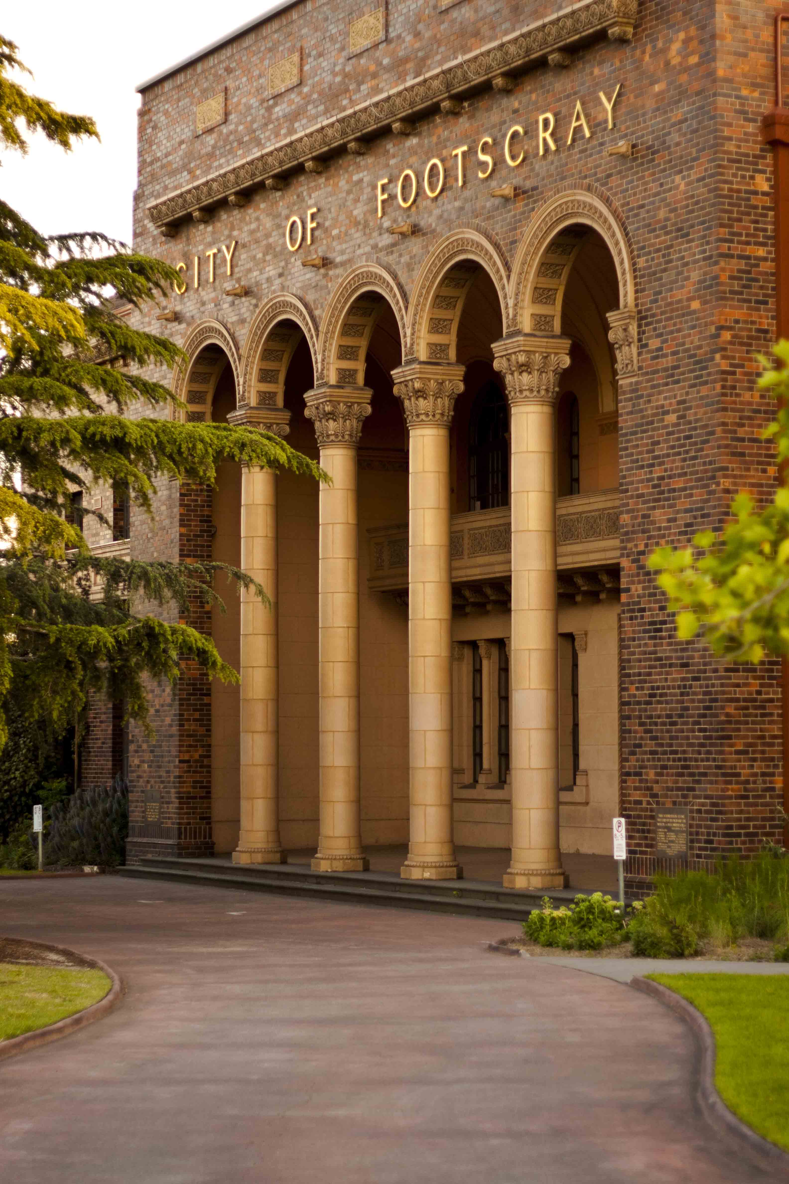
Location in MelbournePopulation: 47,900 (1992)[1] Established: 1859 Area: 17.10 km² (6.6 sq mi) Council Seat: Footscray Region: Melbourne County: Bourke LGAs around City of Footscray: Sunshine Essendon Melbourne Sunshine City of Footscray Melbourne Altona Williamstown Port Melbourne 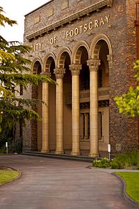 City of Footscray building, located corner of Napier and Hyde Street in Footscray
 Final logo used by the City of Footscray
The City of Footscray was a Local Government Area located about 5 kilometres (3 mi) west of Melbourne, the state capital of Victoria, Australia. The city covered an area of 17.10 square kilometres (6.60 sq mi), and existed from 1859 until 1994.
Contents
History
Footscray was first incorporated as a municipality on 10 June 1859, and was made a borough in 1863. It became a town on 25 February 1887, and was proclaimed a City on 23 January 1891. On 6 January 1922 and 5 February 1941, Footscray annexed land previously part of the Shire of Werribee, which became the West Ward (later to be known as Kingsville Ward). Further additions to this ward were made at the expense of the City of Williamstown on 12 May 1943.[2]
On 15 December 1994, along with nearly all other councils in Victoria, the City of Footscray was abolished, and merged into the newly-created City of Maribyrnong along with parts of the City of Sunshine. The only exception was the suburb of South Kingsville, which joined the neighbouring council of Hobsons Bay.[3]
Wards
At dissolution, Footscray was divided into four wards, each electing three councillors:
- North West Ward
- North Ward
- South Ward
- Kingsville Ward (formerly West Ward)
Prior to the 1988 elections an additional Middle Ward existed.[2]
Suburbs
- Footscray
- Kingsville
- Maribyrnong (shared with City of Sunshine)
- Seddon
- South Kingsville
- Spotswood (shared with City of Williamstown)
- West Footscray
- Yarraville
Population
Year Population 1954 57,915 1958 61,700* 1961 60,734 1966 58,666 1971 57,810 1976 51,635 1981 49,756 1986 47,330 1991 46,844 * Estimate in the 1958 Victorian Year Book.
References
- ^ Australian Bureau of Statistics, Victoria Office (1994). Victorian Year Book. p. 49. ISSN 0067-1223.
- ^ a b Victorian Municipal Directory. Brunswick: Arnall & Jackson. 1992. pp. 374–375. Accessed at State Library of Victoria, La Trobe Reading Room.
- ^ Australian Bureau of Statistics (1 August 1995). Victorian local government amalgamations 1994-1995: Changes to the Australian Standard Geographical Classification. Commonwealth of Australia. p. 8. ISBN 0-642-23117-6. http://www.ausstats.abs.gov.au/ausstats/free.nsf/0/76E601D6DB55E88ACA25722500049195/$File/12570_1994-95.pdf. Retrieved 2007-12-16.
Former Local Government Areas in Melbourne, Victoria Altona · Berwick · Box Hill · Brighton · Broadmeadows · Brunswick · Bulla (S) · Camberwell · Caulfield · Chelsea · Coburg · Collingwood · Cranbourne · Croydon · Diamond Valley (S) · Doncaster & Templestowe · Dandenong · Eltham (S) · Essendon · Fitzroy · Flinders (S) · Footscray · Frankston · Hastings (S) · Hawthorn · Healesville (S) · Heidelberg · Keilor · Kew · Lillydale (S) · Malvern · Moorabbin · Mordialloc · Mornington (S) · Northcote · Nunawading · Oakleigh · Pakenham (S) · Port Melbourne · Prahran · Preston · Richmond · Ringwood · Sandringham · Sherbrooke (S) · South Melbourne · Springvale · St Kilda · Sunshine · Upper Yarra (S) · Waverley · Werribee · Williamstown
Categories:- Former Local Government Areas of Victoria (Australia)

Wikimedia Foundation. 2010.