- City of Broadmeadows
-
This article is about a former local government area. For the suburb, see Broadmeadows, Victoria.
City of Broadmeadows
Victoria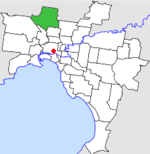
Location in MelbournePopulation: 107,900 (1992)[1] Established: 1857 Area: 63.65 km² (24.6 sq mi) Council Seat: Broadmeadows Region: Melbourne County: Bourke LGAs around City of Broadmeadows: Bulla Bulla Whittlesea Keilor City of Broadmeadows Preston Keilor Essendon Coburg  Final logo used by the City of Broadmeadows
The City of Broadmeadows was a Local Government Area located about 20 kilometres (12 mi) north of Melbourne, the state capital of Victoria, Australia. The city covered an area of 63.65 square kilometres (24.58 sq mi), and existed from 1857 until 1994.
Contents
History
Broadmeadows was first incorporated as a district on 27 November 1857. It became a Shire on 27 January 1871.
On 1 October 1915, as part of a series of adjustments of local government boundaries in Victoria, Broadmeadows briefly absorbed Merriang Shire, a 312-square-kilometre (120 sq mi) area including the towns of Kalkallo, Donnybrook and Wallan and dating from 1863.[2] Many of these areas were transferred to the Shire of Romsey on 31 May 1916.[3]
With the arrival of reticulated water, electricity and electrified rail in the 1920s, the southern part of the Shire was opened up to residential development—however, the Great Depression reduced the demand for new housing, and small farms and derelict subdivisions were major features of the landscape. The Australian Blue Book described the shire in 1949 as "comprising general farming and grazing country which stretches in a narrow strip northward from the northern suburbs of Melbourne", noting that southern areas adjoining Coburg and Essendon were "becoming definitely residential, but in other parts grazing, dairying, poultry farming and hay and grain growing is still going on".[4]
In 1951, the Housing Commission of Victoria resumed 2,270 hectares (5,600 acres) of land near Broadmeadows, and while construction proceeded at a reasonable pace, shopping and other facilities lagged behind. In the process of developing the area, it was decided to sever the rural parts north of Somerton Road from the Shire,[4] and in 1955, parts of the Shire of Broadmeadows were severed and annexed to the Shires of Bulla, Whittlesea and Kilmore. While only 600 people were affected by the move, it represented most of Broadmeadows's land area to that point.[5] On 30 May 1956, Broadmeadows was proclaimed a City.[3]
On 1 October 1979, the areas of Strathmore and Strathmore Heights were transferred to the City of Essendon - a loss of 5.76 square kilometres (2.22 sq mi).[3][6]
On 15 December 1994, along with nearly all other councils in Victoria, the City of Broadmeadows was abolished. The last mayor of the City of Broadmeadows was Cr. Dorothy (Dot) White. Suburbs south of the Western Ring Road merged with Coburg and Brunswick to form the City of Moreland, while suburbs north of the Western Ring Road merged with the Shire of Bulla to form the City of Hume.[7]
In its final years, the council met at the Broadmeadows Town Hall at Pearcedale Parade and Dimboola Road, Broadmeadows. The facility is still used today by the City of Hume.
Wards
On 1 April 1988, the City of Broadmeadows was subdivided into four wards, each of which elected three councillors:
- Broadmeadows Ward
- Fawkner Ward
- Glenroy Ward
- Somerton Ward[3]
Suburbs
North:
- Broadmeadows
- Campbellfield
- Coolaroo
- Dallas*
- Gladstone Park*
- Jacana*
- Meadow Heights*
- Tullamarine (shared with City of Keilor)
- Westmeadows
South:
- Fawkner
- Glenroy
- Gowanbrae*
- Hadfield
- Oak Park*
- Pascoe Vale (shared with City of Coburg)
* Suburbs gazetted since the amalgamation.
Population
Year Population 1903 1,300 1911 2,100 1947 8,971 1954 23,065 1958 43,400* 1961 66,306 1966 87,891 1971 101,100 1976 108,744+ 1981 103,540 1986 101,144 1991 102,996 * Estimate in the 1958 Victorian Year Book.
+ The area annexed to City of Essendon in 1979 contained 8,892 people, so the net figure is 99,852.[6]Mayors (Incomplete)
- 1989-90 R. Kerr
- 1990-91 J. Mallia
- 1991-92 M. Stone
- 1992-93 K.P. Sheahan
- 1993-94 A.A. Simic
- 1994-95 D. White
References
- ^ Australian Bureau of Statistics, Victoria Office (1994). Victorian Year Book. p. 49. ISSN 0067-1223.
- ^ Merriang became a district on 26 June 1863 and a Shire on 3 November 1871. Source: Victorian Municipal Directory (1915)
- ^ a b c d Victorian Municipal Directory. Brunswick: Arnall & Jackson. 1992. pp. 321–322. Accessed at State Library of Victoria, La Trobe Reading Room.
- ^ a b Monash University (1999). "Australian Places - Broadmeadows". Archived from the original on 2003-02-16. http://web.archive.org/web/20030216041023/http://www.arts.monash.edu.au/ncas/multimedia/gazetteer/list/broadmeadows.html. Retrieved 2008-01-04.
- ^ Australian Bureau of Statistics, Victoria Office (1959). Victorian Year Book 1954-1958. pp. 223–224. ISSN 0067-1223.
- ^ a b Australian Bureau of Statistics, Victoria Office (1983). Victorian Year Book. p. 167. ISSN 0067-1223.
- ^ Australian Bureau of Statistics (1 August 1995). Victorian local government amalgamations 1994-1995: Changes to the Australian Standard Geographical Classification. Commonwealth of Australia. pp. 7, 10. ISBN 0-642-23117-6. http://www.ausstats.abs.gov.au/ausstats/free.nsf/0/76E601D6DB55E88ACA25722500049195/$File/12570_1994-95.pdf. Retrieved 2007-12-16.
Former Local Government Areas in Melbourne, Victoria Altona · Berwick · Box Hill · Brighton · Broadmeadows · Brunswick · Bulla (S) · Camberwell · Caulfield · Chelsea · Coburg · Collingwood · Cranbourne · Croydon · Diamond Valley (S) · Doncaster & Templestowe · Dandenong · Eltham (S) · Essendon · Fitzroy · Flinders (S) · Footscray · Frankston · Hastings (S) · Hawthorn · Healesville (S) · Heidelberg · Keilor · Kew · Lillydale (S) · Malvern · Moorabbin · Mordialloc · Mornington (S) · Northcote · Nunawading · Oakleigh · Pakenham (S) · Port Melbourne · Prahran · Preston · Richmond · Ringwood · Sandringham · Sherbrooke (S) · South Melbourne · Springvale · St Kilda · Sunshine · Upper Yarra (S) · Waverley · Werribee · Williamstown
Categories:- Former Local Government Areas of Victoria (Australia)

Wikimedia Foundation. 2010.