- City of Prahran
-
City of Prahran
Victoria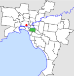
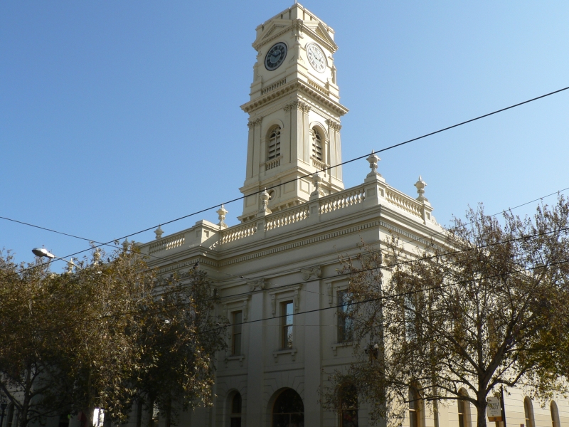
Location in MelbournePopulation: 42,200 (1992)[1] Established: 1855 Area: 9.55 km² (3.7 sq mi) Council Seat: Malvern Region: Melbourne County: Bourke LGAs around City of Prahran: Melbourne Richmond Hawthorn South Melbourne City of Prahran Malvern St Kilda St Kilda Caulfield  Prahran Town Hall
The City of Prahran was a Local Government Area located about 5 kilometres (3 mi) southeast of Melbourne, the state capital of Victoria, Australia. The city covered an area of 9.55 square kilometres (3.69 sq mi), and existed from 1855 until 1994.
Contents
History
Prahran was incorporated as a municipal district on 24 April 1855, which became a borough on 1 October 1863, a town on 13 May 1870 and a City on 30 May 1879.[2]
On 22 June 1994, the City of Prahran was abolished and merged with Malvern into the newly-created City of Stonnington.[3]
Council meetings were held at Prahran Town Hall on Chapel Street and Greville Street, Prahran. It presently serves as a service centre for the City of Stonnington.
Mayors
Main article: List of mayors of PrahranWards
The City of Prahran was subdivided into four wards on 2 December 1887, each electing three councillors:[2]
- Prahran Ward
- South Yarra Ward
- Toorak Ward
- Windsor Ward
Suburbs
- Armadale (split with City of Malvern)
- Melbourne (Domain district)
- Prahran
- South Yarra
- Toorak (split with City of Malvern)
- Windsor
Population
Year Population 1861 9,886 1881 21,268 1891 39,703 1921 50,290 1947 59,882 1954 54,009 1958 51,500* 1961 52,554 1966 54,629 1971 56,766 1976 48,462 1981 45,018 1986 43,051 1991 42,195 * Estimate in the 1958 Victorian Year Book.
References
- ^ Australian Bureau of Statistics, Victoria Office (1994). Victorian Year Book. p. 49. ISSN 0067-1223.
- ^ a b Victorian Municipal Directory. Brunswick: Arnall & Jackson. 1992. pp. 455–456. Accessed at State Library of Victoria, La Trobe Reading Room.
- ^ Australian Bureau of Statistics (1 August 1995). Victorian local government amalgamations 1994-1995: Changes to the Australian Standard Geographical Classification. Commonwealth of Australia. p. 11. ISBN 0-642-23117-6. http://www.ausstats.abs.gov.au/ausstats/free.nsf/0/76E601D6DB55E88ACA25722500049195/$File/12570_1994-95.pdf. Retrieved 2007-12-16.
Former Local Government Areas in Melbourne, Victoria Altona · Berwick · Box Hill · Brighton · Broadmeadows · Brunswick · Bulla (S) · Camberwell · Caulfield · Chelsea · Coburg · Collingwood · Cranbourne · Croydon · Diamond Valley (S) · Doncaster & Templestowe · Dandenong · Eltham (S) · Essendon · Fitzroy · Flinders (S) · Footscray · Frankston · Hastings (S) · Hawthorn · Healesville (S) · Heidelberg · Keilor · Kew · Lillydale (S) · Malvern · Moorabbin · Mordialloc · Mornington (S) · Northcote · Nunawading · Oakleigh · Pakenham (S) · Port Melbourne · Prahran · Preston · Richmond · Ringwood · Sandringham · Sherbrooke (S) · South Melbourne · Springvale · St Kilda · Sunshine · Upper Yarra (S) · Waverley · Werribee · Williamstown
Categories:- Former Local Government Areas of Victoria (Australia)

Wikimedia Foundation. 2010.