- City of Port Melbourne
-
City of Port Melbourne
Victoria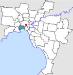
Location in MelbournePopulation: 7,900 (1992)[1] Established: 1860 Area: 10.62 km² (4.1 sq mi) Council Seat: Port Melbourne Region: Melbourne County: Bourke LGAs around City of Port Melbourne: Footscray Melbourne Melbourne Williamstown City of Port Melbourne South Melbourne Williamstown Port Phillip Port Phillip  Final logo used by the City of Port Melbourne
The City of Port Melbourne was a Local Government Area located about 4 kilometres (2 mi) southwest of Melbourne, the state capital of Victoria, Australia, on the south bank of the Yarra River. The city covered an area of 10.62 square kilometres (4.10 sq mi), and existed from 1860 until 1994.
The council area covered the current boundaries of the suburb of Port Melbourne—the Yarra River to the west and north, Boundary Street to the northeast, Hobsons Bay to the south and Pickles Street to the east.[2]
Contents
History
Port Melbourne was first incorporated as the Sandridge Borough on 13 July 1860. It was renamed Port Melbourne on 25 January 1884, and became a town on 20 January 1893. It was proclaimed a City on 14 May 1919.[2]
On 22 June 1994, the City of Port Melbourne was abolished and merged into the newly-created City of Port Phillip along with the Cities of South Melbourne and St Kilda.[3]
The council met at the Port Melbourne Town Hall at Bay Street and Spring Street, Port Melbourne. The facility is now used as a municipal library by the City of Port Phillip.
Wards
Port Phillip was divided into three wards, each electing three councillors:
- Boundary Ward
- Centre Ward
- Sandridge Ward
Population
Year Population 1954 13,104 1958 12,700* 1961 12,370 1966 12,596 1971 11,705 1976 9,356 1981 8,585 1986 8,080 1991 7,496 * Estimate in the 1958 Victorian Year Book.
References
- ^ Australian Bureau of Statistics, Victoria Office (1994). Victorian Year Book. p. 49. ISSN 0067-1223.
- ^ a b Victorian Municipal Directory. Brunswick: Arnall & Jackson. 1992. pp. 453–454. Accessed at State Library of Victoria, La Trobe Reading Room.
- ^ Australian Bureau of Statistics (1 August 1995). Victorian local government amalgamations 1994-1995: Changes to the Australian Standard Geographical Classification. Commonwealth of Australia. p. 11. ISBN 0-642-23117-6. http://www.ausstats.abs.gov.au/ausstats/free.nsf/0/76E601D6DB55E88ACA25722500049195/$File/12570_1994-95.pdf. Retrieved 2007-12-16.
Former Local Government Areas in Melbourne, Victoria Altona · Berwick · Box Hill · Brighton · Broadmeadows · Brunswick · Bulla (S) · Camberwell · Caulfield · Chelsea · Coburg · Collingwood · Cranbourne · Croydon · Diamond Valley (S) · Doncaster & Templestowe · Dandenong · Eltham (S) · Essendon · Fitzroy · Flinders (S) · Footscray · Frankston · Hastings (S) · Hawthorn · Healesville (S) · Heidelberg · Keilor · Kew · Lillydale (S) · Malvern · Moorabbin · Mordialloc · Mornington (S) · Northcote · Nunawading · Oakleigh · Pakenham (S) · Port Melbourne · Prahran · Preston · Richmond · Ringwood · Sandringham · Sherbrooke (S) · South Melbourne · Springvale · St Kilda · Sunshine · Upper Yarra (S) · Waverley · Werribee · Williamstown
Categories:- Former Local Government Areas of Victoria (Australia)

Wikimedia Foundation. 2010.