- City of Doncaster & Templestowe
-
City of Doncaster & Templestowe
Victoria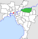
Location in MelbournePopulation: 102,898 (1991)[1] Established: 1856 Area: 89.42 km² (34.5 sq mi) Council Seat: Doncaster Region: Melbourne County: Bourke, Evelyn LGAs around City of Doncaster & Templestowe: Heidelberg Eltham Healesville Heidelberg City of Doncaster & Templestowe Lillydale Camberwell Box Hill
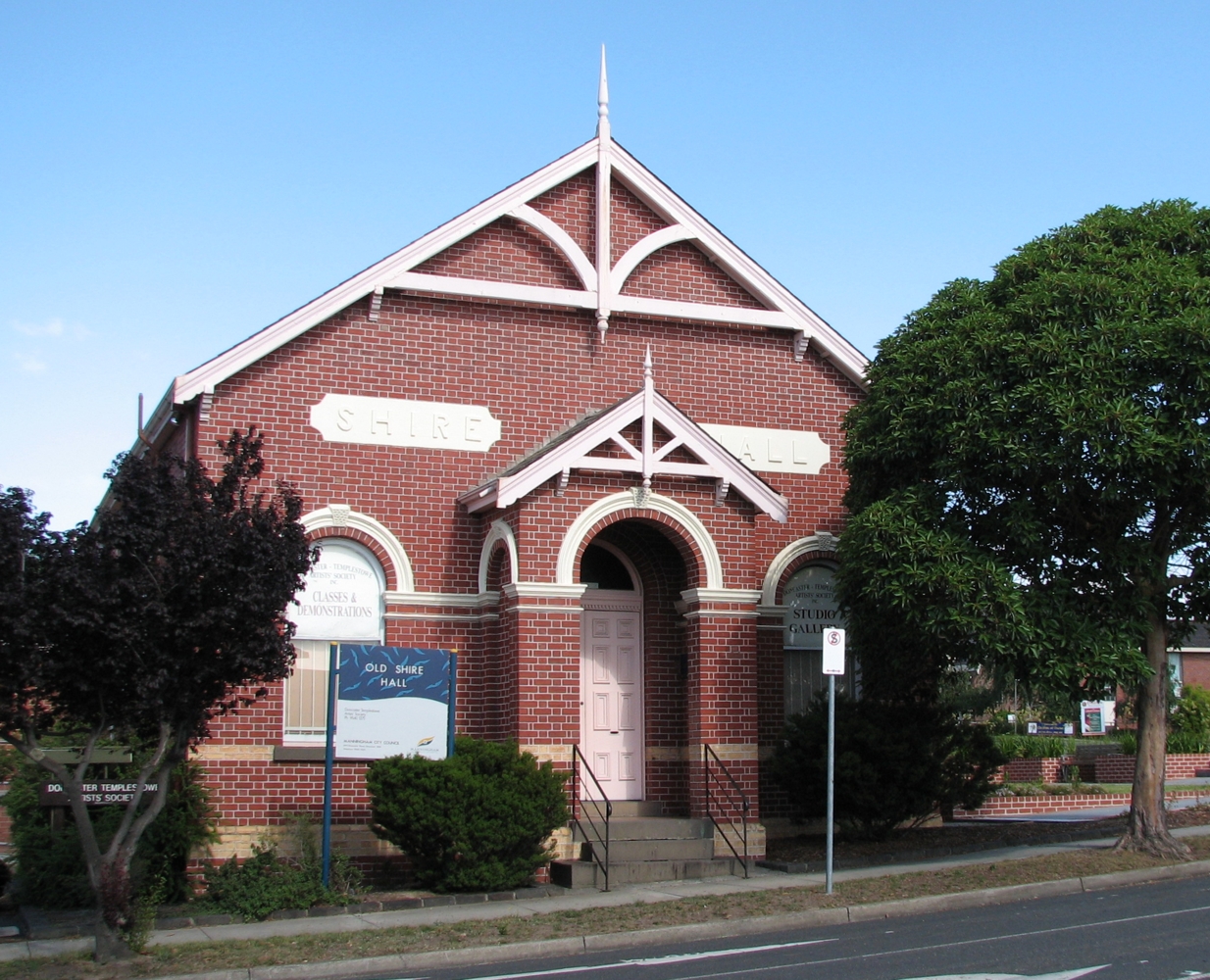
NunawadingRingwood  Former Shire Hall in Council Street
The City of Doncaster & Templestowe was a Local Government Area located about 20 kilometres (12 mi) east-northeast of Melbourne, the state capital of Victoria, Australia. The city covered an area of 89.42 square kilometres (34.53 sq mi), and existed from 1915 until 1994. At its peak in the early '90s, it had a population of just over 100,000.
Contents
History
The origin of local government in the area dates back to 19 December 1856 when the Templestowe Roads Board was formed, following a public meeting and election at Bulleen Hotel[2][3] Two decades later, on 7 May 1875 the Shire of Bulleen was formed incorporating the Roads Board area and Warrandyte[2][4]. On 30 May 1890 the Doncaster Riding was severed and incorporated as the Shire of Doncaster, meeting in the old Shire Hall in Council Street.[2]. By this time, fruit growing had become the mainstay of Doncaster's rural economy. The Shire of Bulleen was renamed to the Shire of Templestowe on 12 May 1892 and reunited with Doncaster 23 years later under local government reforms on 1 October 1915, and the combined entity was named Shire of Doncaster & Templestowe on 16 March 1926. Urbanisation was slow to reach the area, and the 1949 Australian Blue Book described the shire as "mainly undulating country with extensive views [and] some low, hilly ranges". Agricultural activities such as fruit growing, dairying and sheep and cattle grazing dominated the Shire's economic life.[5] By 1955 the population of the area had grown with suburban settlement and a new Shire Hall was built.[2] On 28 February 1967, at a time of rapid suburban growth, Doncaster & Templestowe was proclaimed a City.[6]
On 15 December 1994, along with nearly all other councils in Victoria, the City of Doncaster & Templestowe was abolished, and together with Wonga Park from the Shire of Lillydale, was reincorporated as the City of Manningham.[7]
At the time of dissolution, council meetings were held in the Municipal Offices in Doncaster Road, Doncaster. This facility is still used for the same purpose by the City of Manningham.
Wards
The City of Doncaster & Templestowe was subdivided into four wards, each electing three councillors:[6]
- Doncaster Ward
- Doncaster West Ward
- Templestowe Ward
- Warrandyte Ward
Suburbs
- Bulleen
- Doncaster
- Doncaster East
- Donvale
- East Templestowe
- Mitcham (split with City of Nunawading)
- Park Orchards
- Ringwood North (split with City of Ringwood)
- Templestowe
- Templestowe Lower
- Warrandyte
- Warrandyte South (split with Shire of Lillydale)
- Warranwood
Population
Year Population 1911 1,195 1947 3,786 1954 6,814 1958 11,200* 1961 19,061 1966 38,061 1971 64,286 1976 82,090 1981 90,660 1986 99,269 1991 102,898 * Estimate in the 1958 Victorian Year Book.
Land zoning
The City of Doncaster & Templestowe had about three hundred parks by the 1990s.[8]
References
- ^ Australian Bureau of Statistics, Victoria Office (1994). Victorian Year Book. p. 49. ISSN 0067-1223.
- ^ a b c d Doncaster Templestowe & Warrandyte since 1837. Doncaster-Templestowe Historical Society. 1970. ISBN 0950092002.
- ^ "Templestowe I (Roads Board 1856-1875) Agency VA 4760". Public Record Office Victoria. http://www.prov.vic.gov.au/default.asp. Retrieved 2008-01-05.
- ^ "Bulleen (Shire 1875 - 1892) Agency VA 4358". Public Record Office Victoria. http://www.prov.vic.gov.au/default.asp. Retrieved 2008-01-05.
- ^ Monash University (1999). "Australian Places - Doncaster & Templestowe". Archived from the original on 3 November 2002. http://web.archive.org/web/20021103011835/http://www.arts.monash.edu.au/ncas/multimedia/gazetteer/list/donc+tempstwe.html. Retrieved 2008-01-04.
- ^ a b Victorian Municipal Directory. Brunswick: Arnall & Jackson. 1992. pp. 314–315. Also VMD 1915:612. Accessed at State Library of Victoria, La Trobe Reading Room.
- ^ Australian Bureau of Statistics (1 August 1995). Victorian local government amalgamations 1994-1995: Changes to the Australian Standard Geographical Classification. Commonwealth of Australia. p. 8. ISBN 0-642-23117-6. http://www.ausstats.abs.gov.au/ausstats/free.nsf/0/76E601D6DB55E88ACA25722500049195/$File/12570_1994-95.pdf. Retrieved 2007-12-16.
- ^ Perera, Natasha (1994-12-01). "Council looks at park burials". Herald Sun: p. 40.
Former Local Government Areas in Melbourne, Victoria Altona · Berwick · Box Hill · Brighton · Broadmeadows · Brunswick · Bulla (S) · Camberwell · Caulfield · Chelsea · Coburg · Collingwood · Cranbourne · Croydon · Diamond Valley (S) · Doncaster & Templestowe · Dandenong · Eltham (S) · Essendon · Fitzroy · Flinders (S) · Footscray · Frankston · Hastings (S) · Hawthorn · Healesville (S) · Heidelberg · Keilor · Kew · Lillydale (S) · Malvern · Moorabbin · Mordialloc · Mornington (S) · Northcote · Nunawading · Oakleigh · Pakenham (S) · Port Melbourne · Prahran · Preston · Richmond · Ringwood · Sandringham · Sherbrooke (S) · South Melbourne · Springvale · St Kilda · Sunshine · Upper Yarra (S) · Waverley · Werribee · Williamstown
Categories:- Former Local Government Areas of Victoria (Australia)

Wikimedia Foundation. 2010.