- Shire of Diamond Valley
Infobox Australian Place | type = lga
name = Shire of Diamond Valley
state = vic
region =Melbourne
area = 74.38
est = 1964
seat = Altona
pop = 64,400 (1992) [cite book|title=Victorian Year Book|author=Australian Bureau of Statistics, Victoria Office|year=1994|page=49|id=ISSN 0067-1223]
logosize =
imagesize = 150
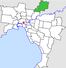
caption = Location inMelbourne
county = Evelyn, Bourke
near-nw = Whittlesea
near-n = Whittlesea
near-ne = Eltham
near-w = Whittlesea
near-e = Eltham
near-sw = Preston
near-s = Heidelberg
near-se = Eltham
_noautocat = yesThe Shire of Diamond Valley was a Local Government Area located about convert|20|km|mi|0 northeast ofMelbourne , the state capital of Victoria,Australia . The shire covered an area of convert|74.38|km2|sqmi|2, and existed from 1964 until 1994.History
The name relates to the lowlands to the west of Diamond Creek, a tributary of the
Yarra River which flows through nearby Eltham.Land in the area was first incorporated as part of the Heidelberg District on 12 October 1860, which became a Shire on 27 March 1864 and was proclaimed as the
City of Heidelberg on 11 April 1934.cite book|title=Victorian Municipal Directory|year=1992|publisher=Arnall & Jackson|location=Brunswick|pages=397-398, 652-653 Accessed atState Library of Victoria , La Trobe Reading Room.] On 30 September 1964, the North Ward of the City of Heidelberg was severed and incorporated as the Shire of Diamond Valley.On 15 December 1994, along with nearly all other councils in Victoria, the Shire of Diamond Valley was abolished. Areas south of the Metropolitan Ring Road and
Greensborough Highway became part of the newCity of Banyule , while those areas north became part of theShire of Nillumbik . A small area in the shire's southwest north ofLa Trobe University , including Gresswell Forest Nature Reserve, became part of theCity of Darebin . [cite book|url=http://www.ausstats.abs.gov.au/ausstats/free.nsf/0/76E601D6DB55E88ACA25722500049195/$File/12570_1994-95.pdf|title=Victorian local government amalgamations 1994-1995: Changes to the Australian Standard Geographical Classification|author=Australian Bureau of Statistics |date=1 August 1995|publisher=Commonwealth of Australia|page=4-5, 10|isbn=0-642-23117-6|accessdate=2007-12-16]Council met at the Diamond Valley Civic Centre in Civic Circuit, Greensborough. The facility is still used by the
Shire of Nillumbik .Wards
The shire was divided into four ridings, each of which elected three councillors:
* South West Riding
* South East Riding
* Centre Riding
* North Ridinguburbs
* Briar Hill (shared with
Shire of Eltham )
* Bundoora (shared withCity of Preston andCity of Whittlesea )
* Diamond Creek
* Eltham North
* Greensborough
* Hurstbridge (shared withShire of Eltham andCity of Whittlesea )
* Macleod (shared withCity of Heidelberg )
* Plenty
* St Helena
* Watsonia
* Watsonia North
* Wattle Glen (shared withShire of Eltham )
* YarrambatPopulation
* Estimate in the 1958 Victorian Year Book.
# The Shire of Diamond Valley was created in 1964. Source of population: 1968 Victorian Year Book.References
Wikimedia Foundation. 2010.