- Churchill, Oxfordshire
-
Coordinates: 51°55′01″N 1°35′24″W / 51.917°N 1.590°W
Churchill 
Parish Church of All Saints
 Churchill
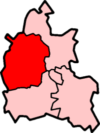
Churchill shown within OxfordshirePopulation 563 (2001 census)[1] OS grid reference SP2824 - London 77.3 miles (124.4 km) Parish Churchill District West Oxfordshire Shire county Oxfordshire Region South East Country England Sovereign state United Kingdom Post town Chipping Norton Postcode district OX7 Dialling code 01608 Police Thames Valley Fire Oxfordshire Ambulance South Central EU Parliament South East England UK Parliament Witney Website Churchill and Sarsden List of places: UK • England • Oxfordshire Churchill is a village and civil parish about 3 miles (4.8 km) southwest of Chipping Norton, Oxfordshire in the Cotswolds Area of Outstanding Natural Beauty.
Contents
History
Churchill's toponym has evolved through forms including Cercelle, Churchell, and Cherchell, reaching its current form was in use by 1537.[citation needed] The origin of the name is uncertain, though it may come from the Old English cyrc, meaning a hill, burial ground, or barrow. (The village does contain several barrows, suggesting the existence of a settlement here from prehistoric times.) However, the name may come from Cyrc-hill, literally Hill-hill — a common construction formed by Anglo-Saxon incomers who did not understand the meaning of a Celtic root (cf. the etymology of Pendle Hill).[citation needed]
Churchill was originally at the foot of a hill (now known as Hastings Hill), but on 31 July 1684 a fire destroyed twenty houses and many other buildings, and killed four people. The village was rebuilt higher up the hill, with stone houses instead of the old timber-framed and thatched cottages. The fire was apparently caused by a baker[citation needed] who, to avoid chimney tax, had knocked through the wall from her oven to her neighbour's chimney. The old village can still be seen as grassy mounds in the pastures around the Heritage Centre.
The former Chipping Norton Railway, part of the Great Western Railway, passed near Churchill. The line had a small railway station, Sarsden Halt, 0.3 miles (480 m) northwest of Churchill. British Railways closed the halt to passengers in 1962[2] and closed the railway in 1964.
Buildings
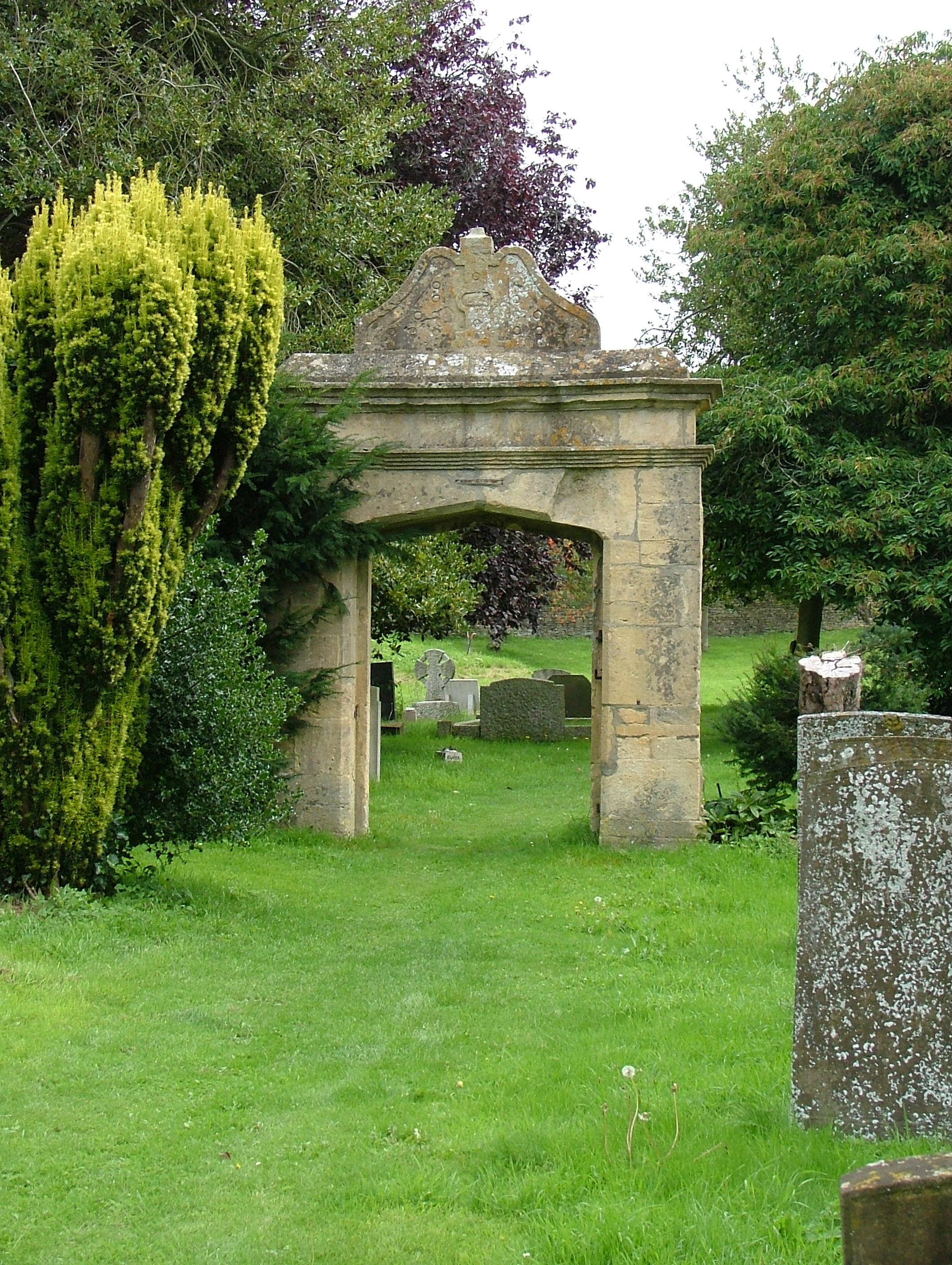
 Old gateway in the graveyard, Churchill
The Heritage Centre is on what is thought to be the site of a Saxon church. In 1348 the church of which the chancel – now the Churchill Heritage Centre – is the last remaining part was built in the Decorated Gothic style. At that time it was at the centre of the village, but after the fire of 1684 the village moved up the hill, and the old parish church of All Saints was left at the edge of the village. By the end of the eighteenth century the church was said to be in disrepair, and in 1825 James Haughton Langston (1796–1863), who had the living of Churchill & Sarsden, and who owned the Sarsden estate and most of Churchill, built a new one higher up the hill in what had become the centre of the village. The new All Saints was consecrated in 1827. The old church fell into disrepair, but the chancel was retained and used as a mortuary chapel and to house the memorials and in 1869 the Gothic Revival architect C.C. Rolfe added a new east window.[3]
A Preservation Society was formed in 1988 to campaign for its retention as the last medieval building in Churchill and the building was repaired. The Heritage Centre opened in 2001 in the restored chancel which now houses a collection of maps and historical records of the village from 1600 to the present, as well as displays about Warren Hastings and William Smith. Having received a Heritage Lottery Fund grant in 2010, the building has been refurbished with new interactive displays and oral history recordings. A temporary exhibition illustrates the story of wartime evacuees to the village and the US Army stationed nearby at the Sarsden estate.
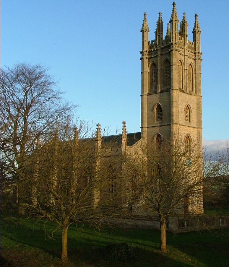
The Church of England parish church of All Saints was designed by James Plowman of Oxford in 1826. It is an architectural mixture of imitations. The tower is a two-thirds copy of the tower of Magdalen College, Oxford, its hammerbeam roof a copy of the roof of Christ Church, Oxford, its buttresses are versions of those of the chapel of New College, Oxford,[4] and its windows are based on those from various Oxford Colleges.
In a restoration appeal for the tower in 1975, Sir John Betjeman wrote of it:It is a beautiful landmark and has [...] been an eye-catcher for miles around, and a delightful one. I am sure it was built with this object in view. Although the style is English Perpendicular Gothic, the Tower is in the great tradition of English landscape gardening. Its disappearance would be a grave loss to a rolling wooded landscape.
The church tower has a ring of eight bells.[5] External stairs lead to the bell-ringers' chamber, the top of the staircase being in the form of a pulpit. In imitation of the May morning celebrations at Magdalen College, villagers gather at sunrise on 1 May each year and sing from the stairs and pulpit.
The Village Hall was originally built in 1870 by James Langston as a Reading Room for the village. It was converted into the village hall after the Second World War.
Churchill had two primary schools: the "Top School", opposite the church on Junction Road, was the Girls' School, and the "Lower School", further down the hill on the Sarsden Road, was the Boys' School. Their dates are somewhat obscure; the Lower School is said to have been built in 1716, though that seems surprisingly early to some historians, and the deeds of the Top School date it to the 1850s, though its rainwater heads are dated 1870. The Lower School was closed in 1947, the Top School in 1982, and both have been converted and divided into domestic dwellings.
Memorials
- A monolith made of stone found in nearby Sarsden Wood, erected in 1891 by the 3rd Earl of Ducie to commemorate William Smith.
- A memorial fountain, erected in 1870 by Julia, Countess of Ducie, to her father, James Haughton Langston. Jennifer Sherwood described this fountain as: "Memorably ugly. A squat, square tower with obelisks and flying buttresses carrying a dumpy spire. The water drips from a rude spout at the side."[3]
- The village War Memorial.
Famous Churchillians
Warren Hastings (1732–1818) was the first Governor-General of British India, born in Churchill on 6 December 1732. His mother died within a week of his birth, and he took her maiden name as his Christian name after his father abandoned him; he was brought up by a foster mother (Mary Ellis). He was educated at the village school, and went on to an illustrious career in the British East India Company, becoming Governor-General in 1774. On his return to England his political enemies had him impeached, and although he won his case against them, it ate up most of his fortune. He did manage, however, to buy back the family estates in Daylesford, a village near Churchill, and died there on 22 August 1818.
William Smith (1769–1839) "Strata Smith" was the "father of English geology". Smith was born in Churchill on 23 March 1769, the son of a blacksmith. He was educated at the village school until the age of eleven, then went to London for two years. In 1788, when he returned to Churchill, his uncle (a Hook Norton farmer) encouraged his interest in surveying, and together they pursued various schemes for land improvement and drainage. At eighteen he became an assistant surveyor, helping to survey Churchill and Sarsden for the 1788 Enclosure Act. His experience of different rock formations led him to develop the theory that the occurrence of different types of fossil could be used to order the geological sequence of rock strata. Although from 1800 he gained a reputation as a Civil Engineer, he became famous for preparing and producing a series of detailed geological maps of England. He died on 28 August 1839 in Northampton.
References
- ^ "Area selected: West Oxfordshire (Non-Metropolitan District)". Neighbourhood Statistics: Full Dataset View. Office for National Statistics. http://neighbourhood.statistics.gov.uk/dissemination/viewFullDataset.do;jsessionid=ac1f930b30d73ec370d62b6f4444bc01a4cf1c94ffa8?instanceSelection=03070&productId=779&$ph=60_61&datasetInstanceId=3070&startColumn=1&numberOfColumns=8&containerAreaId=790500&nsjs=true&nsck=true&nssvg=true&nswid=1020. Retrieved 24 March 2010.
- ^ Jenkins, Brown & Parkhouse, 2004
- ^ a b Sherwood & Pevsner, 1974, page 545
- ^ Sherwood & Pevsner, 1974 , pages 544-545
- ^ Oxford Diocesan Guild of Church Bell Ringers, Chipping Norton Branch
Sources
- Stanley Jenkins, Bob Brown & Neil Parkhouse (2004). The Banbury & Cheltenham Direct Railway. Lydney: Lightmoor Press. ISBN 1899889159.
- Morton, John L. (2001). Strata. Tempus Publishing. ISBN 0-7524-1992-7.
- Sherwood, Jennifer; Pevsner, Nikolaus (1974). The Buildings of England: Oxfordshire. Harmondsworth: Penguin Books. pp. 545–546. ISBN 0 14 071045 0.
- Watkins, Alan (1988). Churchill and Sarsden: A Portrait in Old Photographs. Alan Sutton Publishing. ISBN 0 9513622 0 8.
- Various authors. All Saints Church, Churchill.
External links
- The War Memorial
- http://www.churchillheritage.org.uk The Churchill and Sarsden Heritage Centre
- Churchill and Sarsden Heritage Centre
- Information on Churchill village schools
- Standing Stone — page 1
- Standing Stone — page 2
Oxfordshire • County Council elections • District Council elections • Witney County Constituency Towns Burford (Signet, Upton) • Carterton • Charlbury • Chipping Norton (Southcombe) • Witney (Cogges, Madley Park) • Woodstock (Hensington, Old Woodstock)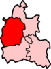
Large Villages Aston, Cote, Shifford and Chimney (Aston, Cote, Shifford, Chimney) • Bampton (Lower Haddon, Weald) • Brize Norton • Ducklington • Enstone (Church Enstone, Neat Enstone, Chalford, Cleveley, Fulwell, Gagingwell, Lidstone, Radford) • Eynsham (Barnard Gate) • Freeland • Hailey (New Yatt) • Hanborough (Church Hanborough, Long Hanborough) • Milton-under-Wychwood • Minster Lovell • North Leigh (East End, Wilcote) • Shipton-under-Wychwood • Standlake (Brighthampton) • Steeple Barton (Middle Barton) • StonesfieldOther Civil
Parishes
(Component
Villages
and Hamlets)Alvescot • Ascott-under-Wychwood (Ascott d'Oyley, Ascott Earl) • Asthall (Asthall Leigh, Worsham) • Black Bourton • Bladon • Blenheim • Broadwell • Bruern • Cassington (Worton) • Chadlington • Chastleton • Chilson (Shorthampton) • Churchill • Clanfield • Combe • Cornbury and Wychwood (Cornbury, Wychwood) • Cornwell • Crawley • Curbridge • Fawler • Fifield • Filkins and Broughton Poggs (Filkins, Broughton Poggs) • Finstock • Fulbrook • Glympton • Grafton and Radcot (Grafton, Radcot) • Great Tew • Hardwick-with-Yelford (Hardwick, Yelford) • Heythrop (Dunthrop) • Holwell • Idbury (Bould, Foscot) • Kelmscott • Kencot • Kiddington with Asterleigh (Asterleigh, Kiddington, Over Kiddington) • Kingham • Langford • Leafield • Lew • Little Faringdon • Little Tew • Lyneham • Northmoor • Over Norton • Ramsden (Mount Skippett) • Rollright (Great Rollright, Little Rollright) • Rousham • Salford • Sandford St. Martin (Ledwell) • Sarsden • Shilton • South Leigh • Spelsbury (Dean, Taston) • Stanton Harcourt • Swerford • Swinbrook and Widford (Swinbrook, Widford) • Tackley • Taynton • Westcott Barton • Westwell • Wootton (Dornford, Hordley) • Worton (Nether Worton, Over Worton)Former Districts
and BoroughsChipping Norton Rural District • Municipal Borough of Chipping Norton • Witney Urban District • Witney Rural District • Municipal Borough of Woodstock • Woodstock Rural DistrictFormer
ConstituenciesList of Parliamentary constituencies in Oxfordshire • List of places in Oxfordshire • List of civil parishes in Oxfordshire Categories:- Villages in Oxfordshire
- Civil parishes in Oxfordshire
- West Oxfordshire

Wikimedia Foundation. 2010.