- Enstone
-
Coordinates: 51°55′05″N 1°27′14″W / 51.918°N 1.454°W
Enstone 
 Enstone
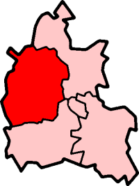
Enstone shown within OxfordshirePopulation 1,103 (parish, including Chalford, Cleveley, Fulwell, Gagingwell, Lidstone, & Radford) (2001 census)[1] OS grid reference SP3724 Parish Enstone District West Oxfordshire Shire county Oxfordshire Region South East Country England Sovereign state United Kingdom Post town Chipping Norton Postcode district OX7 Dialling code 01608 Police Thames Valley Fire Oxfordshire Ambulance South Central EU Parliament South East England UK Parliament Witney Website EnstoneVillage.co.uk List of places: UK • England • Oxfordshire Enstone is a village and civil parish in Oxfordshire about 4 miles (6.4 km) east of Chipping Norton.
The civil parish is the largest in Oxfordshire, comprising the villages of Church Enstone and Neat Enstone (referred to collectively as Enstone) and the hamlets of Chalford, Cleveley, Fulwell, Gagingwell, Lidstone, and Radford.
Contents
Toponym
Enstone's toponym is derived from a standing stone called the Ent Stone, part of the ruins of a neolithic tomb just off the Charlbury Road. The site is also known as the Hoar Stone.[2]
Parish church
The earliest parts of the Church of England parish church of Saint Kenelm are Norman, but the building has been rebuilt in stages since the 12th century. The bell tower dates from the middle of the 16th century. A stained glass window installed in the north aisle as a First World War memorial may have been made by Morris & Co.[3]
East of St. Kenelm's church is a mediaeval barn that was built for Winchcombe Abbey, a Benedictine monastery in Gloucestershire that owned the manor of Enstone. The barn has a cruck roof and a date stone fom 1382 but its manner of construction suggests it is a late 15th century building. It may therefore have been rebuilt at that time, retaining the date stone from an earlier structure.[4]
In 1657 an attempt to merge the Benefices of Enstone and Heythrop was abandoned in the face of local opposition.[5] They were finally merged in 1964.[5] In 2001 the Benefice of Enstone and Heythrop merged with that of Ascott-under-Wychwood, Chadlington, and Spelsbury to form the Chase Benefice.[6]
Economic history
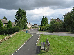
 A backstreet in Church Enstone
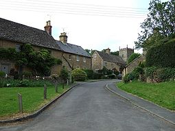
 A view of Neat Enstone
Enstone is at the junction of two old main roads: one between Oxford and Chipping Norton and the other between Enstone and Bicester. Both were once turnpikes, the Act of Parliament for the latter having been passed in 1797. Since the 1920s the Oxford - Chipping Norton road has been classified as part of the A44 and the Enstone - Bicester Road has been the B4030.
South of Enstone Airfield is a disused quarry. It is now the Whiteways Technical Centre, where the Lotus Renault GP motor racing team is based.
RAF Enstone
RAF Enstone, northeast of Church Enstone, was a Bomber Command Operational Training Unit in the Second World War.[7] It was decommissioned in 1947[8] and is now the civilian Enstone Airfield. The area of the former RAF buildings has been redeveloped as an industrial estate, and the northeastern perimeter of the airfield has been redeveloped as a poultry farm.
Amenities
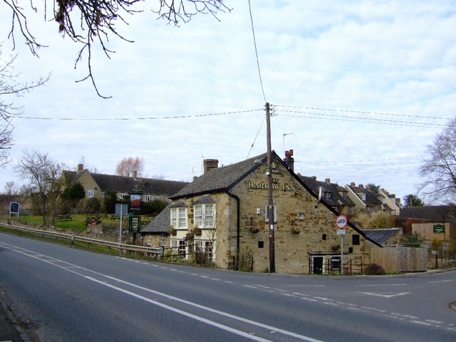
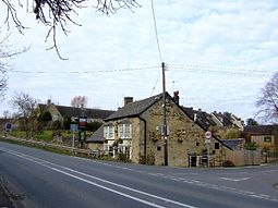 The Harrow Inn, Neat Enstone
Enstone has two public houses: the Crown at Church Enstone and the Harrow at Neat Enstone. The village also has a County Council primary school.[9] There is also a Post Office and general store, an art gallery[10] and a retirement home. Enstone has a Women's Institute.[11][12]
Enstone Sports Sunday Football Club plays in Cherwell Trophies Sunday Morning League Division Two.[13]
References
- ^ "Area selected: West Oxfordshire (Non-Metropolitan District)". Neighbourhood Statistics: Full Dataset View. Office for National Statistics. http://www.neighbourhood.statistics.gov.uk/dissemination/LeadTableView.do?a=7&b=798813&c=Great+Tew&d=16&g=481687&i=1001x1003x1006&k=headcounts&o=1&m=0&r=1&s=1269378817046&enc=1&domainId=15&dsFamilyId=779. Retrieved 23 March 2010.
- ^ Sherwood & Pevsner, 1974, page 595
- ^ Sherwood & Pevsner, 1974, pages 593-594
- ^ Sherwood & Pevsner, 1974, page 594
- ^ a b Crossley, 1983, pages 131-143
- ^ A Church Near You: Enstone: St Kenelm, Enstone
- ^ Old Airfields website: Oxfordshire. RAF Enstone
- ^ Control Towers website: RAF Enstone
- ^ Enstone Primary School
- ^ Sycamore Gallery
- ^ Oxfordshire Federation of Women's Institutes
- ^ Enstone Village website
- ^ Webteams.co.uk page for Enstone Sports Sunday F.C.
Sources and further reading
- Emery, Frank (1974). The Oxfordshire Landscape. The Making of the English Landscape. London: Hodder & Stoughton. pp. 31, 32, 144, 145. ISBN 0 340 04301 6.
- Jordan, John (1857). A Parochial History of Enstone, in the County of Oxford: Being an Attempt to Exemplify the Compilation of Parochial Histories.
- Sherwood, Jennifer; Pevsner, Nikolaus (1974). Oxfordshire. The Buildings of England. Harmondsworth: Penguin Books. pp. 624–628. ISBN 0 14 071045 0.
- Stewart, Sheila (1988). Lifting The Latch: A Life on the Land - Based on the Life of Mont Abbott of Enstone, Oxfordshire. Day Books. ISBN 978 09532213 32.
External links
 Media related to Enstone at Wikimedia Commons
Towns Burford (Signet, Upton) • Carterton • Charlbury • Chipping Norton (Southcombe) • Witney (Cogges, Madley Park) • Woodstock (Hensington, Old Woodstock)
Large Villages Aston, Cote, Shifford and Chimney (Aston, Cote, Shifford, Chimney) • Bampton (Lower Haddon, Weald) • Brize Norton • Ducklington • Enstone (Church Enstone, Neat Enstone, Chalford, Cleveley, Fulwell, Gagingwell, Lidstone, Radford) • Eynsham (Barnard Gate) • Freeland • Hailey (New Yatt) • Hanborough (Church Hanborough, Long Hanborough) • Milton-under-Wychwood • Minster Lovell • North Leigh (East End, Wilcote) • Shipton-under-Wychwood • Standlake (Brighthampton) • Steeple Barton (Middle Barton) • StonesfieldOther Civil
Parishes
(Component
Villages
and Hamlets)Alvescot • Ascott-under-Wychwood (Ascott d'Oyley, Ascott Earl) • Asthall (Asthall Leigh, Worsham) • Black Bourton • Bladon • Blenheim • Broadwell • Bruern • Cassington (Worton) • Chadlington • Chastleton • Chilson (Shorthampton) • Churchill • Clanfield • Combe • Cornbury and Wychwood (Cornbury, Wychwood) • Cornwell • Crawley • Curbridge • Fawler • Fifield • Filkins and Broughton Poggs (Filkins, Broughton Poggs) • Finstock • Fulbrook • Glympton • Grafton and Radcot (Grafton, Radcot) • Great Tew • Hardwick-with-Yelford (Hardwick, Yelford) • Heythrop (Dunthrop) • Holwell • Idbury (Bould, Foscot) • Kelmscott • Kencot • Kiddington with Asterleigh (Asterleigh, Kiddington, Over Kiddington) • Kingham • Langford • Leafield • Lew • Little Faringdon • Little Tew • Lyneham • Northmoor • Over Norton • Ramsden (Mount Skippett) • Rollright (Great Rollright, Little Rollright) • Rousham • Salford • Sandford St. Martin (Ledwell) • Sarsden • Shilton • South Leigh • Spelsbury (Dean, Taston) • Stanton Harcourt • Swerford • Swinbrook and Widford (Swinbrook, Widford) • Tackley • Taynton • Westcott Barton • Westwell • Wootton (Dornford, Hordley) • Worton (Nether Worton, Over Worton)Former Districts
and BoroughsChipping Norton Rural District • Municipal Borough of Chipping Norton • Witney Urban District • Witney Rural District • Municipal Borough of Woodstock • Woodstock Rural DistrictFormer
ConstituenciesCategories:- Villages in Oxfordshire
- Civil parishes in Oxfordshire
- West Oxfordshire


Wikimedia Foundation. 2010.