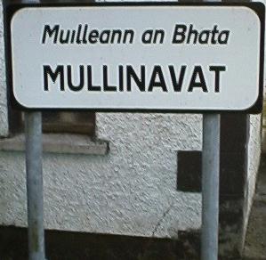
- Mullinavat
-
Mullinavat
Muileann an Bhata— Town — Location in Ireland
 Mullinavat
Coordinates: 52°22′00″N 7°10′00″W / 52.366667°N 7.166667°WCoordinates: 52°22′00″N 7°10′00″W / 52.366667°N 7.166667°W Country Ireland Province Leinster County County Kilkenny Area – Town 78.6 km2 (30.3 sq mi) Population (2006) – Urban 1,533 Time zone WET (UTC+0) – Summer (DST) IST (WEST) (UTC-1) Irish Grid Reference 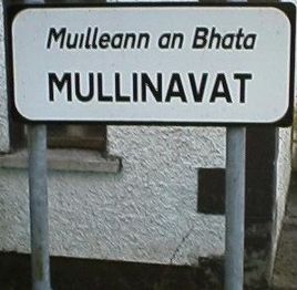 Mullinavat
Mullinavat (Irish: Muileann an Bhata, meaning "the Mill of the Stick") is a town in south County Kilkenny, Ireland. Its main industries are tourism and agriculture. It has a renowned sporting history, particularly in hurling.
Contents
Location and access
The village is located centrally on the N9 national primary road from Waterford to Dublin. The town was by-passed in July 2010 when the Kilkenny -- Waterford section of the M9 opened. There are link roads to New Ross and Piltown from the town centre. The town is bounded by Killahy in the upper end of the parish to Fahee (Fahy) in the lower end, a distance of 7.4 miles (11.9 km). In the west lies Rathnasmolagh with Listrolin at the eastern extremity, a distance of 6.6 miles (10.6 km). The town measures 48.84 square miles (78.6 kilometres).
Rail
Mullinavat railway station opened on 21 May 1853 and finally closed on 1 January 1963.[1]
Bus
The town is served by buses from both Bus Éireann and Kavanaghs Rapid Express, thanks to its location on the main Dublin Waterford route. Kavanaghs Buses[2] run day and night, serving Dublin Airport. Bus Éireann's services run from 05.30 and finish at 19.40 on the Dublin Route, and 09.00 until 23.00 on the Waterford route, but are subject to change. Online timetable.[3] Despite campaigns, there is no commuter service to Waterford from Mullinavat, as it is located in the Kilkenny county area.
History
Name
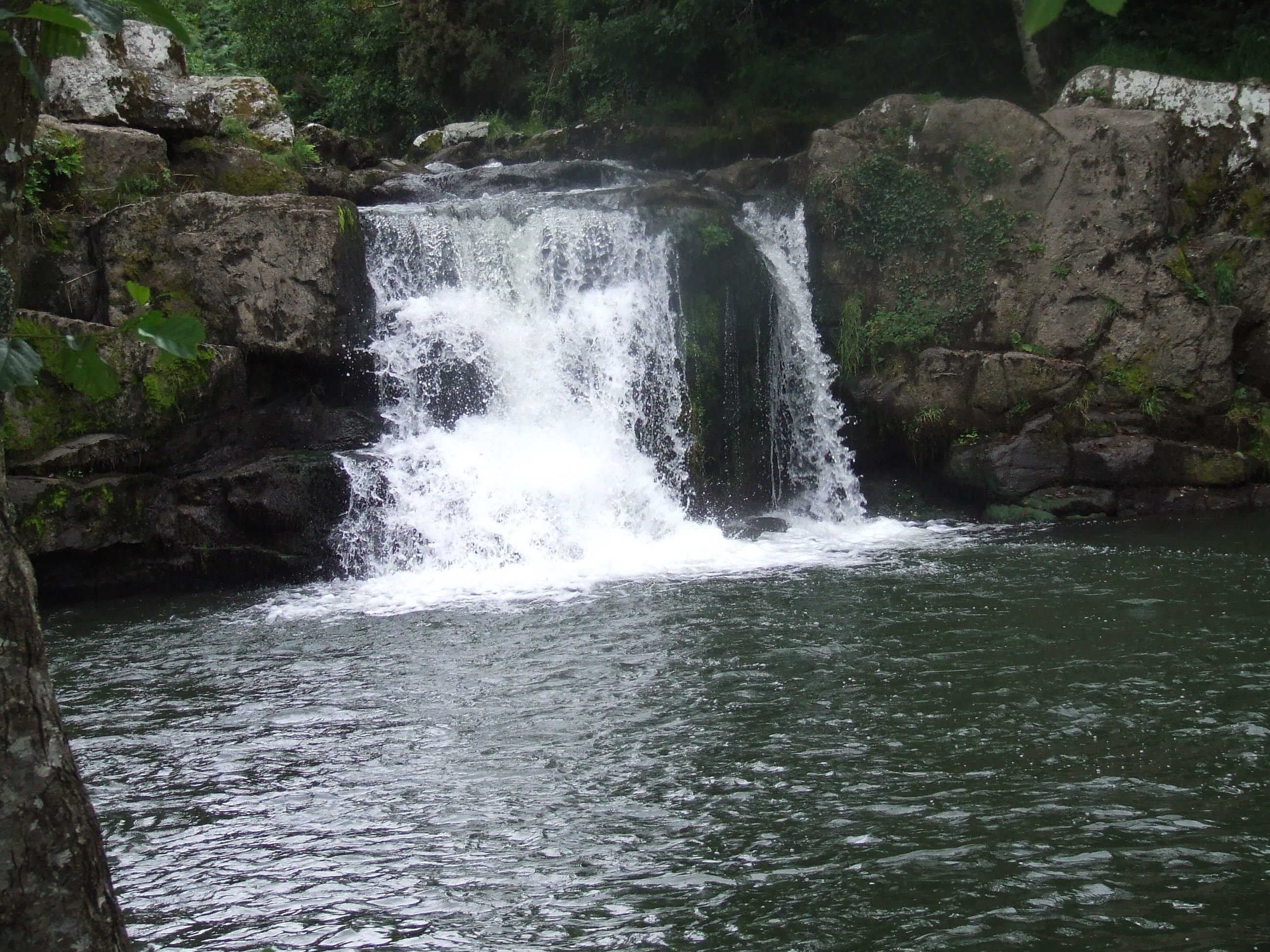
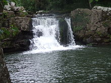 Pollanassa waterfall
The town's name in Irish translates as 'The Mill of the Stick'. Tradition has it that the name was derives from an mill which could only be approached by means of a rough stick over the Glendonnel River, where the bridge on the main road is now, beside the Garda Barracks.
Historical parishes
Mullinavat originally comprised the civil parishes of Kilbecan, Kilahy and Rossinan, all located in the barony of Knocktopher. Prior to 1842, Mullinavat formed one Ecclesiastical parish with Kilmacow. In the middle of the 18th century, Mullinavat consisted of only a few houses. In 1801, the number of houses was 35, with 158 inhabitants. The erection of a church here in 1805 had a decided influence on the general improvement of the village, which in 1841 had 110 inhabited houses. In 1871, the population of Mullinavat was 531. The parish church of Kilbecan was in use up to 1830, then used as a Protestant church. It was dedicated to St. Becan, Bishop and confessor whose feast day is set down as May 27.
The first chapel built in the Mullinavat district since the reformation, stood in the townland of Deerpark. It was called the 'Chapel of Scart' as it was situated close to the townsland of Scart. Its site is on the west side of the Waterford Road, near the Blackwater River. It is handed down that whenever the river became so swollen as to be impassable, the people at the Clonassey and Ballyda side used to assemble on Sunday mornings on the western bank, opposite the chapel. They would kneel and pray while the people on the other side had mass within the chapel walls. This chapel was in use for a long period and was abandoned in 1772. The next chapel called 'The Chapel of Park' stood at the village of Park. It was closed in 1805, having been used as the district chapel for '33 years, the term of our Lord's life on Earth'. The present chapel of Mullinavat was built in 1805, during the pastoral term of rev. Marum p.p., of Kilmacow. It stands in the townsland of Garrandarragh ('oak grove'). It was renovated in 1960. The first chapel in Bigwood was in use from about 1787 to 1824. Another chapel was built in 1842 by the contributions of the people of neighbouring townlands in the parishes of Mullinavat, Kilmacow, Glenmore and Slieverue. This chapel was in use until 1966 when the present church was erected during the pastoral term of Very Rev. Canon D. Hughes.
Killahy
The parish of Killahy was mentioned at the time of the suppression of the religious houses in 1540. The parish church of Killahy was about 33 ft (10 m). long, and 19 ½ ft. wide. It was dedicated to the exaltation of the Holy Cross on September 14. About two or three hundred yards to the SouthEast, in the townland of Red Acres, there was a holy well known as the 'Well of the Holy Cross'. It was frequented for devotional purposes until about 1850, when it was destroyed by its owner.
Rossinan
The parish of Rossinan was also mentioned at the suppression of the religious houses. The original Irish name Rois Seanain meaning 'The point or Wood of St. Synan or Senanus'. Whether this saint in identical with his namesake, the patron of the adjoining parish of Kilmacow is unknown. The parish church of St. Synan was situated in Rossinan, close to the left bank of the Blackwater River. No trace of the church now remains as the railway line from Waterford to Kilkenny was constructed over it around 1850. The graveyard met the same fate, as the road from Waterford to Mullinavat runs through the centre of it.
Tory Hill
Tory Hill (Ir. Sliabh gCruinn, 'Round Mountain') rising to a height of 966 ft (294 m). above sea level, is said to have derived its name from an outlaw named Edmund Den, who flourished in this locality around the year 1700. There is a pattern held each year on Tory Hill on the second Sunday of July. This is locally called 'Tory Hill Sunday' and 'Frocchans Sunday'. It never was a religious celebration, but merely consisted of the people of the neighbourhood gathering to pick the wild berries called 'Frocchans'. In the Holy Year of 1950 a large cross was erected on the summit of the hill, and since then the rosary had been said by the people who gather beneath the cross.
Listrolin, Clonassey and Ballinacooley
Named after 'Fort of the Wren', Listrolin is situated in the heart of the Walsh Mountains, overlooking Mullinavat, Mooncoin, Kilmacow and Tempelorum. The mountains were acquired by the Walsh family when they landed in Ireland with Strongbow. This vast area was controlled by the family until Oliver Cromwell invaded the area. The Mountains were full of castles owned by the family's descendants. See Inchicarron Castle, Clonassey Castle and Ballinacooley Castle. In 1946 the townslands of Clonassy, Listrolin and Rochestown were annexed from Mooncoin, becoming part of Mullinavat district parish. The ancient church of this district stood in Listrrolin, in the laneway leading over the Assy River to Ballinacoaley. Around the year 1850, the remains of the old church and graveyard were uprooted and tilled.
Clonassey Castle
Stood in the second field from the road under John Murphy's house. The remains of the foundations are to be seen in what is still known as 'The Castle Field'. Its last occupant was Robert Walsh, Member of Parliament for County Kilkenny in the parliament of 1689. He was slain at the siege of Limerick in 1691.
Inchicarron Castle
Stood where Simon Dwyer now lives and was occupied by John Mac Walter Walsh, a poet of considerable merit. He was known as 'Tatter Jack Walsh', Tatter meaning father or head of the clan. Unfortunately only one of his poems survives, but the name of the best-known Walsh dance tune is still 'Tatter Jack Walsh'. In his old age, his property was confiscated, and he betook himself to friends in Lismatigue. He is believed to have lived on the moat where R. Dalton now lives. There he died in 1660 and was buried in Kilbeacon cemetery.
Sport:GAA club history
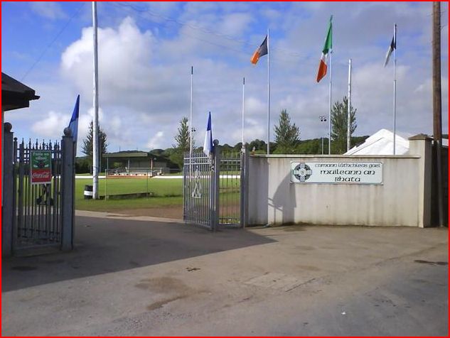
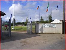 Mullinavat GAA grounds
Mullinavat Football Club was formed in 1887, the first year of official Gaelic Athletic Association. championships. Gaelic football was the dominant sport in the parish until around 1913 when a hurling team from Mullinavat entered the Junior championship for the first time. The present pitch was bought in 1953 for £590. Fr. Joseph Gallavan C.C. was the driving force behind the purchase and development of the field.
The appointment as parish priest in 1983 of the legendary Kilkenny coach Monsignor Tommy Maher was of crucial importance to the development of hurling in Mullinavat. Fr. Tommy as he is better known needs no introduction to followers of hurling. A past pupil of St Kieran's College, he was a member of the Kilkenny team beaten by Tipperary in the 1945 All-Ireland Hurling Final. He won a County Championship medal with Thomastown in 1946. In the mid-1950s he became coach to the Kilkenny team and quickly made his presence felt as Kilkenny, in 1957 ended the County Wexford dominance in Leinster. During his term as coach, which was a new concept then, Kilkenny captured seven All-Irelands. In 1983 he was appointed Parish Priest of Mullinavat and immediately became involved in the local hurling scene. It came as no surprise to anybody that, in 1984, Mullinavat won the Junior Championship, and in 1985, won the Special Junior B Championship. A couple of years later, he retired completely from the game but his interest has never waned and he is currently the Club President.
In 1989 Mullinavat won the Intermediate Championship when trained by Jim Walsh. Jim was a prominent hurler on the Mullinavat team for many years and played for the County minor team in 1966. He won an intermediate All-Ireland medal in 1972. The team reached the semi-final of the senior championship in 1993 but were relegated to the intermediate grade in 1994. In 1997 they reached the semi-final of this grade and in 1998 they contested the junior football final. In 1998 Fr. Tommy Maher retired as parish priest and was replaced by another famous hurling coach, Fr. Liam Barron, who has guided the Kilkenny minor teams to many victories in recent times. The victory of the minor team in 1998 was the springboard for further championship success in the following years. In 1999 the Club won The Intermediate Football League, the Special Junior B Hurling league, the Roinn B under-21 Championship and reached the final of the Intermediate Hurling Championship. In 2000 the Intermediate football championship was won and in 2001 the Club won the Intermediate Hurling championship. After a brief two years in the top flight the club was relegated back to Intermediate ranks, but senior status was regained in 2006 after an emphatic victory in the Intermediate Championship. The club was relegated to Intermediate the following year but reached the Intermediate final again in 2010 only to lose out by a point to Dicksboro. In 2011 they won Minor-B championship. [4][5]
Economy
Mullinavat's economy is typical to that in south Kilkenny. Its main economic activities are Tourism, Construction, and Agriculture although it does have a growing services sector, particularly in retailing and hospitality as well as hardware and machinery hire. Nonetheless the town serves its local population well, with many public services, from health centres to agricultural training and advice in the Teagasc centre.
Strict planning rulings from Kilkenny County Council forbid large-scale development in the town. Some locals regularly criticize the council on this issue, as the towns young, highly educated workforce ultimately leave the town for employment in major cities, particularly Waterford. The majority of the population commute to Waterford by car, with a small minority by bus.
Agriculture and Forestry
Mulinavat is in an area of productive land, which has been exploited for Agriculture and Forestry. The main forms of agriculture are tillage of barley, oats, wheat, miscanthus, and maize. Production of sugarbeet stopped with the closure of the Carlow sugar plant. The other main agriculture activity is dairying. Most farmers in the area work with the Glanbia group. There is also beef or livestock farming. Minority forms of farming include bull breeding (Hereford) and poultry. Many farmers in the area work in a mixture of all the above areas in typical mixed farms. Some farmers in Mullinavat are active participants in the EU's Rural environmental protection scheme REPS[6] scheme to maintain and improve the rural environment for both commercial farming and the natural habitats.
Large scale afforestation is undertaken by Coillte, the national forestry company. Forestry has been important in Mullinavat since the 1960s, mainly conifer plantations. In recent years, Government policy has promoted the development of deciduous woodland using species such as oak, beech and ash.
Construction
The idyllic rural setting of the town, along with its good service provisions and quality of life have had a dramatic effect on house prices in the area, which rose extremely fast, even by national standards. The demand grew because of proximity to Waterford City, as well as demand from large numbers of British ex-patriots who moved to the area over a short period of time. This in conjunction with appropriately strict planning regulations led to the emergence of some exclusive areas in the surrounding townslands, which became too expensive for locals.
Services
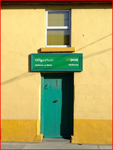
 Mullinavat post office
Shops
Bars
Restaurants
HotelBroadband HSDPA(2006) ADSL(2007)
Primary School
Health clinic
GP
Veterinary surgeon
GAA club (St Beacons)
Public Park with Playground
Rural Walkways and trek path
Youth Club (Foróige)
Garda StationReferences
- ^ "Mullinavat station". Railscot - Irish Railways. http://www.railscot.co.uk/Ireland/Irish_railways.pdf. Retrieved 2007-11-19.
- ^ [1][dead link]
- ^ http://www.buseireann.ie/pdf/1202289437-4.pdf
- ^ mullinavat.kilkenny.gaa.ie
- ^ History courtesy of authors of the book Mullinavat GAA 1884-1984.
- ^ "Dept of Agriculture & Food- Rural Environment Protection Scheme - Basics and Contacts". Agriculture.gov.ie. Archived from the original on November 24, 2007. http://web.archive.org/web/20071124125337/http://www.agriculture.gov.ie/index.jsp?file=areasofi/reps.xml. Retrieved 2008-10-27.
See also
Places in County Kilkenny Towns 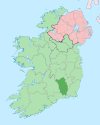
Villages - Aughamucky
- Ballyhale
- Bennettsbridge
- Carigeen
- Castlewarren
- Freshford
- Galmoy
- Goresbridge
- Gowran
- Hugginstown
- Inistioge
- Jenkinstown
- Johnstown
- Johnswell
- Kells
- Killamery
- Killinaspick
- Kilmacow
- Kilmoganny
- Knocktopher
- Mullinavat
- Paulstown
- Piltown
- Redhouse
- The Rower
- Slieverue
- Stoneyford
- Tullaroan
- Urlingford
- Windgap
Townlands - Ballyda
- Cantwell's Court
- Flagmount
- Hoodsgrove
- Jeanville
- Loughcullen
- List of townlands in County Kilkenny
- Category:Mountains and hills of County Kilkenny
- Category:Rivers of County Kilkenny
- Category:Geography of County Kilkenny
Categories:- Towns and villages in County Kilkenny
- Census towns in County Kilkenny


Wikimedia Foundation. 2010.