- Ballyhale
Infobox Place Ireland
name = Ballyhale
gaeilge = Baile Héil
crest
motto =
map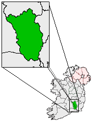
pin coords = left: 56px; top: 72px
north coord = 52.466286
west coord = 7.202225
irish grid =
area =
elevation =
province = Leinster
county = County Kilkenny
town pop =
rural pop =
census yr =
web = www.kilkennycoco.ie/eng/Ballyhale ("Baile Héil" in Irish) is a
village inCounty Kilkenny in Ireland. It is south of the city ofKilkenny , roughly half way between Kilkenny andWaterford . There are three parishes that make up Ballyhale. They are Knocktopher, Knockmoylan and Ballyhale.Transport
Ballyhale railway station opened on 20 May 1853, but finally closed on 1 January 1963. [cite web | title=Ballyhale station | work=Railscot - Irish Railways | url=http://www.railscot.co.uk/Ireland/Irish_railways.pdf | accessdate=2007-09-11]
port
Ballyhale Shamrocks GAA are the localGaelic Athletic Association club.Education
"Scoil Phádraig" is a mixed primary school located on the southern part of Ballyhale on the road towards Waterford. The old school building was built in 1948 and there was a new school added to this in 1993 with six classrooms. In 2006 the school began its quest to win a Green Flag for recycling and environmental awareness. [http://www.scoilphadraig1.schools.officelive.com "Scoil Phádraig"]
ee also
*
List of towns in the Republic of Ireland References
* [http://maps.google.com/maphp?hl=en&tab=wl&q=Ballyhale,%20Ireland (Google Maps)]
Wikimedia Foundation. 2010.