Killamery

Killamery

Infobox Place Ireland
name = Killamery
gaeilge = Cill Lamraí
crest

motto =
map

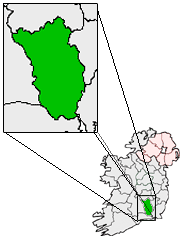
pin coords = left: 58px; top: 68px
north coord = 52.478337
west coord = 7.447357
irish grid =
area =
elevation =
province = Leinster
county = County Kilkenny
town pop =
rural pop =
census yr =
web = www.kilkennycoco.ie/eng/

Killamery ("Cill Lamraí" in Irish) is a village in County Kilkenny, Ireland. It was the site of a monastery (circa 632) and has a High Cross.

Two bullauns and a holy well are also found nearby.

The village is located near the County Tipperary border on the N76 National secondary road, halfway between Kilkenny to the northeast and Clonmel to the southwest.

ocial life

There is currently just one public house in the village, "The Auld House", which is a popular and vibrant social centre for a broad rural area.

ee also

* List of towns and villages in Ireland
* List of abbeys and priories in the Republic of Ireland (County Kilkenny)

External links

* [http://www.ancientworlds.net/516671 Killamery brooch]
* [http://cloghmore.bravepages.com/kilkenny/killamery.html Killamery High Cross]


Wikimedia Foundation. 2010.

Игры ⚽ Нужна курсовая?

Look at other dictionaries:

  • N76 road (Ireland) — N76 road Route information Length: 49 km (30 mi) Location …   Wikipedia

  • Килламери — Деревня Ирландии Килламери англ. Killamery, ирл. Cill Lamraí Страна …   Википедия

  • County Kilkenny — For other uses, see Kilkenny (disambiguation). County Kilkenny Contae Chill Chainnigh Coat of a …   Wikipedia

  • Kilkenny — For other uses, see Kilkenny (disambiguation). Kilkenny Cill Chainnigh   City   …   Wikipedia

  • Windgap, County Kilkenny — Infobox Irish Place name = Windgap gaeilge = Beárna na Gaoithe crest motto = map pin coords = left: 35px; top: 75px north coord = 52.464167 | west coord = 7.398611 | irish grid = area = | elevation = province = Leinster county = County Kilkenny… …   Wikipedia

  • National secondary road — The N59 at Kylemore Lough in County Galway A national secondary road (Irish: Bóthar Náisiúnta den Dara Grád) is a category of road in Ireland. These roads form an important part of the national route network, but are secondary to the main… …   Wikipedia

  • Kingdom of Osraige — Osraige Country Ireland Ancestral house Ulaid / Érainn Titles Kings of Munster Kings of Leinster Kings of Osraige Kings of Corcu Loígde Kingdom of Ireland titles: Lord Baron of Upper Ossory Earl of Upper Ossory Baron Gowran …   Wikipedia

  • Mooncoin — Móin Choinn   Town   Church at Mooncoin …   Wikipedia

  • Máel Sechnaill mac Máele Ruanaid — Cross of the Scriptures, Clonmacnoise, commissioned by Máel Sechnaill s son Flann Sinna and erected in 901. Simpler crosses were erected by Máel Sechnaill, including the south cross at Clonmacnoise and those at Kinnitty and Killamery by Kilkenny …   Wikipedia

  • Mullinahone — (Irish: Muileann na hUamhan, meaning mill on the river ) is a village in the barony of Slievardagh, South Tipperary in Ireland. It is also a parish in the Roman Catholic Archdiocese of Cashel and Emly. The Irish Census of 2006 recorded the… …   Wikipedia

Share the article and excerpts

Direct link
Do a right-click on the link above
and select “Copy Link”