- Castlewarren
Infobox Irish Place
name = Castlewarren
gaeilge = Caisleán an Bhairínigh
crest
motto =
map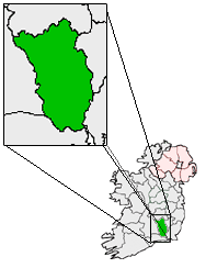
pin coords = left: 60px; top: 49px
north coord = 52.42 | west coord = 7.06 | irish grid =
area = | elevation = 200 m
province = Leinster
county =County Kilkenny
rural pop = 375
census yr = 2002
web = |Castlewarren ("Caisleán an Bhairínigh" in Irish) previously known as Boula, is a small
village inCounty Kilkenny ,Ireland , located some convert|4|km|mi north of the N10 national primary road atFlagmount . Thecastle site is on top of aridge convert|200|m|ft above sea level.t. Scuithin's
The Catholic church in the village is dedicated to St. Scuithin. There was an old
kiln where the church now stands; the people used to build a make-shift altar in the kiln where mass was celebrated. As time went on they began to build small shelters to protect the women of the congregation during inclement weather. The present church was built in 1829 in the shape of a cross. Castlewarren is a sub-parish of Clara,County Kilkenny .Also see
Wikimedia Foundation. 2010.