- Minnehaha Falls
-
This article is about the waterfall in Minnesota. For the waterfall in Georgia, see Minnehaha Falls, Georgia.
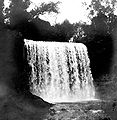
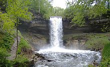 Minnehaha Falls, May 2006
Minnehaha Creek is a tributary of the Mississippi River located in Hennepin County, Minnesota that extends from Lake Minnetonka in the west and flows east for 22 miles (35 km) through several suburbs west of Minneapolis and then through south Minneapolis. Including Lake Minnetonka, the watershed for the creek covers 181 square miles (470 km2). The creek might have been unremarkable except for the 53-foot (16 m) Minnehaha Falls located near the creek's confluence with the Mississippi. The site is not far from Fort Snelling, one of the earliest white settlements in the region.
While the name is often translated as "Laughing Water", the correct translation is "curling water" or "waterfall". The name comes from the Dakota language elements mni, meaning water, and ȟaȟa, meaning waterfall.[1][2] Thus the expression "Minnehaha Falls" translates as "Waterfall Falls". The "Laughing Water" translation comes from Mary Eastman's book Dacotah, published in 1849. On the Fort map of 1823, the falls were named Brown's Falls. The Dakota called Minnehaha Creek, "Wakpa Cistinna", meaning "Little River".[2]
Contents
History
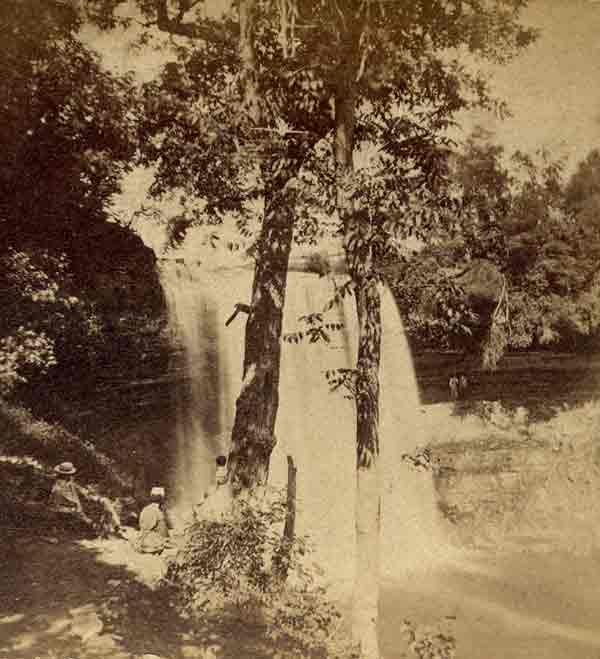
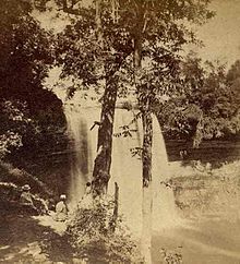 Minnehaha Falls, circa 1860
In 1852, Ard Godfrey built a house, sawmill, and gristmill on Joe Brown's old claim, but he and his wife Harriet abandoned the site in 1871, as the mills at St. Anthony Falls economically overshadowed any commercial potential of Minnehaha.[2]
The falls became a tourist destination, especially after the 1855 publication of The Song of Hiawatha by Henry Wadsworth Longfellow. However, Longfellow never visited the falls himself. He was inspired by the stories of Mary Eastman and Henry Rowe Schoolcraft and by a photograph of the falls.
Beginning in 1885, the state legislature began acquiring the land to become the first Minnesota State Park. But in 1889, it was turned over to the city of Minneapolis for a city park.[3] Residents and visitors could fish, swim, picnic, and visit a zoo. The park also featured pony rides and a refectory. Each year, 20,000 campers stayed in the Auto Tourist Camp in the park— it was closed in the 1950s.[2]
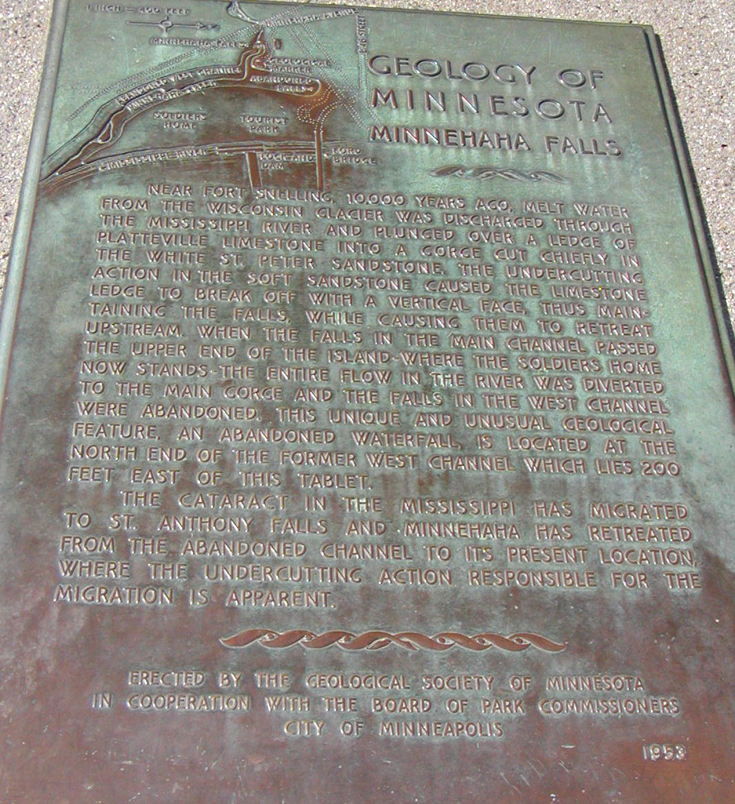
In geologic time, the site of Minnehaha Falls is linked historically to Saint Anthony Falls, which is several miles upriver on the Mississippi. Around 10,000 years ago, the St. Anthony Falls were located near the site where Minnehaha Creek entered the river. As erosion brought the falls upriver, they passed Minnehaha Creek, causing a new waterfall to form. The story actually becomes even more complex because the Mississippi eventually abandoned the portion of St. Anthony Falls that was then nearest to Minnehaha and this abandoned channel and waterfall have since been covered by tons of fill dirt.[4] The lower portion of Minnehaha Creek now flows through a wide and deep channel once belonging to the larger river. The end of Minnehaha Creek where it joins the Mississippi River is the lowest surface point in the city of Minneapolis at 686 ft (209 m) above sea level.
Erosion within the last century has resulted in a falls that is fairly narrowly channeled and vigorous, notably after a heavy rain. Photographs of the waterfall from the 1800s (such as the one from 1860) show a much wider, curtain like character to the falls. When the falls is dry, the older, much-broader ledge can be observed. If there were sufficient interest and funding, some remedial work could theoretically restore the 19th century appearance of the falls.[5]
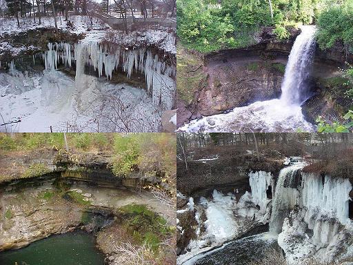
Due to the extremely cold temperatures in the area during the winter months, the falls freeze, creating a dramatic cascade of ice that can last well into the spring. If there is a rain shortage in the autumn, the falls may virtually dry up. In the summer, especially in the rainy months of June and July, the flow can be surprisingly forceful.
Minnehaha Park
Minnehaha Historic District

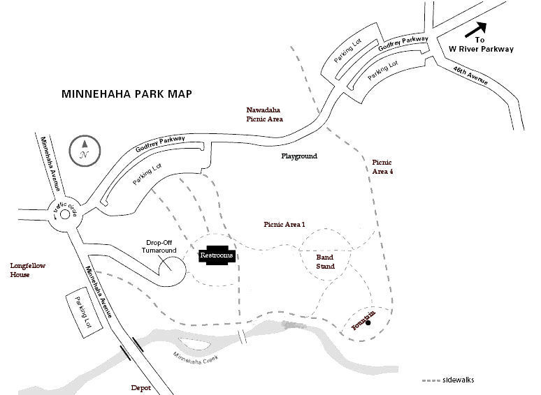
Location: Roughly Hiawatha and Minnehaha Aves, and Godfrey Rd., Minneapolis, Minnesota Coordinates: 44°54′54″N 93°12′36″W / 44.915°N 93.21°WCoordinates: 44°54′54″N 93°12′36″W / 44.915°N 93.21°W Built: 1849 Architect: H.W.S. Cleveland; Et al. Architectural style: Greek Revival, Late Victorian, Georgian Governing body: Local NRHP Reference#: 69000369 Added to NRHP: November 25, 1969[6] Today, the falls are located near the entrance of Minnehaha Park in Minneapolis. The 193-acre[7] park is divided into two main portions: an upper section above the falls which is kept trimmed and maintained like many other city parks, and the lower section which is largely left in a natural state which is largely popular for free climbing due to the steep terrain. Minnehaha Park is a popular site for cultural festivities and weddings.
Some historic structures are located in the park.
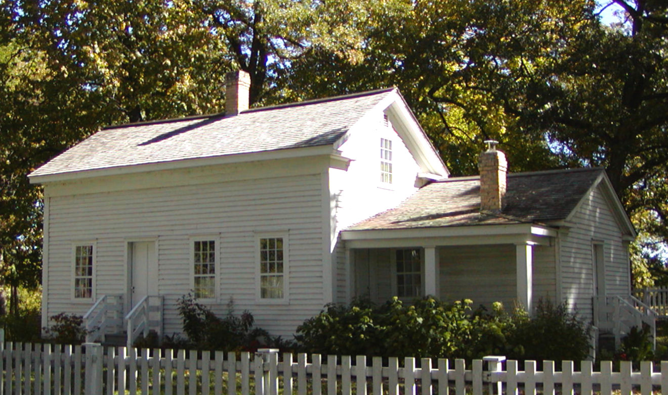
- The home of John H. Stevens, built in 1849 or 1850 near St. Anthony Falls was moved to Minnehaha Park in 1896. According to the Minneapolis Park and Recreation Board, the home has the distinction of being the first wood-frame dwelling built west of the Mississippi. It was in this home that the name Minneapolis was suggested, and the government of Hennepin County was organized. In 1896 over 10,000 school children helped pull the house to Minnehaha park and in 1982, the home was situated in its current location.
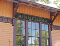
- A small train station officially named Minnehaha Depot but also known as "the Princess Depot" was built in 1875; it was a stop on the Milwaukee Road railroad and provided easy access to the park from Fort Snelling, downtown Minneapolis, and downtown St. Paul. The depot handled as many as 39 round trips per day; it was once integrated into the region's streetcar system. In 1964, title was transferred to the Minnesota Historical Society. The Minnesota Transportation Museum has assisted in the restoration of the building. The depot is open on Sundays from 1:30 to 4:30. The 50th Street / Minnehaha Park station of the Hiawatha light rail line currently serves the park.
A building known as the Longfellow House is also on the park grounds and provides some history of the park. It houses a small collection of historical photographs and is the main informational site for the Grand Rounds Scenic Byway, a 50-mile (80 km) automobile, bicycle, and pedestrian parkway (a designated National Scenic Byway) that circles through the city. The house was built in 1906 for Robert "Fish" Jones, who owned and operated Longfellow Zoological Gardens, which succeeded the original zoo in the park. The home is a 2/3 scale replica of the Longfellow National Historic Site, the long-time home of poet Henry Wadsworth Longfellow in Cambridge, Massachusetts. Jones donated the Gardens to the Park Board in 1924.
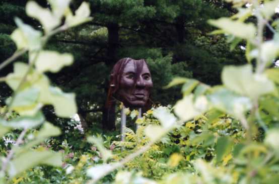
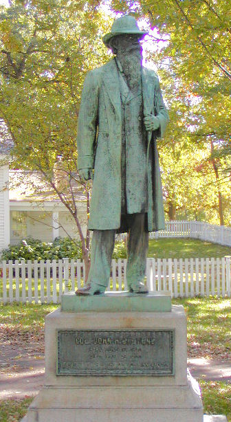
Statues on the grounds commemorate several notable figures including John H. Stevens, Gunnar Wennerberg, Hiawatha and Minnehaha, Little Crow, and Henry Wadsworth Longfellow. The main Minnesota Veterans Home is located on the bluff at the confluence of the Mississippi and Minnehaha Creek.
Minnehaha Park is listed on the National Register of Historic Places as the Minnehaha Historic District. Minnehaha Park is also within the Mississippi National River and Recreation Area, a unit of the National Park Service.
Park geology
Visitors to the park can view the ancient geological history of Minnesota as they walk the path leading from the upper falls down to the Mississippi River. The uppermost layer of soils and gravels of Minnesota were deposited by the most recent Ice Age, about 10,000 years ago. Four great ice ages have swept away all traces of the more recent Mesozoic and Cenozoic eras in the Twin Cities area, however standing at the upper falls, one is standing directly on the Platteville Limestone Formation laid down during the Ordovician Period of the Paleozoic Era. During the Ordovician Period, about 450 million years ago, the North American continent was situated along the equator, and a warm shallow sea covered much of Minnesota.[8] Sea life was abundant and a large number of marine fossils including corals, bryozoans, brachiopods, clams, snails, cephalopods, and trilobites can be found in the limestone and shale sediments at several areas in the Twin Cities and along the Mississippi River in the park and elsewhere.[9][10][11]
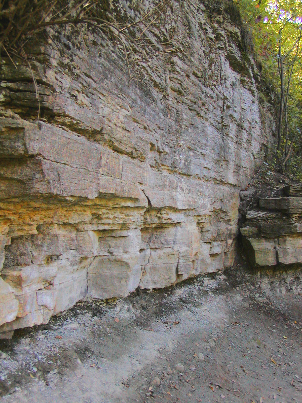
Walking from the upper falls to the base of the falls one passes through the thin layer of the Glenwood Shale Formation, and just below the base of the falls, one enters the level of the Saint Peter Sandstone Formation of pure white quartz sandstone. The Minnesota St. Peter Sandstone is "famous the world over as the example of a well-rounded, sell-sorted, pure quartz sand. It is the Ivory Snow of sediments, because it is close to 99.44% pure".[12] This sand was first deposited as beach sand, probably eroded from earlier Cambrian sandstones, along the shores of the Ordovician sea. Walking along the creek to the area at which the foot bridge crosses, the Glenwood Shale Formation, a thin layer of grey-green rock probably deposited in a deeper-water offshore from the beaches, can be seen where it has been exposed by erosion. Shale was formed from ancient mud deposits and the Glenwood shale in the park is filled with numerous small fossils, appropriately termed "fossil hash". Together, these three formations that are visible as one walks from the upper falls to the river represent a sequence of sea-level rise during Ordovician time.[10][13]
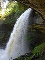
Image gallery Minnehaha Park
-

Seasons of Minnehaha
-
A close up next to the falls, 2005
-
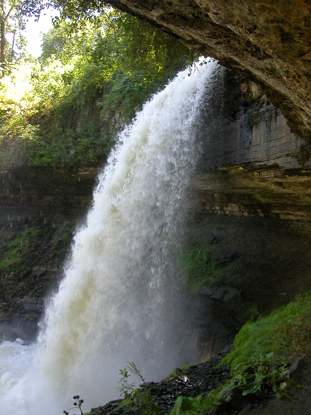
Behind the falls in 2005
-
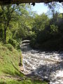
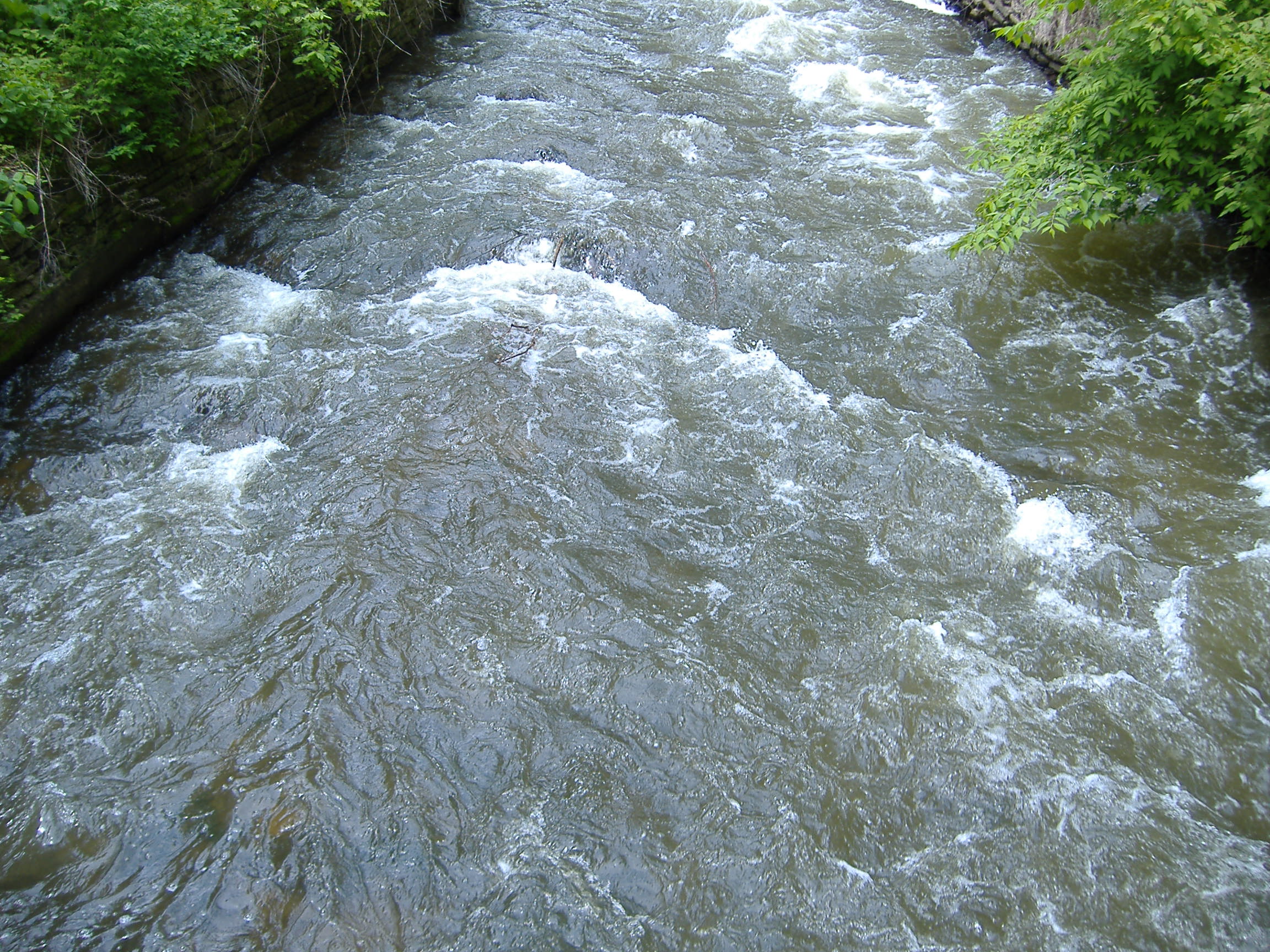
A view downstream taken from behind Minnehaha Falls in 2005
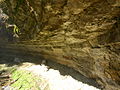
-
Down a trail at Minnehaha Falls, someone carved out the limestone to make a cave. Photo taken fall 2007.
-

Taoyateduta known as Chief Little Crow
-

John H. Stevens' house
-

2/3 scale replica of Longfellow's house
-

Minnehaha depot
-
Minnehaha depot
-

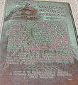
Minnehaha depot plaque
-

Gunnar Wennerberg statue
-
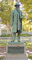
John H. Stevens Statue
-
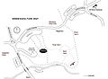
Map of the north end of the park
-
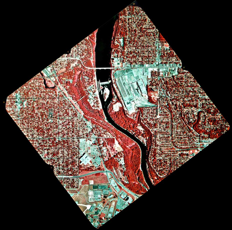
Falls are southwest of Ford Bridge, with the Veterans Home overlooking Lock and Dam 1. (1994 IR photo)
-

Limestone/sandstone layers on the bank of Minnehaha Creek
-
Plaque describing geology of Minnehaha Falls
-

Minnehaha creek
-
Minnehaha Falls in 1914
-
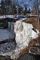
Minnehaha Falls frozen, March 2009
External links
- Minneapolis Park and Recreation Board: Minnehaha Park
- Urbancreek - A collection of old Minnehaha photos
- Minnehaha Creek Watershed District
- Collection of contemporary Minnehaha Falls photos
- USGS Photographic Library: Minnehaha Falls, 1914
References
- Minnehaha Regional Park. National Park Service. Accessed July 17, 2004.
- ^ Dakota Dictionary Online
- ^ a b c d Cairn, Rich and Susan (2003). "History of Minnehaha Creek Watershed". Minnehahacreek.org. http://www.minnehahacreek.org/pdf/MinnehahaHistory.pdf. Retrieved 2007-08-17.
- ^ "2008 Parks Calendar". Minnesota DNR. 2007. Archived from the original on 2007-12-03. http://web.archive.org/web/20071203174521/http://files.dnr.state.mn.us/outdoor_activities/state_parks/parks_calendar2008.pdf. Retrieved 2007-08-17.
- ^ Steller, Chris (May 9, 2008). "Paradise backfilled: Making a mountain out of a river bed at Minnehaha Park". Minnesota Monitor. http://www.minnesotamonitor.com/showDiary.do?diaryId=3951. Retrieved 2008-05-12.
- ^ http://www.minnpost.com/ronway/2008/06/02/2066/corps_doesnt_actually_know_whether_falls_walls_are_historic
- ^ "National Register Information System". National Register of Historic Places. National Park Service. 2009-03-13. http://nrhp.focus.nps.gov/natreg/docs/All_Data.html.
- ^ http://www.minneapolisparks.org/default.asp?PageID=4&parkid=252
- ^ http://jan.ucc.nau.edu/~rcb7/nat.html
- ^ ftp://mgssun6.mngs.umn.edu/pub2/mnglance/Mn_Precambrian.pdf
- ^ a b Mossler, J. and Benson, S., 1995, 1999, 2006, Fossil Collecting in the Twin Cities Area. Minnesota at a Glance: Minnesota Geological Survey: University of Minnesota.
- ^ http://www.sciencebuzz.org/blog/collecting-fossils-minnesota
- ^ http://books.google.co.uk/books?id=qzg525aWqF4C&printsec=frontcover&dq=Minnesota+Geology&hl=en&ei=tK5XTtv0Hcry0gGficGdDA&sa=X&oi=book_result&ct=result&resnum=1&ved=0CC4Q6AEwAA#v=onepage&q=St.%20Peter%20sandstone&f=false
- ^ http://www.geo.umn.edu/courses/1001/campus/pages/river/river.htm
U.S. National Register of Historic Places Topics Lists by states Alabama • Alaska • Arizona • Arkansas • California • Colorado • Connecticut • Delaware • Florida • Georgia • Hawaii • Idaho • Illinois • Indiana • Iowa • Kansas • Kentucky • Louisiana • Maine • Maryland • Massachusetts • Michigan • Minnesota • Mississippi • Missouri • Montana • Nebraska • Nevada • New Hampshire • New Jersey • New Mexico • New York • North Carolina • North Dakota • Ohio • Oklahoma • Oregon • Pennsylvania • Rhode Island • South Carolina • South Dakota • Tennessee • Texas • Utah • Vermont • Virginia • Washington • West Virginia • Wisconsin • WyomingLists by territories Lists by associated states Other Categories:- Historic districts in Minnesota
- Mississippi National River and Recreation Area
- National Register of Historic Places in Minneapolis, Minnesota
- Parks in Minneapolis, Minnesota
- Protected areas on the Mississippi River
- Regional parks in Minnesota
- Rivers of Minnesota
- Waterfalls of Minnesota
- Geography of Hennepin County, Minnesota


Wikimedia Foundation. 2010.