- Clarks Fork Yellowstone River
-
Clarks Fork Yellowstone River River Country United States State Montana Source Beartooth Mountains - location 45°39′00″N 108°42′55″W / 45.65°N 108.71528°W Mouth Laurel, Montana - elevation 3,241 ft (988 m) - coordinates 45°39′00″N 108°42′55″W / 45.65°N 108.71528°W Length 141 mi (227 km) 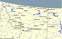
The Clarks Fork Yellowstone River (sometimes called the Clarks Fork River) is a tributary of the Yellowstone River, 150 mi (241 km) long in the U.S. states of Montana and Wyoming.[1]
It rises in southern Montana, in the Gallatin National Forest in the Beartooth Mountains, approximately 4 mi (6 km) northeast of Cooke City and southwest of Granite Peak. It flows southeast into the Shoshone National Forest in northwest Wyoming, east of Yellowstone National Park, then northeast back into Montana. It passes Belfry, Bridger, Fromberg, and Edgar, and joins the Yellowstone approximately 2 mi (3 km) southeast of Laurel.
The Clarks Fork of the Yellowstone River should not be confused with the Clark Fork River, which is located in Montana and Idaho.
Images of Clarks Fork of the Yellowstone 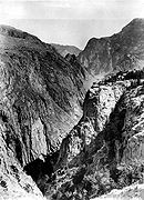 Clark Fork Canyon, 1893
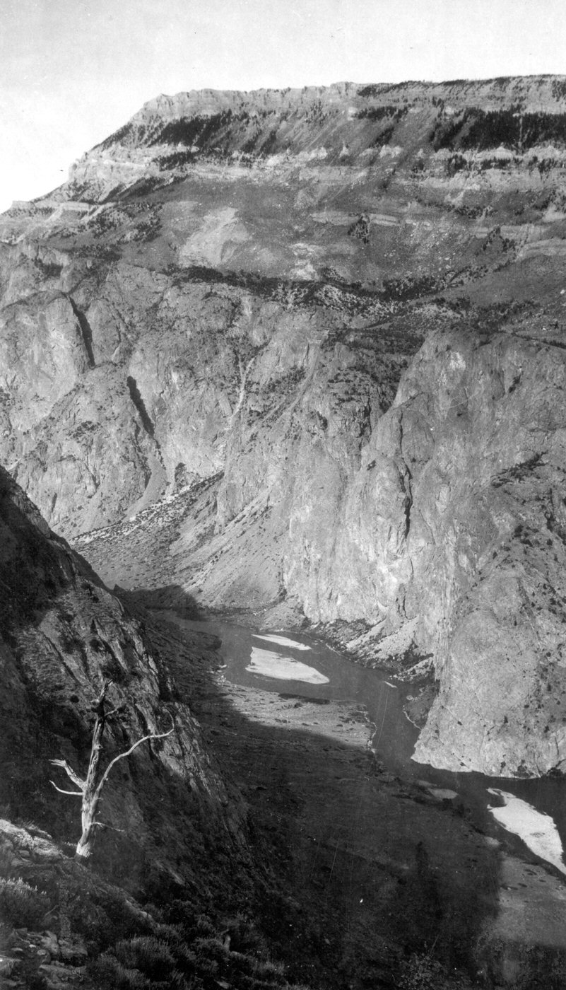
 Inner Canyon, 1922
See also
- Montana Stream Access Law
- List of rivers of Montana
- List of Wyoming rivers
References
- ^ George William Sherk (2000), Dividing the Waters: The Resolution of Interstate Water Conflicts in the United States, Martinus Nijhoff Publishers, ISBN 9789041198198, http://books.google.com/?id=EFB-rmHcf6EC&pg=RA1-PA966&dq=%22Clarks+Fork+Yellowstone+River%22
 State of Montana
Topics - Index
- History
- Governors
- People
- Geography
- State Government
- Delegations
- Visitor Attractions
Society - Crime
- Demographics
- Economy
- Education
- Politics
Regions - The Flathead
- Glacier National Park
- Regional designations of Montana
- Western Montana
- Yellowstone
Largest cities Counties - Beaverhead
- Big Horn
- Blaine
- Broadwater
- Carbon
- Carter
- Cascade
- Chouteau
- Custer
- Daniels
- Dawson
- Deer Lodge
- Fallon
- Fergus
- Flathead
- Gallatin
- Garfield
- Glacier
- Golden Valley
- Granite
- Hill
- Jefferson
- Judith Basin
- Lake
- Lewis and Clark
- Liberty
- Lincoln
- Madison
- McCone
- Meagher
- Mineral
- Missoula
- Musselshell
- Park
- Petroleum
- Phillips
- Pondera
- Powder River
- Powell
- Prairie
- Ravalli
- Richland
- Roosevelt
- Rosebud
- Sanders
- Sheridan
- Silver Bow
- Stillwater
- Sweet Grass
- Teton
- Toole
- Treasure
- Valley
- Wheatland
- Wibaux
- Yellowstone
 State of Wyoming
Topics - Governors
- Delegations
- Geography
- Government
- History
- People
- Visitor Attractions
- State Symbols
- Radio Stations
Society - Crime
- Demographics
- Economy
- Education
- Politics
Regions Cities Counties Categories:- Rivers of Montana
- Rivers of Wyoming
- Landforms of Park County, Montana
- Landforms of Carbon County, Montana
- Tributaries of the Yellowstone River


Wikimedia Foundation. 2010.