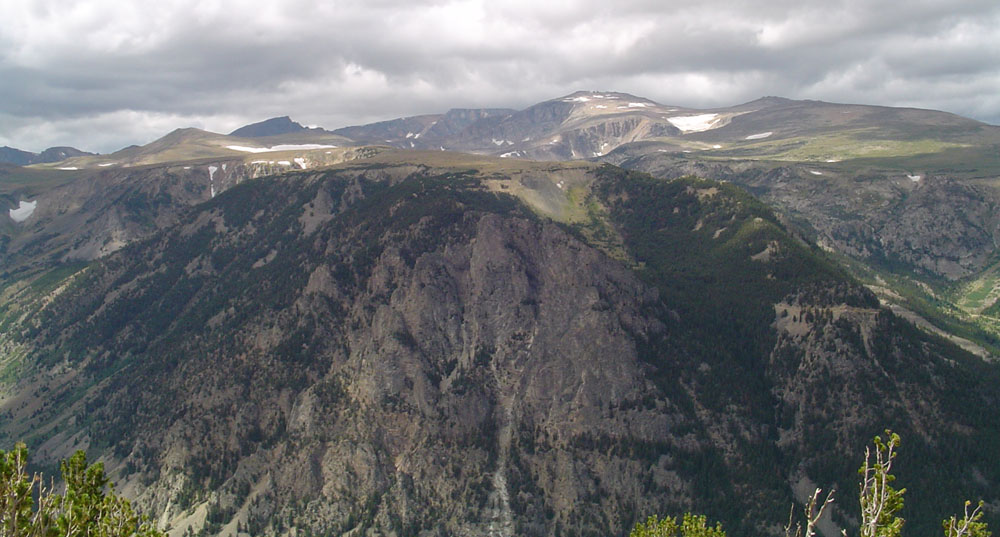
- Beartooth Mountains
Geobox|Range
name=Beartooth Mountains

image_caption=
map_caption=
country=United States
state=Montana
parent=Rocky Mountains
border=|border1=
geology=|period=|orogeny=Laramide
highest=Granite Peak
highest_elevation_imperial=12799
highest_lat_d=45|highest_lat_m=09|highest_lat_s=48|highest_lat_NS=N
highest_long_d=109|highest_long_m=48|highest_long_s=26|highest_long_EW=WThe Beartooth Mountains are located in south centralMontana , U.S. and are part of the 900,000 acre (3,600 km²)Absaroka-Beartooth Wilderness , within Custer andGallatin National Forest s. The Beartooths are home to the largest contiguous land area in the U.S. of over 10,000 feet (3,048 m) [ [http://www.sweetgrasscounty.com/recreation/WILDHIKE1.htm] ] , and is the location of Granite Peak, which at 12,799 feet (3,901 m) is the highest point in the state of Montana. The mountains are just north ofYellowstone National Park and are part of theGreater Yellowstone Ecosystem . The mountains are traversed by road via theBeartooth Highway (U.S. 212) with the highest elevation at Beartooth Pass (10,974 ft, 3,345 m). The name of the mountain range is attributed to a rugged peak found in the range, Beartooth Peak, that has the appearance of a bear's tooth.The remoteness of the region contributed to their obscurity until the 1870s. The Crow tribe of Native Americans utilized the valleys of the mountains for hunting game animals and for winter shelter from the harsh winds of the plains. Though trappers entered the region in the 1830s, formal exploration by the U.S. Government did not occur until 1878. Since then, almost 400 species of plants have been discovered and the Beartooths are considered to be the most biologically unique mountain range in
North America . The region is also one of the few remaining with sizable populations ofGrizzly Bear s outside ofAlaska andCanada . Black Bears,mountain goat s,Bighorn Sheep ,elk ,moose ,wolverine , mountain lion, andlynx are also found here.Since 2000 the wolf has also reappeared in the region, probably migrating out ofYellowstone National Park . Primarily plants and grasses exist above the 9,000 foot (2,700 m) timberline andspruce ,fir ,Whitebark Pine , andLodgepole Pine are found below.The Beartooth mountains are composed of
Precambrian granite and crystallinemetamorphic rock s dated at approximately 4 billion years old, making these rocks some of the oldest on Earth. The mountains are also the location of the largest known deposits ofplatinum andchromium and the second largest deposits ofnickel found in the U.S. Huge expansive plateaus are found at altitudes in excess of 10,000 feet (3048 m) with over 25 peaks exceeding 12,000 feet (3,658 m). The mountains have over 300 pristine lakes and some waterfalls in excess of 300 feet (91 m). The highest alpine areas are easily subject to resource damage due to human encroachment which can take decades or more to recover, due to the short 6 to 12 week growing season. Winters are severe with heavy snow and incessant winds. Approximately 25 smallglacier s exist in the Beartooths with Grasshopper Glacier being one of the more distinctive.References
External links
*cite web | last = U.S. Forest Service | first = | authorlink = | coauthors = | year = | url = http://www.fs.fed.us/r1/custer/recreation/D2.shtml | title = Beartooth Ranger District | format = | work =
Custer National Forest | publisher = | accessdate = 2006-07-11 | accessyear =
*cite web | last = Wilderness.net | first = | authorlink = | coauthors = | year = | url = http://www.wilderness.net/index.cfm?fuse=NWPS&sec=wildView&wname=Absaroka-Beartooth&error=404 | title = Absaroka-Beartooth Wilderness | format = | work = TheNational Wilderness Preservation System | publisher = | accessdate = 2006-07-11 | accessyear =
Wikimedia Foundation. 2010.
