- Metlika
-
Metlika
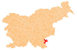
Občina Metlika— Town and Municipality — Metlika Location of the Municipality of Metlika in Slovenia Location of the Town of Metlika in Slovenia Coordinates: 45°39′N 15°19′E / 45.65°N 15.317°ECoordinates: 45°39′N 15°19′E / 45.65°N 15.317°E Country  Slovenia
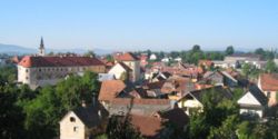
Government - Mayor Renata Brunskole Area - Total 108.9 km2 (42 sq mi) Population (2002)[1] - Total 8,123 - Density 74.6/km2 (193.2/sq mi) Time zone CET (UTC+01) - Summer (DST) CEST (UTC+02) Metlika is a town and municipality in the southeastern Slovenia. It lies on the left bank of the river Kolpa on the border with Croatia. The municipality is at the heart of the area of Bela Krajina, the southeastern part of the traditional region of Lower Carniola. It is now included in the Jugovzhodna Slovenija statistical region. Archaeological evidence has shown that the area has been settled since prehistoric times. In the 14th century the town was granted town privileges. It was frequently attacked during Ottoman raids in the 15th and 16th centurues. In the 17th century it was afflicted by an earthquake and in 1705 the entire town burnt to the ground in a massive fire.[2]
Metlika Castle is an originally 15th century castle located above the old part of the town. It was rebuilt in the early 18th century after the town fire and again after it was damaged for a second time by fire in 1790.
The parish church in the town is dedicated to Saint Nicholas and belongs to the Roman Catholic Diocese of Novo Mesto. It was built on the site of a 14th century building after the fire of 1705 in the Baroque style.[3] Other churches in the town are dedicated to Saint Martin, also built in the 18th century and Saint Roch, built in 1858.[4] There is also a Greek Catholic church, one of only two churches of this rite in Slovenia. It was built in 1903 and is dedicated to Saints Cyril and Methodius.[5]
References
- ^ Statistical Office of the Republic of Slovenia, census of 2002
- ^ Metlika Municipality site
- ^ Slovenian Ministry of Culture register of national heritage reference number 2024
- ^ Slovenian Ministry of Culture register of national heritage reference numbers 2823 and 2028
- ^ Slovenian Ministry of Culture register of national heritage reference number 9154
External links
Metlika Settlements Administrative centre: Metlika
Bereča vas, Boginja vas, Bojanja vas, Boldraž, Boršt, Božakovo, Božič Vrh, Brezovica pri Metliki, Bušinja vas, Dole, Dolnja Lokvica, Dolnje Dobravice, Dolnji Suhor pri Metliki, Drage, Dragomlja vas, Drašiči, Čurile, Geršiči, Gornja Lokvica, Gornje Dobravice, Gornji Suhor pri Metliki, Grabrovec, Gradac, Grm pri Podzemlju, Hrast pri Jugorju, Jugorje pri Metliki, Kamenica, Kapljišče, Klošter, Krasinec, Krašnji Vrh, Krivoglavice, Križevska vas, Krmačina, Mačkovec pri Suhorju, Malo Lešče, Mlake, Okljuka, Otok, Podzemelj, Prilozje, Primostek, Radovica, Radoviči, Radoši, Rakovec, Ravnace, Rosalnice, Sela pri Jugorju, Slamna vas, Svržaki, Škemljevec, Škrilje, Trnovec, Vidošiči, Zemelj, Želebej, ŽeleznikiLandmarks Metlika Castle, Bela Krajina Museum, Parish Church of Saint Nicholas, Komenda, Rosalnice Tri fare churches, Gradac CastleCategories:- Populated places in the Municipality of Metlika
- Municipalities of Slovenia
- Croatia–Slovenia border crossings
Wikimedia Foundation. 2010.


