- Ajdovščina
Infobox Settlement
name =
official_name =Ajdovščina
native_name =
other_name =
nickname =
settlement_type =
total_type =
motto =
imagesize = 300px
image_caption =
flag_size =
image_
seal_size =
shield_size =60px
image_blank_emblem =
blank_emblem_type =
blank_emblem_size =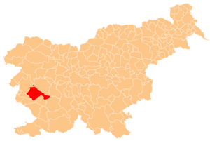
mapsize =
map_caption = Location of the Municipality of Ajdovščina in Slovenia
mapsize1 =
map_caption1 =
image_dot_
dot_mapsize =
dot_map_caption =
dot_x = |dot_y =
pushpin_
pushpin_label_position = left
pushpin_map_caption =Location of the city of Ajdovščina in Slovenia
pushpin_mapsize =
subdivision_type = Country
subdivision_name =Slovenia
subdivision_type1 = Municipality
subdivision_name1 = Ajdovščina
subdivision_type2 =
subdivision_name2 =
subdivision_type3 =
subdivision_name3 =
subdivision_type4 =
subdivision_name4 =
seat_type =
seat =
government_footnotes =
government_type =
leader_title =Mayor
leader_name =Marijan Poljšak
leader_title1 =
leader_name1 =
leader_title2 =
leader_name2 =
leader_title3 =
leader_name3 =
leader_title4 =
leader_name4 =
established_title =
established_date =
established_title1 =
established_date1 =
established_title2 =
established_date2 =
established_title3 =
established_date3 =
founder =
named_for =
area_magnitude =
unit_pref =Imperial
area_footnotes =
area_total_km2 =245.2
area_land_km2 =
area_water_km2 =
area_total_dunam =
area_total_sq_mi =
area_land_sq_mi =
area_water_sq_mi =
area_water_percent =
area_urban_km2 =
area_urban_sq_mi =
area_metro_km2 =
area_metro_sq_mi =
area_blank1_title =
area_blank1_km2 =
area_blank1_sq_mi =
elevation_footnotes =
elevation_m =
elevation_ft =
elevation_max_m =
elevation_max_ft =
elevation_min_m =
elevation_min_ft =
population_as_of =2002
population_footnotes =
population_note =
population_total =18,095
population_density_km2 =
population_density_sq_mi =
population_metro =
population_density_metro_km2 =
population_density_metro_sq_mi =
population_urban =
population_density_urban_km2 =
population_density_urban_sq_mi =
population_blank1_title =males
population_blank1 =9,004
population_blank2_title =female
population_blank2 =9,091
population_density_blank1_km2 =
population_density_blank1_sq_mi =
timezone =
utc_offset =
timezone_DST =
utc_offset_DST =
coor_type =
latd=45 |latm=53 |lats= |latNS=N
longd=13 |longm=55 |longs= |longEW=E
postal_code_type =
postal_code =
area_code =
blank_name =Average age
blank_info =38.83 years
blank1_name =Residential areas
blank1_info =convert|29.99|m2|sqft|abbr=on/person
blank2_name =Households
blank2_info =5,720
blank3_name =Families
blank3_info =4,835
website = [http://www.ajdovscina.si/ Official site]
footnotes = Source:Statistical Office of the Republic of Slovenia , census of 2002.Ajdovščina ( _it. Aidussina, _de. Haidenschaft) is a small town and a municipality with the same name and a population of 7000, located in the
Vipava Valley ("Vipavska dolina"),Slovenia .The first mentions of Ajdovščina go as far as 2000 BC but the town became better known around 200 BC as "Mansio Fluvio Frigido", a small post in use by the
Roman empire later in the 200 AC also known as "Castra" or "Castrum ad Fluvio Frigido" whose remains are still visible.Ajdovščina and its surroundings were a very important commercial and strategical point as some major battles took place in the Vipava Valley, such as in 394 AD the
Battle of the Frigidus . A local legend mentions thatTheodosius I used the strong northern winds that are known asburja ( _en. bora) and common in Ajdovščina and theVipava Valley to his favor and disabled the enemyarchers andpilum units with the help of the wind.The river Hubelj is the dividing line between the 2 bigger parts of Ajdovščina, that are localy known as Šturje and Ajdovščina. During the pre-
World War I years the river was also the border betweenGoriška andCarniola , two of the Slovenianregions .Despite the fact that the Italian border is less than 20 km away the style of the town does not resemble that of a typical Italian town. This may be attributed to the fact that in
World War II Ajdovščina was under Italian administration between 1918-1945 and this left a big mark on the local people. And because the bora winds that are known would cause a lot of trouble to the common Italian house construction. Thus the population adopted and modified the classicalKras architecture for their own needs, like for example putting stones on roofs.After the World War II Ajdovščina became the economical and cultural centre of the upper Vipava Valley.
Major industries include textile fabrics, construction, food, beverage and furniture.
The climate is
Mediterranean (minimum temperature in winter −1 °C, maximum 17 °C; in the summer time maximum temperature 39 °C, minimum 20 °C). The town is located around 25 km from theAdriatic Sea .Towns and villages
Ajdovščina ,Batuje , Bela, Brje,Budanje , Cesta,Col ,Črniče , Dobravlje, Dolenje,Dolga Poljana , Gaberje,Gojače , Gozd,Grivče , Kamnje, Kovk,Kožmani , Križna gora, Lokavec,Male Žablje ,Malo Polje ,Malovše ,Otlica ,Plače , Planina, Podkraj, Potoče,Predmeja , Ravne, Selo,Skrilje , Stomaž, Šmarje, Tevče,Ustje ,Velike Žablje ,Vipavski Križ , Višnje, Vodice,Vrtovče ,Vrtovin ,Zavino ,Žagolič ,Žapuže Demographics
;Population by mother tongue, census 2002:Slovene 16760:Bosnian 325:Serbian 182:Serbo-Croatian 141:Croatian 139:Albanian 164:Macedonian 40:Italian 16:Hungarian 7:German 3:Others 38:Unknown 380
Notable citizens
*
Martin Baučer (1595-1668) - historian;
*Anton Čebej (1722-1774) - painter;
*Josip Križaj (1911-1948) - pilot;
*Tobia Lionelli (1647-1714) - preacher;
*Karel Lavrič (1818-1876) - politician;
*Danilo Lokar (1892-1989) - author;
*Veno Pilon (1896-1970) - painter;
*Edi Šelhaus (b. 1919) - photographer;
*Avgust Žigon (1877-1941) - literary historian.See
List of Slovenes .ee also
*
NK Primorje External links
* [http://www.ajdovscina.si/ Ajdovščina] , official page of municipality sl icon
* More info: http://www.tic-ajdika-mp.si/11b-e.html
* [http://www.burger.si/VipavskaDolina/Ajdovscina/AjdovscinaENG.html Virtual Ajdovščina by Burger] (virtual photos)
* [http://www.venopilon.com/en/index1.html Pilon Gallery] in Ajdovščina
* [http://www.aeroklub-jk-ajdovscina.si/letalisce.htm Airpark Ajdovščina]
* [http://www.burger.si/VipavskaDolina/Skica.html Panorama of Vipava valley] (Java, 360 photos - useQuickTime program)
* [http://planina.okoljski-center.org/ Planina Pri Ajdovščini]

Wikimedia Foundation. 2010.