- Fort Lowell
-
Fort Lowell Tucson, Arizona 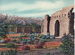
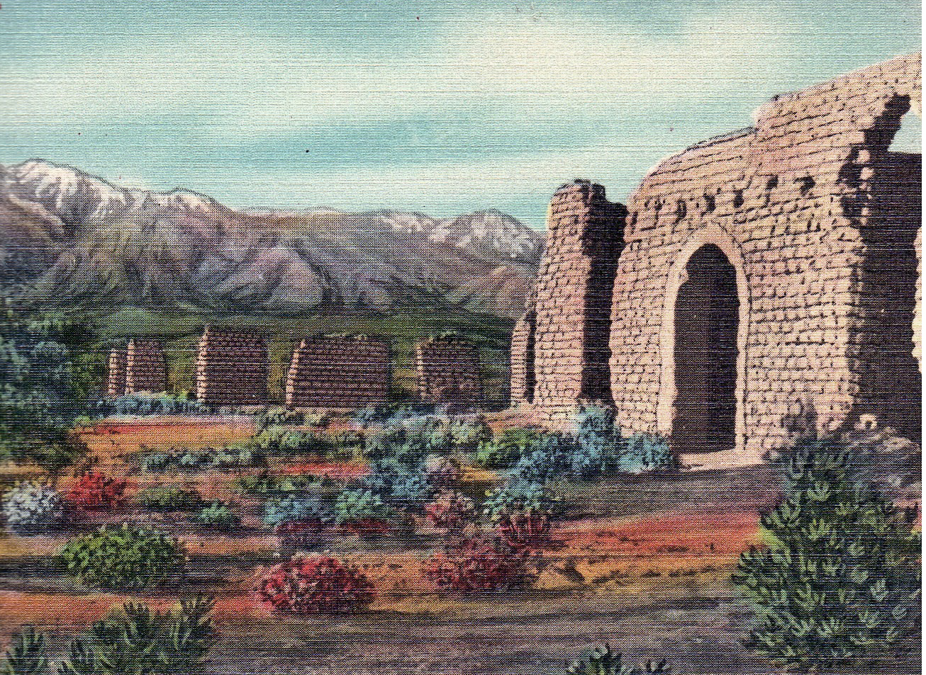
Ruins of Commanding Officer's quarters at Old Fort Lowell, Tucson.Type Army fortification Built 1873 Built by  United States
Construction
materialsadobe, mesquite, earth In use 1873 - 1891 Current
conditiontourist attraction Controlled by  Arizona
Occupants United States ArmyBattles/wars Apache Wars Fort Lowell was a United States Army post active from 1873 to 1891 on the outskirts of Tucson, Arizona. Fort Lowell was the successor to Camp Lowell, an earlier Army installation.[1] The Army chose a location just south of the confluence of the Tanque Verde and Pantano creeks, at the point where they form the Rillito Wash, due to the year-round supply of water. The Hohokam natives had chosen the site centuries early, presumably for the same reason. To this day, shards of Hohokam pottery can still be found in the area. The Army claimed a military reservation that encompassed approximately eighty square miles and extended east toward the Rincon Mountains.[2]
Contents
History
Old West Era
The fort played a pivotal role during the Apache Wars, providing additional protection for the Tucson area. Far too large and well-manned to be attacked directly, Fort Lowell provided supplies and manpower for outlying military installations. During its eighteen years of operation, the fort averaged thirteen officers and 239 enlisted men. Among the units present during this period were the 2nd, 4th, 5th and 6th Cavalry Regiments, as well as the 1st, 8th, and 12th Infantry Regiments.[1]
The orientation of the post was set according to magnetic north. It featured a large parade grounds, officers' quarters, quartermaster and commissary storehouses, corrals, quarters for enlisted men as well as for married non-commissioned officers. The most prominent building on post was the hospital, the adobe remnants of which still stand under a protective structure. A lane lined with cottonwood trees, aptly named Cottonwood Lane, graced the area in front of the officers' houses.
Among the more well known officers to have served at Fort Lowell were the young Walter Reed, the Army physician famous for his yellow fever research, and Charles Bendire, the amateur ornithologist after whom Bendire's Thrasher is named.
After the Army decommissioned the post in 1891, Mexican families from Sonora soon moved north to take advantage of the free housing. This occupation has become known as the El Fuerte Period.[3]
Fort Lowell Today
Fort Lowell lay in ruins for many years, its adobe structures slowly melting back into the desert. Pima County eventually converted the bulk of the former post into Old Fort Lowell Park, which features ball fields, tennis and racquetball courts, a large public swimming pool, and the Fort Lowell Museum dedicated to Fort Lowell's days as an active military installation. Fort Lowell also includes a large pond.
The city of Tucson now owns the park. Tucson recently purchased the former Adkins property immediately west of Craycroft Road on which the last of the original officers' quarters stand. Plans indicated that they would be open to the public as a museum. However, high levels of lead paint were found and the buildings were not opened. On the north end of the former Adkins parcel stands a pile of large stones that, according to local lore, formed a wall of the guardhouse in which Geronimo was kept prior to his removal from Arizona.
A reconstructed Fort Lowell was featured in the 1972 film Ulzana's Raid, starring Burt Lancaster. However, the reconstructed fort was actually built in an area just southwest of the Santa Rita Mountains, near Nogales, Arizona.
The Fort Lowell Museum is a branch museum of the Arizona Historical Society, and is located in the reconstructed Commanding Officer's quarters. Exhibits focus on military life on the Arizona frontier. The Fort Lowell Historic District is the neighborhood located on or near Fort Lowell. It is set aside as a historic district.
See Also
- Fort Tucson
Gallery
-
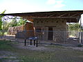
Remains of the post hospital.
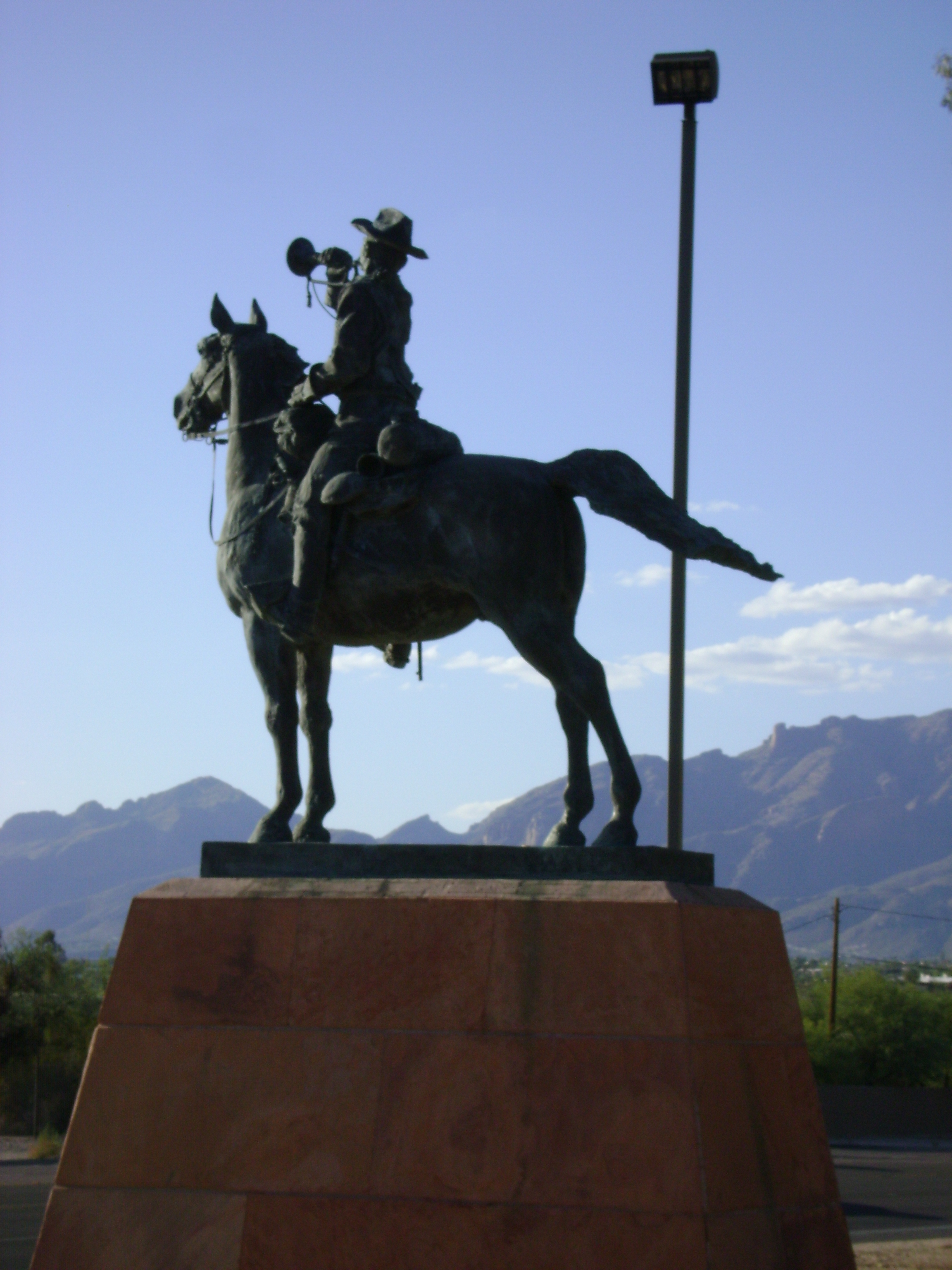
-

Statue of cavalry soldier at Fort Lowell Park.
-
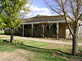
The Fort Lowell Museum.
References
- ^ a b http://www.oflna.org/fort_lowell_museum/ftlowell.htm Fort Lowell, retrieved June 28, 2009
- ^ http://parentseyes.arizona.edu/ftlowell/thefort.html The Fort, retrieved June 28, 2009
- ^ http://parentseyes.arizona.edu/ftlowell/elfuerte.html El Fuerte, retrieved June 28, 2009
External links
- Old Fort Lowell Neighborhood Association - Museum information and history
- Arizona Historical Society Museums
- Old Fort Lowell Neighborhood Association
Coordinates: 32°15′36″N 110°52′26″W / 32.26°N 110.87389°W
State of ArizonaTopics - Index
- Climate
- Delegations
- Geography
- History
- Museums
- Music
- People
- Transportation
- Visitor Attractions
Society - Culture
- Demographics
- Economy
- Education
- Politics
Regions - Arizona Strip
- Arizona Sun Corridor
- Coconino Plateau
- Colorado Plateau
- Grand Canyon
- Kaibab Plateau
- Mogollon Plateau
- Mogollon Rim
- Mojave Desert
- Monument Valley
- North Central Arizona
- Northeast Arizona
- Northern Arizona
- Oak Creek Canyon
- Phoenix Metropolitan Area
- Safford area
- San Francisco Volcanic Field
- Sonoran Desert
- Southern Arizona
- Verde Valley
- White Mountains
Counties Cities Categories:- Forts in Arizona
- Museums in Tucson, Arizona
- History of Tucson, Arizona
- Buildings and structures in Tucson, Arizona
- Landmarks in Tucson, Arizona
- Military and war museums in Arizona
- Arizona Territory
- Arizona folklore


Wikimedia Foundation. 2010.