- Oak Lane Historic District
-
Oak Lane Historic District

Location: Oak Lane between High and Locust Sts., Davenport, Iowa Coordinates: 41°32′22″N 90°33′47″W / 41.53944°N 90.56306°WCoordinates: 41°32′22″N 90°33′47″W / 41.53944°N 90.56306°W Built: 1875-1906 Architect: Gustav Hanssen
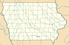
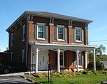
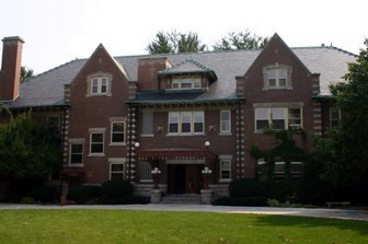
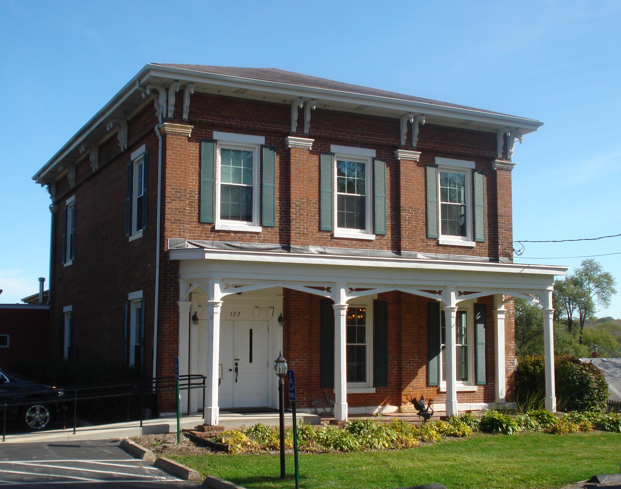
William A. OtisArchitectural style: Queen Anne Governing body: Private MPS: Davenport MRA NRHP Reference#: 84000331 [1] Added to NRHP: November 1, 1984 The Oak Lane Historic District is located on the east side of Davenport, Iowa, United States. It has been listed on the National Register of Historic Places since 1984.[1] The historic district is a residential area that stretches along Oak Lane between High Street on the north and Locust Street on the south.
References
- ^ a b "National Register Information System". National Register of Historic Places. National Park Service. 2009-03-13. http://nrhp.focus.nps.gov/natreg/docs/All_Data.html.
External Links
U.S. National Register of Historic Places Topics Lists by states Alabama • Alaska • Arizona • Arkansas • California • Colorado • Connecticut • Delaware • Florida • Georgia • Hawaii • Idaho • Illinois • Indiana • Iowa • Kansas • Kentucky • Louisiana • Maine • Maryland • Massachusetts • Michigan • Minnesota • Mississippi • Missouri • Montana • Nebraska • Nevada • New Hampshire • New Jersey • New Mexico • New York • North Carolina • North Dakota • Ohio • Oklahoma • Oregon • Pennsylvania • Rhode Island • South Carolina • South Dakota • Tennessee • Texas • Utah • Vermont • Virginia • Washington • West Virginia • Wisconsin • WyomingLists by territories Lists by associated states Other Davenport, Iowa City and Government History | Neighborhoods | National Register of Historic Places: Downtown, East, West | City Hall | Scott County Court House | U.S. Court House
Landmarks Education Transportation Neighborhoods College Square | Cork Hill | Crescent Warehouse | Hamburg | McClellan Heights | Prospect Park | Riverview Terrace | Vander Veer Park | West Third Street
Other Bix 7 | Credit Island | Lock and Dam No. 15 | Vander Veer Park | African Americans
Quad Cities and surrounding metropolitan area of Iowa and Illinois Iowa Illinois - Henry County
- Mercer County
- Rock Island County
- Rock Island
- Moline
- East Moline
- Aledo
- Annawan
- Andalusia
- Barstow
- Bishop Hill
- Buffalo Prairie
- Cambridge
- Carbon Cliff
- Cleveland
- Coal Valley
- Colona
- Coyne Center
- Dayton
- Edgington
- Galva
- Geneseo
- Green River
- Hampton
- Hillsdale
- Hooppole
- Kewanee
- Illinois City
- Milan
- Nekoma
- Oak Grove
- Orion
- Ophiem
- Osco
- Port Byron
- Reylonds
- Swedona
- Silvis
- Woodhull
Attractions Colleges Historical Places Bettendorf Joseph F. Bettendorf House
Davenport LeClaire Cody Road Historic District • Dawley House • James Gamble House • Horton-Suiter House • Kattenbracher House • McCaffrey House • Old Mill House • Rambo House • John Smith House • Stone House • Jacob Suiter House • John H. Suiter House • William Suiter House • George Tromley, Jr., House • George Tromley, Sr., House • Samuel Van Sant HouseLong Grove Alexander Brownlie HousePleasant Valley Roswell Spencer HouseRiverdale James Brown House • East Hill House and Carriage HouseCategories:- Historic districts in Iowa
- Queen Anne architecture in Iowa
- Historic districts in Davenport, Iowa
- Buildings and structures on the National Register of Historic Places in Iowa
- National Register of Historic Places in Scott County, Iowa

Wikimedia Foundation. 2010.