- Oak Ridge, North Carolina
-
Oak Ridge, North Carolina — Town — 
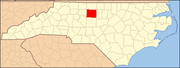
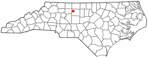
SealLocation of Oak Ridge, North Carolina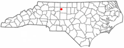
Coordinates: 36°10′1″N 79°58′57″W / 36.16694°N 79.9825°WCoordinates: 36°10′1″N 79°58′57″W / 36.16694°N 79.9825°W Country United States State North Carolina County Guilford Government – Mayor Ray Combs – Mayor Pro Tem Roger Howerton – Council David Rowe – Council Jim Kinneman – Council Danny Yanusz Area – Total 14.7 sq mi (38.1 km2) – Land 14.7 sq mi (38.0 km2) – Water 0.0 sq mi (0.1 km2) Elevation 948 ft (289 m) Population – Total 6,185 – Density 271.9/sq mi (105.0/km2) Time zone Eastern (EST) (UTC-5) – Summer (DST) EDT (UTC-4) ZIP code 27310 Area code(s) 336 FIPS code 37-48480[1] GNIS feature ID 0991433[2] Website www.oakridgenc.com Oak Ridge is a town in northwestern Guilford County, North Carolina, United States. The population was 3,988 at the 2000 census. As of 2010, the US Census Bureau indicated that the population had risen to 6,185 [1]. The Oak Ridge Military Academy, a private, coed, college-preparatory military boarding school, was established here in 1852. It is the third-oldest military school in the nation still in operation, and it is the official military school of North Carolina, as designated by the state legislature. Until the late 1990s the Oak Ridge area was mostly rural farmland, with numerous tobacco and strawberry farms. However, since its incorporation as a town in 1998, Oak Ridge has undergone rapid population growth. Many of the area's farms have been sold to developers and turned into upper-class housing developments, and several shopping centers have been built around the military academy. One rural pastime which is still popular in Oak Ridge is the raising and breeding of horses; each Easter weekend the town hosts a popular horse show.
Contents
History[3]
For centuries before European settlers arrived, the natural beauty of the Oak Ridge area was a backdrop for human habitation. Tradition holds—and archeological evidence bears it out—that the crest of the ridge, which runs from the southwest some fifty miles to present-day Reidsville in the northeast, was well used by Native Americans. It was along this route in 1781 that General Cornwallis' men passed by Oak Ridge farms on maneuvers that led them to Guilford Courthouse to fight the last battle of the American Revolutionary War before Yorktown and surrender.
In the second half of the 18th century, western Guilford County was settled largely by Quakers migrating from Pennsylvania and Nantucket Island and by pioneers out of Virginia. They were described as being "orderly, law-abiding, religious" and, by evidence of their prosperous farms and commodious homes, hard-working."[by whom?]
In the early 1820s, the citizens of Oak Ridge established a nine-month school in a one-room cabin. Their desire to provide quality education for their children led in 1851 to the founding of the Oak Ridge Institute, described as "a school of high classical standing." The community raised $700.00 to erect a large school house on land donated by Allen Lowery on a knoll along the former colonial route that had become the Danville-Salisbury stagecoach road, now known as Oak Ridge Road or N.C. Highway 150, where Oak Ridge Elementary School is now located.
The community surrounding the Academy retains much of its rural quality in the presence of land continuously farmed since its settlement. Before the mid-nineteenth century, the predominantly Quaker community was largely isolated politically, culturally and geographically from the plantation and slave owning eastern regions of North Carolina that dominated the state legislature. The economic base of the county remained essentially unchanged until after the Civil War. In many respects it remains representative of the agrarian society of antebellum Piedmont North Carolina.
Through the Benbow family, Oak Ridge has also been associated with the early development of the state's textile industry. Charles Benbow and his brother-in-law, Jesse Saunders, established Benbow & Co. in 1837 to operate the Cross Creek Textile Mill in Fayetteville. Charles was also a principal owner of the West Plank Road Company whose nearby Bethania-Fayetteville timbered highway opened Oak Ridge to the commerce and culture of eastern North Carolina. Charles's son, Jesse Benbow, was known as a progressive farmer who introduced mechanized agriculture with the reaper and wheat drill to the area.
Like others in the Society of Friends, Oak Ridge Quakers struggled against slavery, even purchasing slaves in order to free them. Legend suggests that Jesse Benbow hid slaves in his house along the abolitionist "Underground Railroad" heading north.
What is more certain is that Charles and his sons linked a commitment to quality education to progressive social attitudes. They were founders and trustees of the New Garden Friends Boarding School (which became Guilford College, the second oldest coeducational college in the United States). After establishing Oak Ridge Institute, the Benbows, with other Oak Ridge residents, boarded students in their homes. Contributing houses throughout the Oak Ridge Historic District have long been associated with the school, as either the homes of founders and trustees, boarding houses, or the residences of principals, teachers, and officials.
For most of two centuries, the business and social affairs of Oak Ridge residents have centered around the farm and such institutions of the rural lifestyle as the crossroads general store and the local gristmill. Evidence of such emphasis on these community focal points can still be found at the intersection of present-day Linville Road and Oak Ridge Road. Here, at the heart of the old community, are the neoclassical-style Oak Ridge Elementary School (erected in 1924), a small grocery store and filling station (1951), and two early farmhouses (c. 1863 and 1928). The Old Mill of Guilford, dating from the mid-to-late 18th century, is located a short distance south of the Historic District on N.C. 68. It is one of the oldest mills still operating commercially in the United States today.
Oak Ridge Horse Show
Each spring, the public school grounds host the Oak Ridge Easter Horse Show, held annually since 1945 to raise funds for community projects. A major beneficiary has been the Elementary School itself, which has received financial assistance for construction, equipment, and youth sports programs.
The Horse Show thus is a living testament to the ready self-reliance that built the first school and nurtured the Institute that became today's Oak Ridge Military Academy. Its theme recalls agrarian origins, and its purposes sustain a tradition of service that shapes the civic character of new generations of inhabitants.
Architectural History
The Oak Ridge community has representative buildings of most of the architectural styles developed in America since 1800. For the most part, they are understated, vernacular versions of the styles they represent. It makes for an interesting mix in a rural village landscape.
The Charles Benbow House, the earliest surviving structure in the District, is a two-story Flemish bond brick home of traditional Quaker plan with eclectic vernacular detailing, including Georgian, Federal and Greek Revival elements. His son Jesse Benbow [2], built a more refined Greek Revival four-square home in 1858 on land inherited from his father. This structure has been described as being "expressive of the Guilford citizen's preference in architecture as in lifestyle for simplicity, modesty, and the fundamental elements."
The Oak Ridge Military Academy has several exemplary Neoclassical and Colonial Revival brick institutional buildings, as well as vernacular frame structures. Most of the sixteen buildings on the 30-acre (120,000 m2) campus were erected in the pre-Depression decades of the 20th century. Although many of the buildings have been updated and renovated, as a group they reflect the school's transformation from a classical preparatory and business school to today's military oriented definition of the educational program.
There are two distinctive houses associated with the Institute's (as it was previously known) administrators. Maple Glade is the stately Neoclassical home built in 1905 for the principal, J. Allen Holt. Oakhurst, the elaborate Queen Anne home at the eastern edge of campus, designed by state-wide noted architect Frank P. Milburn, was constructed in 1897 for Holt's brother and co-principal, Martin H. Holt.
West of the campus and just east of the Charles Benbow House, around the intersection of Oak Ridge Road and Linville Road, is an important collection of architectural styles including the 1863 log I-house belonging originally to the Moore family, the 1898 Neoclassical Robert M. Stafford House with its large vernacular doric-style columns, a late 19th or early 20th century folk-victorian L-plan farmhouse, the 1924 National Folk side gable J.F. Linville House, the 1925 Craftsman brick house of Robert A. Stafford, and the 1937 Colonial Revival Sheriff David B. Stafford House. Together at the old community crossroads they record an evolution of residential styles in the rural Piedmont.
Across the Historic District, however, the modest building style, known as National Folk, predominates. Many earlier forms established in log or heavy-hewn timber houses persisted, but the newer structures used techniques permitting lighter materials. Although most of these buildings may not be considered notable on an individual basis, they are as a collection valuable as part of the rural context and its architectural evolution.
The evolution of the National Folk style is apparent in the variety of its forms in the Historic District. Among the more understated examples are those found near and on the Academy campus. These one-story frame structures, such as the 1910 Brendle House and the c. 1925 Commandant's House were built as housing for Institute staff. The Brendle House exemplifies the two rooms wide and one room deep hall-and-parlor plan, with Craftsman-style influence in the exposed rafter ends. The Commandant's House bears the massed-plan, side-gabled form, its two-room depth made possible by new lighter weight rook framing. Another variation is found in the former home of Institute secretary Dorsey L. Nance west of campus and N.C. 68. The latest example, built in 1945 by Colonel Zack L. Whitaker as Commandant housing, lies east of the campus, and was influenced by the then popular Cape Cod variation of the Colonial Revival style which had small side porches rather than a full-facade shed roof porch.
The District has three examples of the National Folk I-house form, the two-story version of the hall-and-parlor plan: the 1898 Zack L. Whitaker House, the 1920 Barrow/Brown House, and the undated structure at the corner of Linville and Scoggins roads. These examples have two exterior end chimneys.
The unusual 1 1⁄2-story Craftsman-style house of D. Lanier Donnell, Sr., was built in 1923 entirely of locally gathered fieldstone. Nearby, the 1933 R.P. Larkin and 1919 J.L. Sawyer houses represent interesting vernacular variations on the Colonial Revival style.
Historic District
The boundaries of the Oak Ridge Historic District encompass a one and three-quarter mile stretch of Oak Ridge Road (N.C. 150), between junctions with Williard Road at the southwest and Bastille Lane at the northeast extremities. They extend northwest for one-half mile from Oak Ridge Road along Linville Road.
More than 400 acres (1.6 km2) comprise the district, contributing some 70 historical resources in pre-1945 primary and accessory structures and open parcels of traditionally farmed lands. The Oak Ridge Military Academy National Historic District lies within the Oak Ridge District.
Geography
Oak Ridge is located at 36°10′1″N 79°58′57″W / 36.16694°N 79.9825°W (36.166944, -79.982577)[4].
According to the United States Census Bureau, the town has a total area of 14.7 square miles (38 km2), of which, 14.7 square miles (38 km2) of it is land and 0.04 square miles (0.10 km2) of it (0.27%) is water.
Demographics
As of the census[1] of 2000, there were 3,988 people, 1,382 households, and 1,173 families residing in the town. The population density was 271.9 people per square mile (105.0/km²). There were 1,462 housing units at an average density of 99.7 per square mile (38.5/km²). The racial makeup of the town was 93.48% White, 4.21% African American, 0.28% Native American, 0.73% Asian,, 0.63% from other races, and 0.68% from two or more races. Hispanic or Latino of any race were 1.30% of the population.
There were 1,382 households out of which 44.6% had children under the age of 18 living with them, 78.4% were married couples living together, 4.2% had a female householder with no husband present, and 15.1% were non-families. 11.5% of all households were made up of individuals and 3.9% had someone living alone who was 65 years of age or older. The average household size was 2.89 and the average family size was 3.15.
In the town the population was spread out with 29.7% under the age of 18, 4.7% from 18 to 24, 31.4% from 25 to 44, 26.9% from 45 to 64, and 7.4% who were 65 years of age or older. The median age was 38 years. For every 100 females there were 97.8 males. For every 100 females age 18 and over, there were 98.9 males.
The median income for a household in the town was $74,609, and the median income for a family was $82,070. Males had a median income of $56,250 versus $35,952 for females. The per capita income for the town was $29,346. About 2.2% of families and 3.8% of the population were below the poverty line, including 3.6% of those under age 18 and 3.8% of those age 65 or over.
Notable Citizens
Chris Daughtry, contestant and singer from American Idol, known for the hit song "It's Not Over"
Kevin Harvick, NASCAR driver #29
David Juggernaut Siedel, the leading National Forensics league coach in the state of North Carolina for the last five years.
References
- ^ a b "American FactFinder". United States Census Bureau. http://factfinder.census.gov. Retrieved 2008-01-31.
- ^ "US Board on Geographic Names". United States Geological Survey. 2007-10-25. http://geonames.usgs.gov. Retrieved 2008-01-31.
- ^ Oak Ridge Historic District Guidelines: Design Guidelines Handbook
- ^ "US Gazetteer files: 2010, 2000, and 1990". United States Census Bureau. 2011-02-12. http://www.census.gov/geo/www/gazetteer/gazette.html. Retrieved 2011-04-23.
External links
Municipalities and communities of Guilford County, North Carolina Cities Archdale‡ | Burlington‡ | Greensboro | High Point‡
Towns Gibsonville‡ | Jamestown | Kernersville‡ | Oak Ridge | Pleasant Garden | Sedalia | Stokesdale | Summerfield | Whitsett
CDPs Unincorporated
communitiesBrowns Summit | Climax | Colfax | Julian | Monticello
Footnotes ‡This populated place also has portions in an adjacent county or counties
Categories:- Populated places in Guilford County, North Carolina
- Towns in North Carolina

Wikimedia Foundation. 2010.