- National Register of Historic Places listings in Woods County, Oklahoma
-
 Location of Woods County in Oklahoma
This is a list of the National Register of Historic Places listings in Woods County, Oklahoma.
This is intended to be a complete list of the properties on the National Register of Historic Places in Woods County, Oklahoma, United States. The locations of National Register properties for which the latitude and longitude coordinates are included below, may be seen in a Google map.[1]
There are 12 properties listed on the National Register in the county.
-
- This National Park Service list is complete through NPS recent listings posted November 10, 2011.[2]
Current listings
[3] Landmark name [4] Image Date listed Location City or town Summary 1 Alva Armory September 8, 1988 Choctaw and 3rd Sts.
36°48′24″N 98°39′40″W / 36.806667°N 98.661111°WAlva 2 Branson Building January 5, 1984 531 Barnes St.
36°48′12″N 98°40′01″W / 36.803333°N 98.666944°WAlva 3 Building at 405-407 College Avenue January 5, 1984 405 College Ave.
36°48′15″N 98°40′01″W / 36.804167°N 98.666944°WAlva 4 Building at 409 College Avenue January 5, 1984 409 College Ave.
36°48′15″N 98°40′01″W / 36.804167°N 98.666944°WAlva 5 Building at 500 Flynn Street January 5, 1984 500 Flynn St.
36°48′18″N 98°39′55″W / 36.805°N 98.665278°WAlva 6 Central National Bank January 5, 1984 401 College Ave.
36°48′15″N 98°40′01″W / 36.804167°N 98.666944°WAlva 7 I.O.O.F. Hall January 5, 1984 527 Barnes St.
36°48′12″N 98°39′59″W / 36.803333°N 98.666389°WAlva 8 Kavanaugh and Shea Building January 5, 1984 403 College Ave.
36°48′15″N 98°40′01″W / 36.804167°N 98.666944°WAlva 9 Nickel Ensor McClure House September 3, 2010 1301 Locust St.
36°48′00″N 98°40′41″W / 36.8°N 98.678056°WAlva 10 Science Hall July 14, 1983 Northwestern Oklahoma State University campus
36°47′48″N 98°40′06″W / 36.796667°N 98.668333°WAlva 11 Stine Building April 21, 1982 601 Barnes St.
36°48′12″N 98°40′00″W / 36.803333°N 98.666667°WAlva 12 Waynoka Sante Fe Depot and Harvey House June 20, 1974 Along the former Sante Fe railroad tracks
36°35′00″N 98°52′59″W / 36.583333°N 98.883056°WWaynoka See also
- List of National Historic Landmarks in Oklahoma
- National Register of Historic Places listings in Oklahoma
References
- ^ The latitude and longitude information provided in this table was derived originally from the National Register Information System, which has been found to be fairly accurate for about 99% of listings. For about 1% of NRIS original coordinates, experience has shown that one or both coordinates are typos or otherwise extremely far off; some corrections may have been made. A more subtle problem causes many locations to be off by up to 150 yards, depending on location in the country: most NRIS coordinates were derived from tracing out latitude and longitudes off of USGS topographical quadrant maps created under the North American Datum of 1927, which differs from the current, highly accurate WGS84 GPS system used by Google maps. Chicago is about right, but NRIS longitudes in Washington are higher by about 4.5 seconds, and are lower by about 2.0 seconds in Maine. Latitudes differ by about 1.0 second in Florida. Some locations in this table may have been corrected to current GPS standards.
- ^ "National Register of Historic Places: Weekly List Actions". National Park Service, United States Department of the Interior. Retrieved on November 10, 2011.
- ^ Numbers represent an ordering by significant words. Various colorings, defined here, differentiate National Historic Landmark sites and National Register of Historic Places Districts from other NRHP buildings, structures, sites or objects.
- ^ "National Register Information System". National Register of Historic Places. National Park Service. . http://nrhp.focus.nps.gov/natreg/docs/All_Data.html.
U.S. National Register of Historic Places Topics Lists by states Alabama • Alaska • Arizona • Arkansas • California • Colorado • Connecticut • Delaware • Florida • Georgia • Hawaii • Idaho • Illinois • Indiana • Iowa • Kansas • Kentucky • Louisiana • Maine • Maryland • Massachusetts • Michigan • Minnesota • Mississippi • Missouri • Montana • Nebraska • Nevada • New Hampshire • New Jersey • New Mexico • New York • North Carolina • North Dakota • Ohio • Oklahoma • Oregon • Pennsylvania • Rhode Island • South Carolina • South Dakota • Tennessee • Texas • Utah • Vermont • Virginia • Washington • West Virginia • Wisconsin • WyomingLists by territories Lists by associated states Other Municipalities and communities of Woods County, Oklahoma Cities 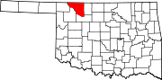
Towns Unincorporated
communitiesCamp Houston | Hopeton | Lookout
Categories:- Woods County, Oklahoma
- National Register of Historic Places in Oklahoma by county
- Buildings and structures in Woods County, Oklahoma
-

Wikimedia Foundation. 2010.