- National Register of Historic Places listings in Stephens County, Oklahoma
-
 Location of Stephens County in Oklahoma
This is a list of the National Register of Historic Places listings in Stephens County, Oklahoma.
This is intended to be a complete list of the properties on the National Register of Historic Places in Stephens County, Oklahoma, United States. The locations of National Register properties for which the latitude and longitude coordinates are included below, may be seen in a Google map.[1]
There are 10 properties listed on the National Register in the county.
-
- This National Park Service list is complete through NPS recent listings posted November 10, 2011.[2]
Current listings
[3] Landmark name [4] Image Date listed Location City or town Summary 1 Brittain-Garvin House August 31, 2000 411 North 9th St.
34°30′26″N 97°57′27″W / 34.507222°N 97.9575°WDuncan 2 H.C. Chrislip House August 6, 1993 709 N. 14th St.
34°30′40″N 97°57′53″W / 34.511111°N 97.964722°WDuncan 3 Duncan Armory December 13, 1996 100 feet from the junction of 14th St. and an unmarked alley between Fuqua Park and Ash Ave.
34°30′22″N 97°57′55″W / 34.506111°N 97.965278°WDuncan 4 Duncan Public Library November 30, 1999 301 N. 8th St.
34°30′19″N 97°57′23″W / 34.505278°N 97.956389°WDuncan 5 W.T. Foreman House June 5, 2003 814 W. Oak Ave.
34°30′14″N 97°57′27″W / 34.503889°N 97.9575°WDuncan 6 Johnson Hotel and Boarding House May 14, 1986 314 W. Mulberry
34°29′42″N 97°57′04″W / 34.495°N 97.951111°WDuncan 7 Marlow Armory April 7, 1994 702 W. Main St.
34°38′50″N 97°57′49″W / 34.647222°N 97.963611°WMarlow 8 Montgomery-Linam House September 22, 1983 301 N. 5th St.
34°39′02″N 97°57′29″W / 34.650556°N 97.958056°WMarlow 9 Patterson Hospital December 7, 1995 929 W. Willow Ave.
34°30′04″N 97°57′33″W / 34.501111°N 97.959167°WDuncan 10 Louis B. Simmons House March 2, 2001 401 N. 9th St.
34°30′23″N 97°57′27″W / 34.506389°N 97.9575°WDuncan See also
- List of National Historic Landmarks in Oklahoma
- National Register of Historic Places listings in Oklahoma
References
- ^ The latitude and longitude information provided in this table was derived originally from the National Register Information System, which has been found to be fairly accurate for about 99% of listings. For about 1% of NRIS original coordinates, experience has shown that one or both coordinates are typos or otherwise extremely far off; some corrections may have been made. A more subtle problem causes many locations to be off by up to 150 yards, depending on location in the country: most NRIS coordinates were derived from tracing out latitude and longitudes off of USGS topographical quadrant maps created under North American Datum of 1927, which differs from the current, highly accurate GPS system used by Google maps. Chicago is about right, but NRIS longitudes in Washington are higher by about 4.5 seconds, and are lower by about 2.0 seconds in Maine. Latitudes differ by about 1.0 second in Florida. Some locations in this table may have been corrected to current GPS standards.
- ^ "National Register of Historic Places: Weekly List Actions". National Park Service, United States Department of the Interior. Retrieved on November 10, 2011.
- ^ Numbers represent an ordering by significant words. Various colorings, defined here, differentiate National Historic Landmark sites and National Register of Historic Places Districts from other NRHP buildings, structures, sites or objects.
- ^ "National Register Information System". National Register of Historic Places. National Park Service. . http://nrhp.focus.nps.gov/natreg/docs/All_Data.html.
U.S. National Register of Historic Places Topics Lists by states Alabama • Alaska • Arizona • Arkansas • California • Colorado • Connecticut • Delaware • Florida • Georgia • Hawaii • Idaho • Illinois • Indiana • Iowa • Kansas • Kentucky • Louisiana • Maine • Maryland • Massachusetts • Michigan • Minnesota • Mississippi • Missouri • Montana • Nebraska • Nevada • New Hampshire • New Jersey • New Mexico • New York • North Carolina • North Dakota • Ohio • Oklahoma • Oregon • Pennsylvania • Rhode Island • South Carolina • South Dakota • Tennessee • Texas • Utah • Vermont • Virginia • Washington • West Virginia • Wisconsin • WyomingLists by territories Lists by associated states Other  Category:National Register of Historic Places •
  Portal:National Register of Historic Places
Municipalities and communities of Stephens County, Oklahoma County seat: Duncan Cities 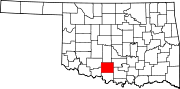
Towns Bray | Central High | Empire City | Loco | Velma
CDP Unincorporated
communitiesGhost town Arthur
Categories:- Stephens County, Oklahoma
- National Register of Historic Places in Oklahoma by county
- Buildings and structures in Stephens County, Oklahoma
-

Wikimedia Foundation. 2010.