- National Register of Historic Places listings in Marshall County, Mississippi
-
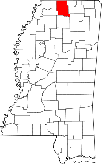 Location of Marshall County in Mississippi
This is a list of the National Register of Historic Places listings in Marshall County, Mississippi.
This is intended to be a complete list of the properties and districts on the National Register of Historic Places in Marshall County, Mississippi, United States. Latitude and longitude coordinates are provided for many National Register properties and districts; these locations may be seen together in a Google map.[1]
There are 20 properties and districts listed on the National Register in the county.
-
- This National Park Service list is complete through NPS recent listings posted November 10, 2011.[2]
Current listings
[3] Landmark name [4] Image Date listed Location City or town Summary 1 Dr. Isham G. Bailey House August 30, 2001 1577 Early Grove Rd.
34°59′17″N 89°22′41″W / 34.988056°N 89.378056°WLamar 2 Byhalia Historic District March 7, 1996 Roughly along Church, Chulahoma (Mississippi Highway 309) and Senter Sts.
34°52′10″N 89°41′27″W / 34.869444°N 89.690833°WByhalia 3 Byhalia United Methodist Church April 9, 1984 College Ave.
34°52′12″N 89°41′31″W / 34.87°N 89.691944°WByhalia 4 Chalmers Institute June 28, 1982 W. Chulahoma Ave.
34°46′01″N 89°27′25″W / 34.766944°N 89.456944°WHolly Springs 5 Civil War Earthworks at Tallahatchie Crossing August 14, 1973 Off Mississippi Highway 7
34°33′25″N 89°29′16″W / 34.556944°N 89.487778°WAbbeville 6 Confederate Armory Site April 11, 1972 North of Holly Springs
34°46′43″N 89°23′40″W / 34.778611°N 89.394444°WHolly Springs 7 Depot-Compress Historic District 
April 20, 1983 Bounded by the railroad tracks, Chesterman St., and College and Van Dorn Aves.
34°46′05″N 89°26′07″W / 34.768056°N 89.435278°WHolly Springs 8 East Holly Springs Historic District April 20, 1983 Bounded by Compress, Chesterman, Randolph, and Spring Sts. and Salem and Van Dorn Aves.
34°46′11″N 89°26′27″W / 34.769722°N 89.440833°WHolly Springs 9 Hillcrest Cemetery June 28, 1982 Center St.
34°45′46″N 89°26′47″W / 34.762778°N 89.446389°WHolly Springs 10 Holly Springs Courthouse Square Historic District 
January 20, 1980 U.S. Route 78
34°46′05″N 89°26′52″W / 34.768056°N 89.447778°WHolly Springs 11 McCoy Administration Building March 19, 1998 150 E. Rust Ave.
34°46′34″N 89°26′49″W / 34.776111°N 89.446944°WHolly Springs 12 Mississippi Industrial College Historic District 
January 20, 1980 Memphis St.
34°46′32″N 89°26′57″W / 34.775556°N 89.449167°WHolly Springs 13 Myers-Hicks Place March 7, 1983 Mississippi Highway 309
34°49′47″N 89°41′19″W / 34.829722°N 89.688611°WByhalia 14 North Memphis Street Historic District April 20, 1983 Bounded by N. Memphis St., Falconer, Salem, and Park Aves., and the Anderson Chapel
34°46′13″N 89°26′55″W / 34.770278°N 89.448611°WHolly Springs 15 Oakview June 28, 1982 Rust Ave. on the Rust College campus
34°46′32″N 89°26′46″W / 34.775556°N 89.446111°WHolly Springs 16 Old Water and Electric Light Plant June 28, 1982 140 E. Falconer Ave.
34°46′09″N 89°26′50″W / 34.769167°N 89.447222°WHolly Springs 17 Robert Raiford Home and Farm August 28, 1998 829 Cayce Rd.
34°52′10″N 89°37′37″W / 34.869444°N 89.626944°WVictoria 18 Southwest Holly Springs Historic District April 20, 1983 Bounded by S. Center, S. Memphis, and Craft Sts., Marbury Ct., and Chulahoma, Gholson, Elder and Mason Aves.
34°45′51″N 89°27′04″W / 34.764167°N 89.451111°WHolly Springs 19 Summer Trees January 19, 1979 Northeast of Red Banks on Mayhome Rd.
34°52′05″N 89°32′54″W / 34.868056°N 89.548333°WRed Banks 20 Wall Doxey State Park December 1, 1997 Between Mississippi Highway 7 and Spring Lake
34°39′51″N 89°27′40″W / 34.664167°N 89.461111°WHolly Springs See also
- List of National Historic Landmarks in Mississippi
- National Register of Historic Places listings in Mississippi
References
- ^ The latitude and longitude information provided in this table was derived originally from the National Register Information System, which has been found to be fairly accurate for about 99% of listings. For about 1% of NRIS original coordinates, experience has shown that one or both coordinates are typos or otherwise extremely far off; some corrections may have been made. A more subtle problem causes many locations to be off by up to 150 yards, depending on location in the country: most NRIS coordinates were derived from tracing out latitude and longitudes off of USGS topographical quadrant maps created under the North American Datum of 1927, which differs from the current, highly accurate WGS84 GPS system used by Google maps. Chicago is about right, but NRIS longitudes in Washington are higher by about 4.5 seconds, and are lower by about 2.0 seconds in Maine. Latitudes differ by about 1.0 second in Florida. Some locations in this table may have been corrected to current GPS standards.
- ^ "National Register of Historic Places: Weekly List Actions". National Park Service, United States Department of the Interior. Retrieved on November 10, 2011.
- ^ Numbers represent an ordering by significant words. Various colorings, defined here, differentiate National Historic Landmark sites and National Register of Historic Places Districts from other NRHP buildings, structures, sites or objects.
- ^ "National Register Information System". National Register of Historic Places. National Park Service. . http://nrhp.focus.nps.gov/natreg/docs/All_Data.html.
U.S. National Register of Historic Places Topics Lists by states Alabama • Alaska • Arizona • Arkansas • California • Colorado • Connecticut • Delaware • Florida • Georgia • Hawaii • Idaho • Illinois • Indiana • Iowa • Kansas • Kentucky • Louisiana • Maine • Maryland • Massachusetts • Michigan • Minnesota • Mississippi • Missouri • Montana • Nebraska • Nevada • New Hampshire • New Jersey • New Mexico • New York • North Carolina • North Dakota • Ohio • Oklahoma • Oregon • Pennsylvania • Rhode Island • South Carolina • South Dakota • Tennessee • Texas • Utah • Vermont • Virginia • Washington • West Virginia • Wisconsin • WyomingLists by territories Lists by associated states Other Municipalities and communities of Marshall County, Mississippi City 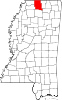
Towns Unincorporated
communitiesBarton | Bethlehem | Cayce | Chulahoma | Hudsonville | Marianna | Mount Pleasant | Orion | Red Banks | Slayden | Victoria | Wall Hill | Waterford | Watson
Categories:- Marshall County, Mississippi
- National Register of Historic Places in Mississippi by county
- Buildings and structures in Marshall County, Mississippi
-


Wikimedia Foundation. 2010.