- National Register of Historic Places listings in Lafourche Parish, Louisiana
-
 Location of Lafourche Parish in Louisiana
This is a list of the National Register of Historic Places listings in Lafourche Parish, Louisiana.
This is intended to be a complete list of the properties and districts on the National Register of Historic Places in Lafourche Parish, Louisiana, United States. The locations of National Register properties and districts for which the latitude and longitude coordinates are included below, may be seen in a Google map.[1]
There are 35 properties and districts listed on the National Register in the parish, including 1 National Historic Landmark.
-
- This National Park Service list is complete through NPS recent listings posted November 10, 2011.[2]
Current listings
[3] Landmark name[4] Image Date listed Location City or Town Summary 1 Acadia Plantation May 29, 1987 Address Restricted Thibodaux Demolished and converted into a residential housing district in 2010.[5] 2 Bank of Lafourche Building March 5, 1986 206 Green St.
29°47′50″N 90°49′13″W / 29.79722°N 90.82028°WThibodaux 3 Bank of Lockport March 30, 1995 111 Barataria St.
29°38′47″N 90°32′17″W / 29.64639°N 90.53806°WLockport 4 Bayou Boeuf Elementary School February 25, 2004 4138 Louisiana Highway 307
29°52′11″N 90°35′38″W / 29.86972°N 90.59389°WThibodaux 5 Bouverans Plantation House July 21, 1983 Louisiana Highway 1
29°37′51″N 90°30′32″W / 29.63083°N 90.50889°WLockport 6 Breaux House March 5, 1986 401 Patriot
29°47′46″N 90°49′9″W / 29.79611°N 90.81917°WThibodaux 7 Building at 108 Green Street March 5, 1986 108 Green St.
29°47′52″N 90°49′13″W / 29.79778°N 90.82028°WThibodaux 8 Chanticleer Gift Shop April 29, 1986 103 W. 3rd
29°47′49″N 90°49′7″W / 29.79694°N 90.81861°WThibodaux 9 Chatchie Plantation House October 25, 1982 East of Thibodaux on Louisiana Highway 308
29°46′27″N 90°46′4″W / 29.77417°N 90.76778°WThibodaux 10 Citizens Bank of Lafourche March 5, 1986 413 W. 4th St.
29°47′46″N 90°49′16″W / 29.79611°N 90.82111°WThibodaux 11 Dansereau House November 21, 1978 506 St. Philip St.
29°47′45″N 90°49′19″W / 29.79583°N 90.82194°WThibodaux 12 Frost House August 6, 2008 612 St. Philip St. Thibodaux 13 Golden Meadow High School November 23, 1998 630 S. Bayou Dr.
29°23′17″N 90°15′53″W / 29.38806°N 90.26472°WGolden Meadow 14 Grand Theatre March 5, 1986 401 Green St.
29°47′47″N 90°49′11″W / 29.79639°N 90.81972°WThibodaux 15 House at 816 Jackson Street July 22, 2009 816 Jackson St.
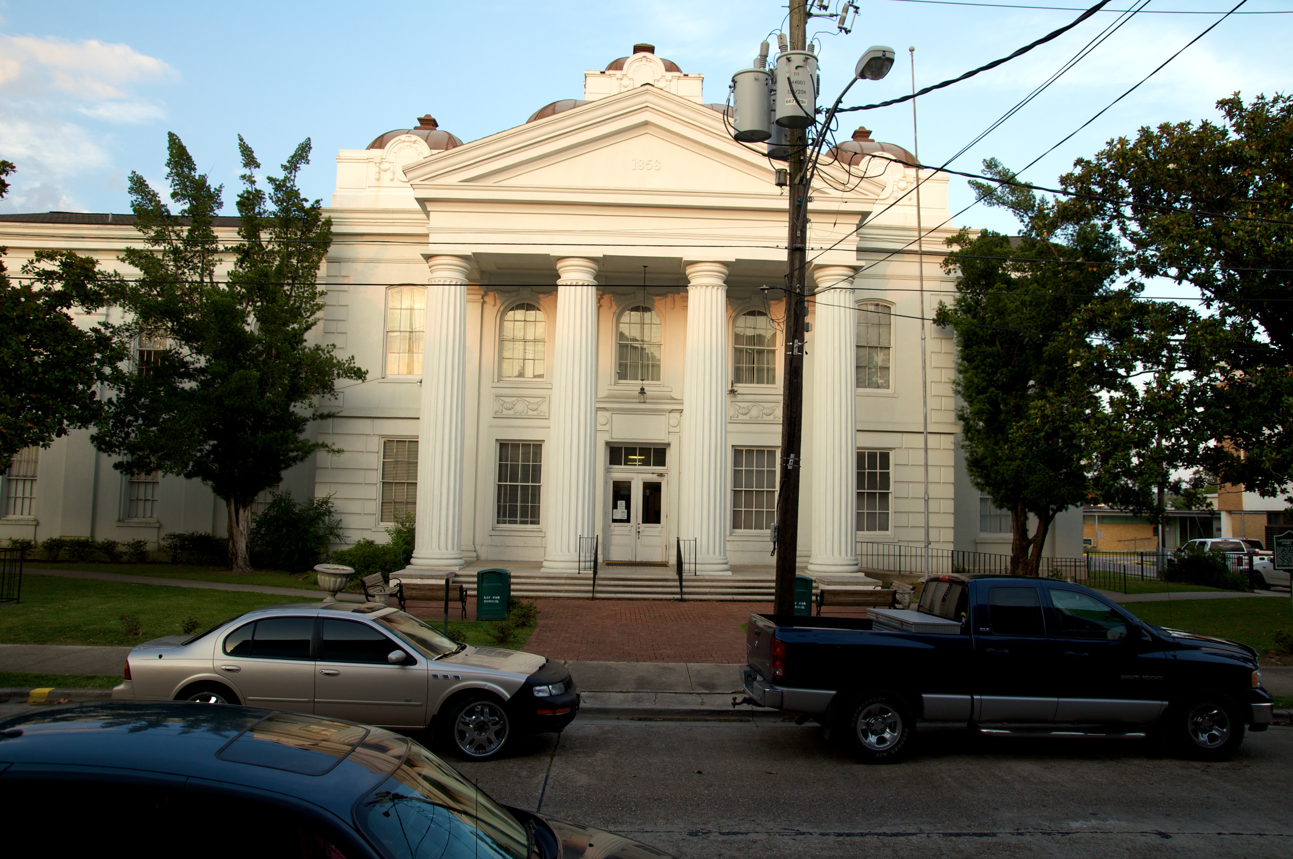
29°47′28.13″N 90°49′22.32″W / 29.7911472°N 90.8228667°WThibodaux 16 Lafourche Parish Courthouse 
August 21, 1979 200 Green St.
29°47′50″N 90°49′11″W / 29.79722°N 90.81972°WThibodaux 17 Lamartina Building March 5, 1986 700-704 W. 3rd
29°47′50″N 90°49′16″W / 29.79722°N 90.82111°WThibodaux 18 Laurel Valley Sugar Plantation 
March 24, 1978 Northeast of Thibodaux off Louisiana Highway 308
29°48′23″N 90°46′18″W / 29.80639°N 90.77167°WThibodaux 19 Ledet House May 23, 1997 Louisiana Highway 308, east of Bayou Lafourche
29°45′9″N 90°42′46″W / 29.7525°N 90.71278°WRaceland 20 Lefort House September 4, 2008 1302 Louisiana Highway 1 Thibodaux 21 McCulla House March 5, 1986 422 E. 1st
29°47′51″N 90°48′53″W / 29.7975°N 90.81472°WThibodaux 22 Merchants and Planters Bank March 30, 1995 110 Main St.
29°38′50″N 90°32′19″W / 29.64722°N 90.53861°WLockport 23 Francis T. Nicholls Junior College Main Building February 12, 1999 906 Louisiana Highway 1, E.
29°47′39″N 90°48′5″W / 29.79417°N 90.80139°WThibodaux 24 Peltier House April 29, 1986 403 Canal Boulevard
29°47′46″N 90°49′7″W / 29.79611°N 90.81861°WThibodaux 25 Percy-Lobdell Building March 5, 1986 314 Saint Mary St.
29°47′45″N 90°49′30″W / 29.79583°N 90.825°WThibodaux 26 Rienzi Plantation House May 31, 1980 Louisiana Highway 308
29°48′0″N 90°49′9″W / 29.8°N 90.81917°WThibodaux 27 Riviere Building March 5, 1986 405 W. 3rd
29°47′49″N 90°49′13″W / 29.79694°N 90.82028°WThibodaux 28 Riviere House March 5, 1986 208 Canal Boulevard
29°47′51″N 90°49′7″W / 29.7975°N 90.81861°WThibodaux 29 Robichaux House March 5, 1986 322 E. 2nd St.
29°47′49″N 90°48′59″W / 29.79694°N 90.81639°WThibodaux 30 St. John's Episcopal Church and Cemetery September 13, 1977 702 Jackson St.
29°47′37″N 90°49′24″W / 29.79361°N 90.82333°WThibodaux 31 Saint Joseph's Co-Cathedral and Rectory March 5, 1986 721 Canal Boulevard
29°47′35″N 90°49′11″W / 29.79306°N 90.81972°WThibodaux 32 Jean Baptiste Thibodaux House November 2, 1982 West of Raceland on Louisiana Highway 308
29°44′6″N 90°37′57″W / 29.735°N 90.6325°WRaceland 33 Zephirin Toups Sr. House August 12, 1993 1045 Bayou Blue By-Pass Rd.
29°43′25″N 90°46′13″W / 29.72361°N 90.77028°WThibodaux 34 Vives House July 15, 2009 923 Jackson St.
29°47′23.44″N 90°49′22.49″W / 29.7898444°N 90.8229139°WThibodaux 35 Edward Douglass White House December 8, 1976 5 miles north of Thibodaux on Louisiana Highway 1
29°49′27″N 90°54′41″W / 29.82417°N 90.91139°WThibodaux See also
- List of National Historic Landmarks in Louisiana
- National Register of Historic Places listings in Louisiana
References
- ^ The latitude and longitude information provided in this table was derived originally from the National Register Information System, which has been found to be fairly accurate for about 99% of listings. For about 1% of NRIS original coordinates, experience has shown that one or both coordinates are typos or otherwise extremely far off; some corrections may have been made. A more subtle problem causes many locations to be off by up to 150 yards, depending on location in the country: most NRIS coordinates were derived from tracing out latitude and longitudes off of USGS topographical quadrant maps created under the North American Datum of 1927, which differs from the current, highly accurate WGS84 GPS system used by Google maps. Chicago is about right, but NRIS longitudes in Washington are higher by about 4.5 seconds, and are lower by about 2.0 seconds in Maine. Latitudes differ by about 1.0 second in Florida. Some locations in this table may have been corrected to current GPS standards.
- ^ "National Register of Historic Places: Weekly List Actions". National Park Service, United States Department of the Interior. Retrieved on November 10, 2011.
- ^ Numbers represent an ordering by significant words. Various colorings, defined here, differentiate National Historic Landmark sites and National Register of Historic Places Districts from other NRHP buildings, structures, sites or objects.
- ^ "National Register Information System". National Register of Historic Places. National Park Service. 2009-03-13. http://nrhp.focus.nps.gov/natreg/docs/All_Data.html.
- ^ http://www.dailycomet.com/article/20100421/ARTICLES/100429832/1212/news0102
U.S. National Register of Historic Places Topics Lists by states Alabama • Alaska • Arizona • Arkansas • California • Colorado • Connecticut • Delaware • Florida • Georgia • Hawaii • Idaho • Illinois • Indiana • Iowa • Kansas • Kentucky • Louisiana • Maine • Maryland • Massachusetts • Michigan • Minnesota • Mississippi • Missouri • Montana • Nebraska • Nevada • New Hampshire • New Jersey • New Mexico • New York • North Carolina • North Dakota • Ohio • Oklahoma • Oregon • Pennsylvania • Rhode Island • South Carolina • South Dakota • Tennessee • Texas • Utah • Vermont • Virginia • Washington • West Virginia • Wisconsin • WyomingLists by territories Lists by associated states Other Municipalities and communities of Lafourche Parish, Louisiana City 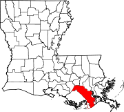
Towns CDPs Unincorporated
communityFootnotes ‡This populated place also has portions in an adjacent parish or parishes
Categories:- Lafourche Parish, Louisiana
- National Register of Historic Places in Louisiana by parish
- Buildings and structures in Lafourche Parish, Louisiana
-


Wikimedia Foundation. 2010.