- National Register of Historic Places listings in Comanche County, Oklahoma
-
 Location of Comanche County in Oklahoma
This is a list of the National Register of Historic Places listings in Comanche County, Oklahoma.
This is intended to be a complete list of the properties and districts on the National Register of Historic Places in Comanche County, Oklahoma, United States. The locations of National Register properties and districts for which the latitude and longitude coordinates are included below, may be seen in a Google map.[1]
There are 31 properties and districts listed on the National Register in the county, including 1 National Historic Landmark.
-
- This National Park Service list is complete through NPS recent listings posted November 10, 2011.[2]
Current listings
[3] Landmark name [4] Image Date listed Location City or town Summary 1 Arrastra Site May 11, 1981 Wichita Mountains Wildlife Refuge
34°45′42″N 98°34′32″W / 34.761667°N 98.575556°WCache 2 Mattie Beal House 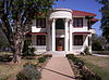
August 19, 1975 5th St. and Summit Ave.
34°35′44″N 98°23′41″W / 34.595556°N 98.394722°WLawton 3 Blockhouse on Signal Mountain November 29, 1978 Off Mackenzie Hill Rd.
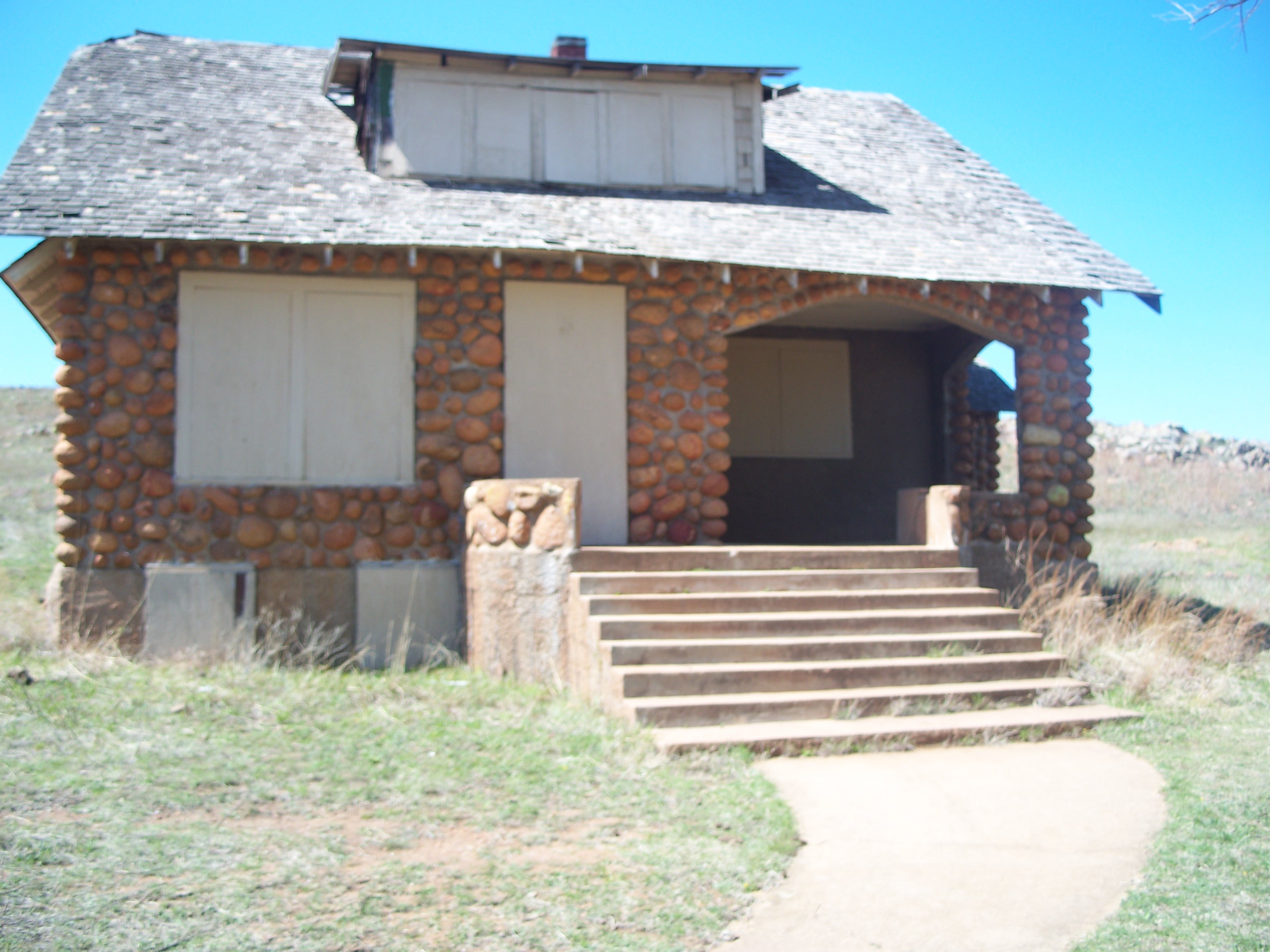
34°40′27″N 98°29′25″W / 34.674167°N 98.490278°WFort Sill 4 Boulder Cabin May 11, 1981 Northwest of Cache
34°42′06″N 98°40′30″W / 34.701667°N 98.675°WCache 5 Buffalo Lodge May 11, 1981 Northwest of Cache
34°44′00″N 98°42′38″W / 34.733333°N 98.710556°WCache 6 Building 309, Fort Sill Indian School October 15, 1973 Eastern edge of Lawton, off U.S. Route 62 Lawton 7 Camp Comanche Site May 12, 1977 Address Restricted Fort Sill 8 Carnegie Library 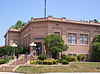
August 19, 1976 B Ave. and 5th St.
34°36′24″N 98°23′40″W / 34.606667°N 98.394444°WLawton 9 Chiefs Knoll May 16, 1978 Macomb and Burrill Rds.
34°40′10″N 98°23′42″W / 34.669444°N 98.395°WFort Sill 10 Douglass School November 25, 2008 102 E. Gore Boulevard Lawton 11 Federal Building and US Courthouse 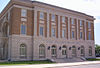
March 24, 2000 Junction of SW. 5th St. and SW. E Ave.
34°36′11″N 98°23′40″W / 34.603056°N 98.394444°WLawton 12 Ferguson House 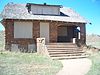
May 11, 1981 Northwest of Cache
34°43′00″N 98°36′20″W / 34.716667°N 98.605556°WCache 13 First Christian Church March 12, 1985 701 D Ave.
34°36′16″N 98°23′54″W / 34.604444°N 98.398333°WLawton 14 First Presbyterian Church of Lawton December 14, 1979 8th St. and D Ave.
34°36′13″N 98°23′58″W / 34.603611°N 98.399444°WLawton 15 First State Bank of Indiahoma November 6, 1980 Main St.
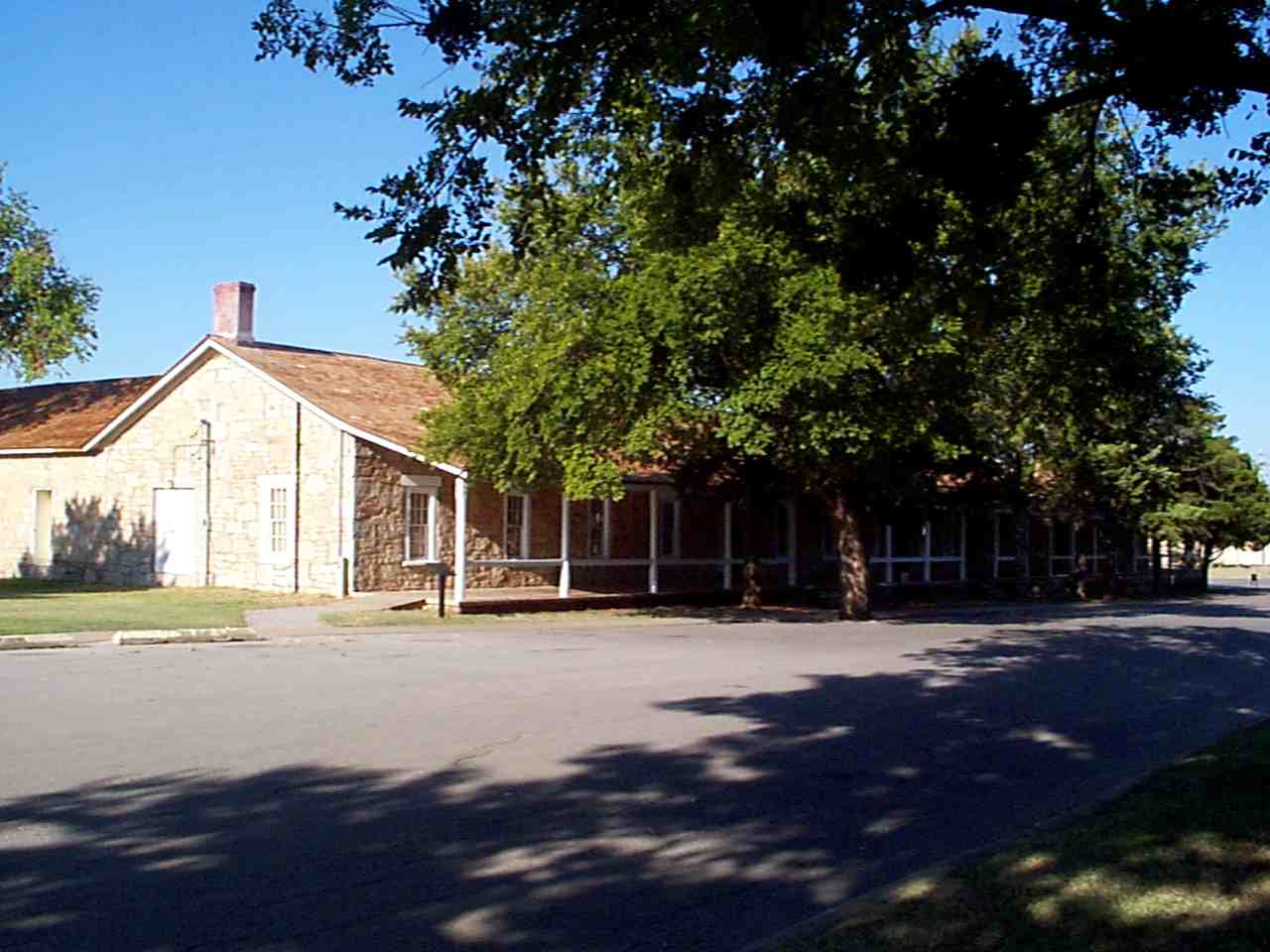
34°37′10″N 98°45′06″W / 34.619444°N 98.751667°WIndiahoma 16 Fort Sill 
October 15, 1966 U.S. Route 62
34°40′13″N 98°23′15″W / 34.670278°N 98.3875°WFort Sill 17 General Officers Quarters April 14, 1975 1310 Shanklin Circle
34°40′42″N 98°23′42″W / 34.678333°N 98.395°WFort Sill 18 Gore Pit District November 21, 1980 Address Restricted Lawton 19 Indian Cemeteries August 10, 1977 Fort Sill Military Reservation
34°42′06″N 98°22′09″W / 34.701667°N 98.369167°WFort Sill 20 Ingram House May 11, 1981 Northeast of Cache
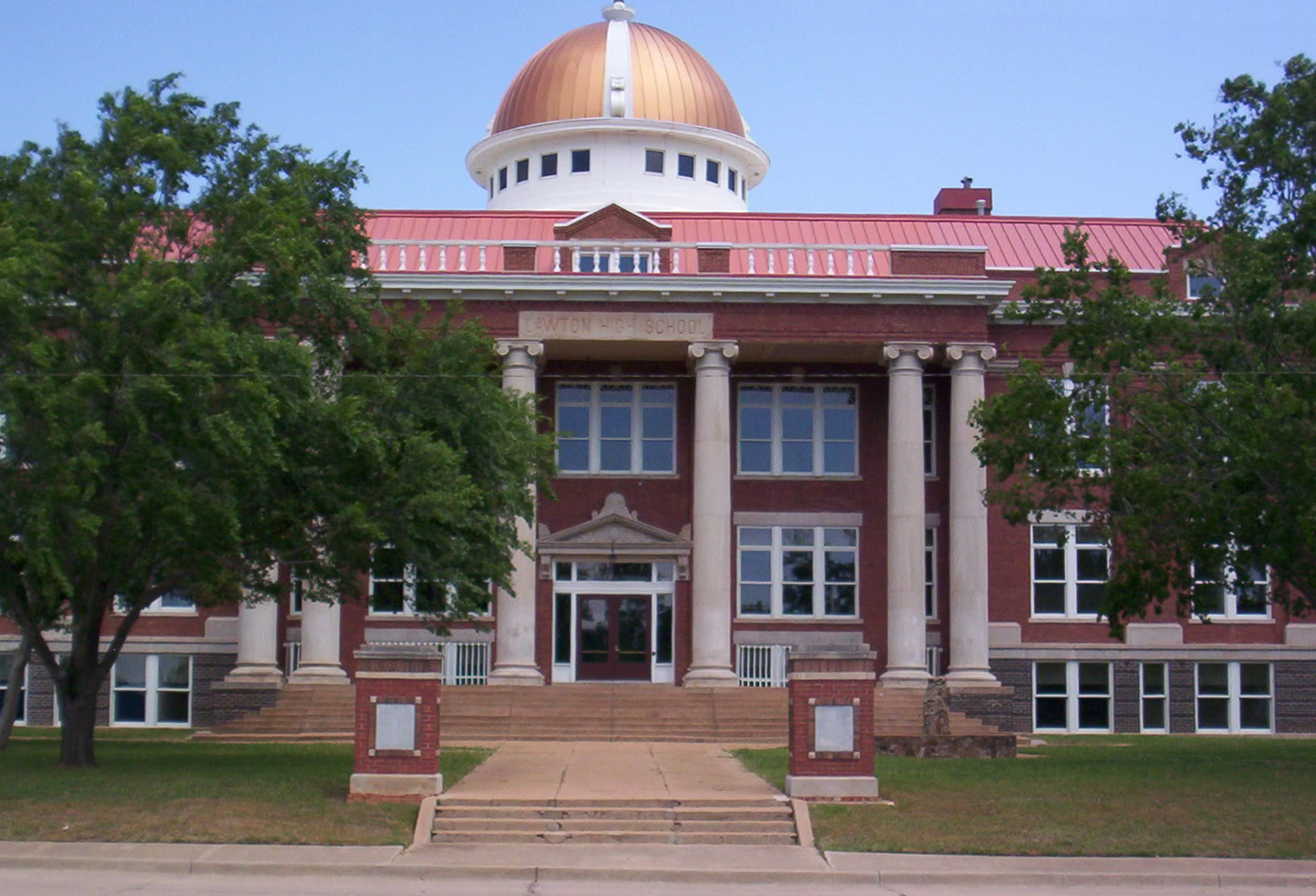
34°43′22″N 98°36′09″W / 34.722778°N 98.6025°WCache 21 Lawton High School 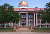
February 27, 1997 809 C Ave.
34°36′21″N 98°24′01″W / 34.605833°N 98.400278°WLawton 22 Lawton National Guard Armory June 5, 2007 600 Northwest Cache Rd.
34°37′21″N 98°23′51″W / 34.6225°N 98.3975°WLawton 23 Mahoney-Clark House December 8, 1982 513-515 W. Gore Ave.
34°36′34″N 98°23′46″W / 34.609444°N 98.396111°WLawton 24 Medicine Bluffs December 31, 1974 Medicine Bluff Creek
34°41′03″N 98°25′00″W / 34.684167°N 98.416667°WFort Sill 25 Medicine Park Hotel and Annex September 25, 1979 E. Lake Dr.
34°43′41″N 98°30′05″W / 34.728056°N 98.501389°WMedicine Park 26 Meers Mining Camp January 20, 1978 20 miles (32 km) northwest of Lawton
34°46′57″N 98°34′45″W / 34.7825°N 98.579167°WLawton 27 Methodist Episcopal Church, South March 12, 1985 702 D Ave.
34°36′14″N 98°23′54″W / 34.603889°N 98.398333°WLawton 28 Old Tower Two December 31, 1974 Northwest of Lawton at the junction of Signal Mountain and Tower Two Rds.
34°40′24″N 98°26′48″W / 34.673333°N 98.446667°WLawton 29 Quanah Parker Star House September 29, 1970 Eagle Park
34°37′42″N 98°38′34″W / 34.628333°N 98.642778°WCache 30 Penateka November 7, 1976 3.5 miles west of Elgin on U.S. Route 277
34°46′53″N 98°22′01″W / 34.781389°N 98.366944°WElgin 31 Henry Post Air Field January 30, 1978 North of Lawton on Fort Sill
34°38′40″N 98°23′47″W / 34.644444°N 98.396389°WLawton See also
- List of National Historic Landmarks in Oklahoma
- National Register of Historic Places listings in Oklahoma
References
- ^ The latitude and longitude information provided in this table was derived originally from the National Register Information System, which has been found to be fairly accurate for about 99% of listings. For about 1% of NRIS original coordinates, experience has shown that one or both coordinates are typos or otherwise extremely far off; some corrections may have been made. A more subtle problem causes many locations to be off by up to 150 yards, depending on location in the country: most NRIS coordinates were derived from tracing out latitude and longitudes off of USGS topographical quadrant maps created under North American Datum of 1927, which differs from the current, highly accurate GPS system used by Google maps. Chicago is about right, but NRIS longitudes in Washington are higher by about 4.5 seconds, and are lower by about 2.0 seconds in Maine. Latitudes differ by about 1.0 second in Florida. Some locations in this table may have been corrected to current GPS standards.
- ^ "National Register of Historic Places: Weekly List Actions". National Park Service, United States Department of the Interior. Retrieved on November 10, 2011.
- ^ Numbers represent an ordering by significant words. Various colorings, defined here, differentiate National Historic Landmark sites and National Register of Historic Places Districts from other NRHP buildings, structures, sites or objects.
- ^ "National Register Information System". National Register of Historic Places. National Park Service. . http://nrhp.focus.nps.gov/natreg/docs/All_Data.html.
U.S. National Register of Historic Places Topics Lists by states Alabama • Alaska • Arizona • Arkansas • California • Colorado • Connecticut • Delaware • Florida • Georgia • Hawaii • Idaho • Illinois • Indiana • Iowa • Kansas • Kentucky • Louisiana • Maine • Maryland • Massachusetts • Michigan • Minnesota • Mississippi • Missouri • Montana • Nebraska • Nevada • New Hampshire • New Jersey • New Mexico • New York • North Carolina • North Dakota • Ohio • Oklahoma • Oregon • Pennsylvania • Rhode Island • South Carolina • South Dakota • Tennessee • Texas • Utah • Vermont • Virginia • Washington • West Virginia • Wisconsin • WyomingLists by territories Lists by associated states Other  Category:National Register of Historic Places •
  Portal:National Register of Historic Places
Municipalities and communities of Comanche County, Oklahoma County seat: Lawton Cities 
Towns Chattanooga‡ | Faxon | Fletcher | Geronimo | Indiahoma | Medicine Park | Sterling
Unincorporated
communitiesArtillery Village | Bethel | Cache Wye | Chatto Crossing | Corral Crossing | Cove Acres | Coxs Corner | Duhringe Pass | Edgewater Park | Four Mile Crossing | Green Meadow Acres | Grenade Crossing | Indiahoma Wye | Lake Ellsworth Addition | Lakeside Village | Latonka Acres | Letitia | Meers | Mountain View | Peachtree Crossing | Porter Hill | Pumpkin Center | Richards Spur | Ridley | Sneed Acres | Taupa | The Holy City
Footnotes ‡This populated place also has portions in an adjacent county or counties
Categories:- Comanche County, Oklahoma
- National Register of Historic Places in Oklahoma by county
- Buildings and structures in Comanche County, Oklahoma
-


Wikimedia Foundation. 2010.