- National Register of Historic Places listings in Cleveland County, Oklahoma
-
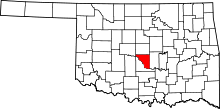 Location of Cleveland County in Oklahoma
This is a list of the National Register of Historic Places listings in Cleveland County, Oklahoma.
This is intended to be a complete list of the properties and districts on the National Register of Historic Places in Cleveland County, Oklahoma, United States. The locations of National Register properties and districts for which the latitude and longitude coordinates are included below, may be seen in a Google map.[1]
There are 20 properties and districts listed on the National Register in the county, including 1 National Historic Landmark.
-
- This National Park Service list is complete through NPS recent listings posted November 10, 2011.[2]
Current listings
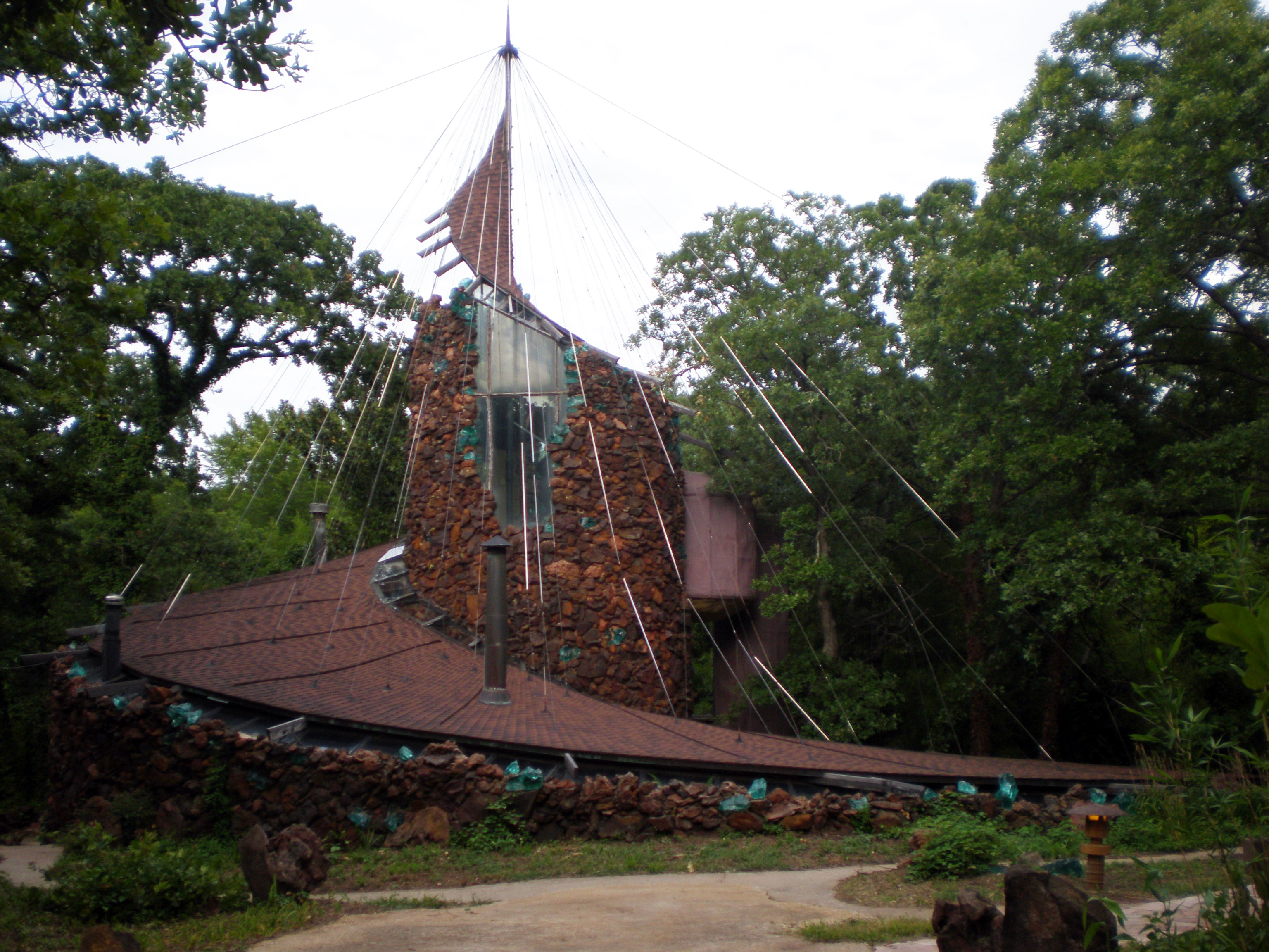
[3] Landmark name [4] Image Date listed Location City or town Summary 1 Eugene Bavinger House 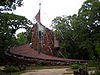
December 13, 2001 730 60th Ave., NE.
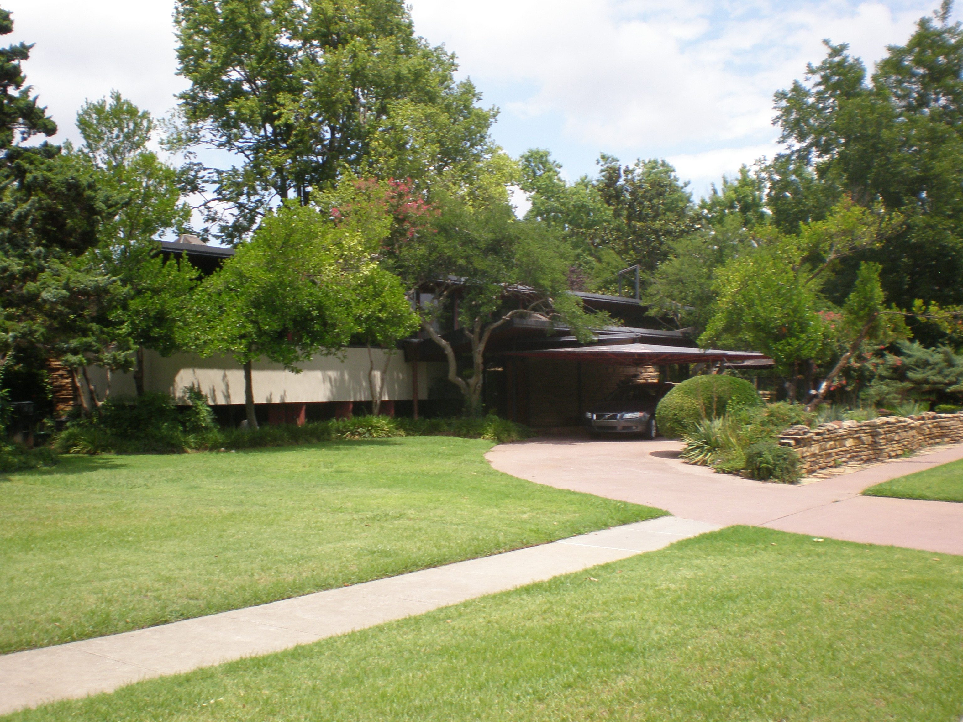
35°13′40″N 97°21′10″W / 35.227778°N 97.352778°WNorman 2 Beta Theta Pi Fraternity House, The University of Oklahoma June 2, 1982 800 S. Chautauqua Ave.
35°12′26″N 97°27′00″W / 35.207222°N 97.45°WNorman 3 Bizzell Library, University of Oklahoma 
January 3, 2001 401 W. Brooks St.
35°12′27″N 97°26′46″W / 35.20749°N 97.44606°WNorman 4 Casa Blanca February 21, 1990 103 W. Boyd
35°12′40″N 97°26′28″W / 35.211111°N 97.441111°WNorman 5 Cleveland County Courthouse December 28, 2000 200 S. Peters Ave.
35°13′11″N 97°25′49″W / 35.219722°N 97.430278°WNorman 6 DeBarr Historic District December 27, 1991 Roughly bounded by Boyd St., DeBarr Ave., Duffy St., and the former ATSF railroad tracks
35°12′44″N 97°26′25″W / 35.212222°N 97.440278°WNorman 7 Patricio Gimeno House December 30, 1991 800 Elm St.
35°12′20″N 97°26′52″W / 35.205556°N 97.447778°WNorman 8 Oscar B. Jacobson House December 23, 1986 609 S. Chatauqua Ave.
35°12′39″N 97°26′58″W / 35.210833°N 97.449444°WNorman 9 H.E. Ledbetter House 
June 14, 2001 701 W. Brooks
35°12′27″N 97°27′04″W / 35.2075°N 97.451111°WNorman 10 Mardock Mission March 14, 1983 Southeast of Stella off State Highway 9
35°12′39″N 97°09′31″W / 35.210833°N 97.158611°WStella 11 Moore Public School Building November 8, 1984 NW. 1st and Broadway
35°20′23″N 97°29′12″W / 35.339722°N 97.486667°WMoore 12 Moore-Lindsay House November 14, 1985 508 N. Peters
35°13′31″N 97°26′39″W / 35.225278°N 97.444167°WNorman 13 Norman City Park New Deal Resources December 28, 2000 Junction of Daws St. and Webster Ave.
35°13′22″N 97°26′14″W / 35.222778°N 97.437222°WNorman 14 Norman Historic District October 10, 1978 105 W. Main and 100-232 E. Main St.
35°13′18″N 97°26′29″W / 35.221667°N 97.441389°WNorman 15 Norman Public Library December 28, 2000 329 S. Peters Ave.
35°13′08″N 97°26′23″W / 35.218889°N 97.439722°WNorman 16 Oklahoma Center for Continuing Education Historic District June 10, 2011 Bounded by Asp Ave., Kellogg Dr., Maple and 4th Sts.
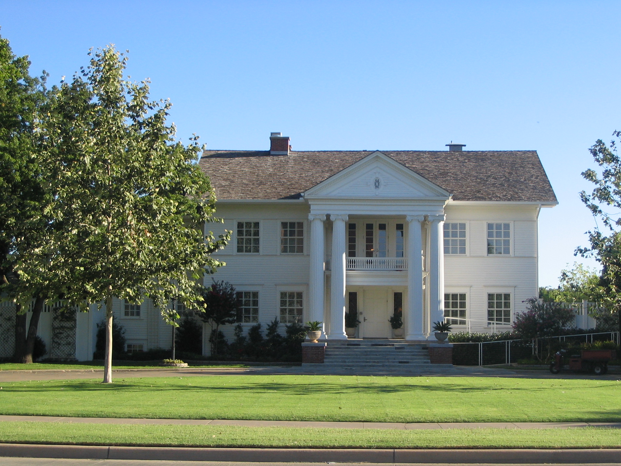
35°11′54″N 97°26′44″W / 35.198333°N 97.445556°WNorman 17 President's House, University of Oklahoma 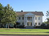
July 6, 1976 401 W. Boyd St.
35°12′41″N 97°25′46″W / 35.211389°N 97.429444°WNorman 18 Santa Fe Depot January 25, 1991 Junction of Abner Norman Dr. and Comanche St.
35°13′12″N 97°26′33″W / 35.22°N 97.4425°WNorman 19 Sooner Theater Building August 31, 1978 101 E. Main St.
35°13′17″N 97°26′34″W / 35.221389°N 97.442778°WNorman 20 United States Post Office-Norman December 28, 2000 207 E. Gray St.
35°13′22″N 97°26′31″W / 35.222778°N 97.441944°WNorman See also
- List of National Historic Landmarks in Oklahoma
- National Register of Historic Places listings in Oklahoma
References
- ^ The latitude and longitude information provided in this table was derived originally from the National Register Information System, which has been found to be fairly accurate for about 99% of listings. For about 1% of NRIS original coordinates, experience has shown that one or both coordinates are typos or otherwise extremely far off; some corrections may have been made. A more subtle problem causes many locations to be off by up to 150 yards, depending on location in the country: most NRIS coordinates were derived from tracing out latitude and longitudes off of USGS topographical quadrant maps created under the North American Datum of 1927, which differs from the current, highly accurate WGS84 GPS system used by Google maps. Chicago is about right, but NRIS longitudes in Washington are higher by about 4.5 seconds, and are lower by about 2.0 seconds in Maine. Latitudes differ by about 1.0 second in Florida. Some locations in this table may have been corrected to current GPS standards.
- ^ "National Register of Historic Places: Weekly List Actions". National Park Service, United States Department of the Interior. Retrieved on November 10, 2011.
- ^ Numbers represent an ordering by significant words. Various colorings, defined here, differentiate National Historic Landmark sites and National Register of Historic Places Districts from other NRHP buildings, structures, sites or objects.
- ^ "National Register Information System". National Register of Historic Places. National Park Service. . http://nrhp.focus.nps.gov/natreg/docs/All_Data.html.
U.S. National Register of Historic Places Topics Lists by states Alabama • Alaska • Arizona • Arkansas • California • Colorado • Connecticut • Delaware • Florida • Georgia • Hawaii • Idaho • Illinois • Indiana • Iowa • Kansas • Kentucky • Louisiana • Maine • Maryland • Massachusetts • Michigan • Minnesota • Mississippi • Missouri • Montana • Nebraska • Nevada • New Hampshire • New Jersey • New Mexico • New York • North Carolina • North Dakota • Ohio • Oklahoma • Oregon • Pennsylvania • Rhode Island • South Carolina • South Dakota • Tennessee • Texas • Utah • Vermont • Virginia • Washington • West Virginia • Wisconsin • WyomingLists by territories Lists by associated states Other Municipalities and communities of Cleveland County, Oklahoma Cities 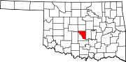
Towns Unincorporated
communitiesBoulevard | Box | Clothier | Corbett | Denver | Franklin | Hall Park | Hollywood Corners | Little Axe | Maguire | McKiddyville | Needmore | Spring Hill | Stella | Willow View
Footnotes ‡This populated place also has portions in an adjacent county or counties
Categories:- Cleveland County, Oklahoma
- National Register of Historic Places in Oklahoma by county
-


Wikimedia Foundation. 2010.