- National Register of Historic Places listings in Colfax County, Nebraska
-
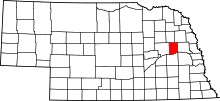 Location of Colfax County in Nebraska
This is a list of the National Register of Historic Places listings in Colfax County, Nebraska. It is intended to be a complete list of the properties and districts on the National Register of Historic Places in Colfax County, Nebraska, United States. The locations of National Register properties and districts for which the latitude and longitude coordinates are included below, may be seen in a Google map.[1]
There are 11 properties and districts listed on the National Register in the county.
-
- This National Park Service list is complete through NPS recent listings posted November 10, 2011.[2]
Current listings
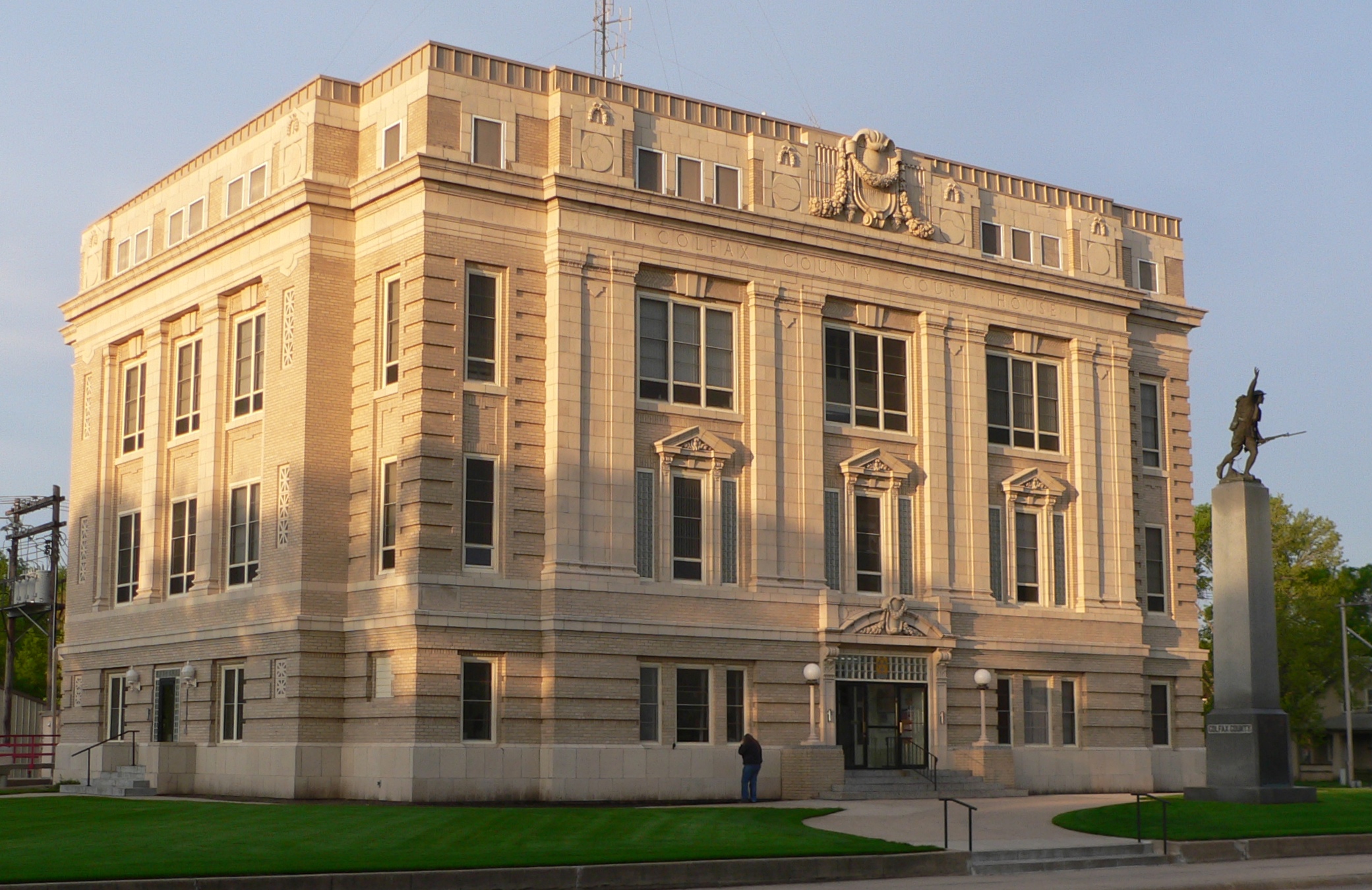
[3] Landmark name Image Date listed Location City or town Summary 1 Colfax County Courthouse 
September 3, 1981 Off Nebraska Highway 15
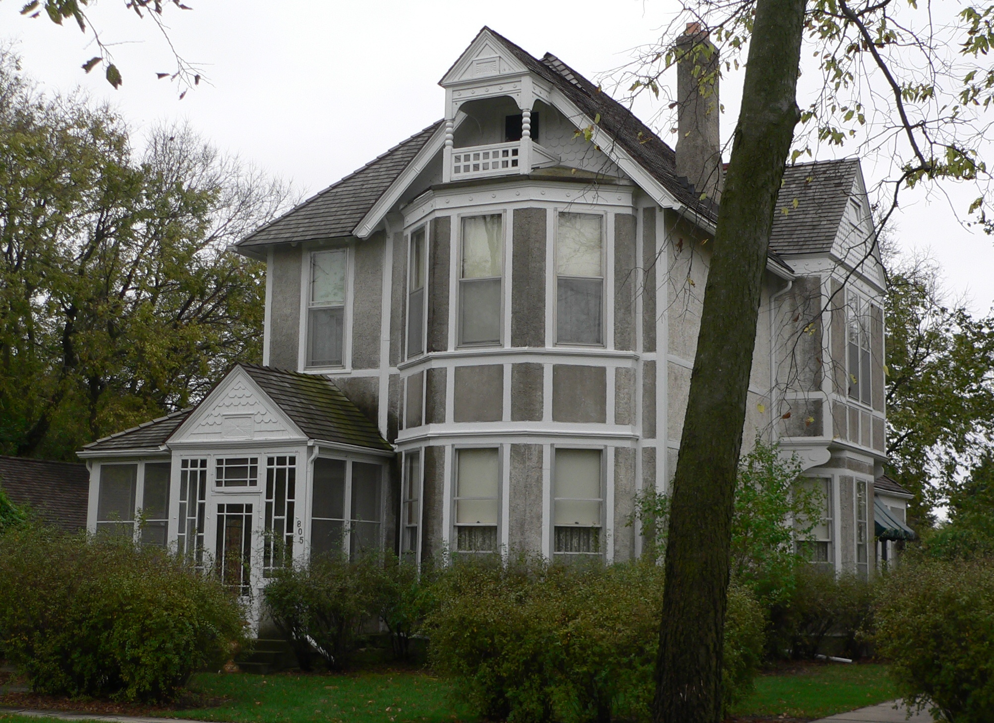
41°26′49″N 97°03′18″W / 41.446944°N 97.055°WSchuyler 2 John Janecek House 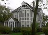
July 15, 1982 805 E. 8th St.
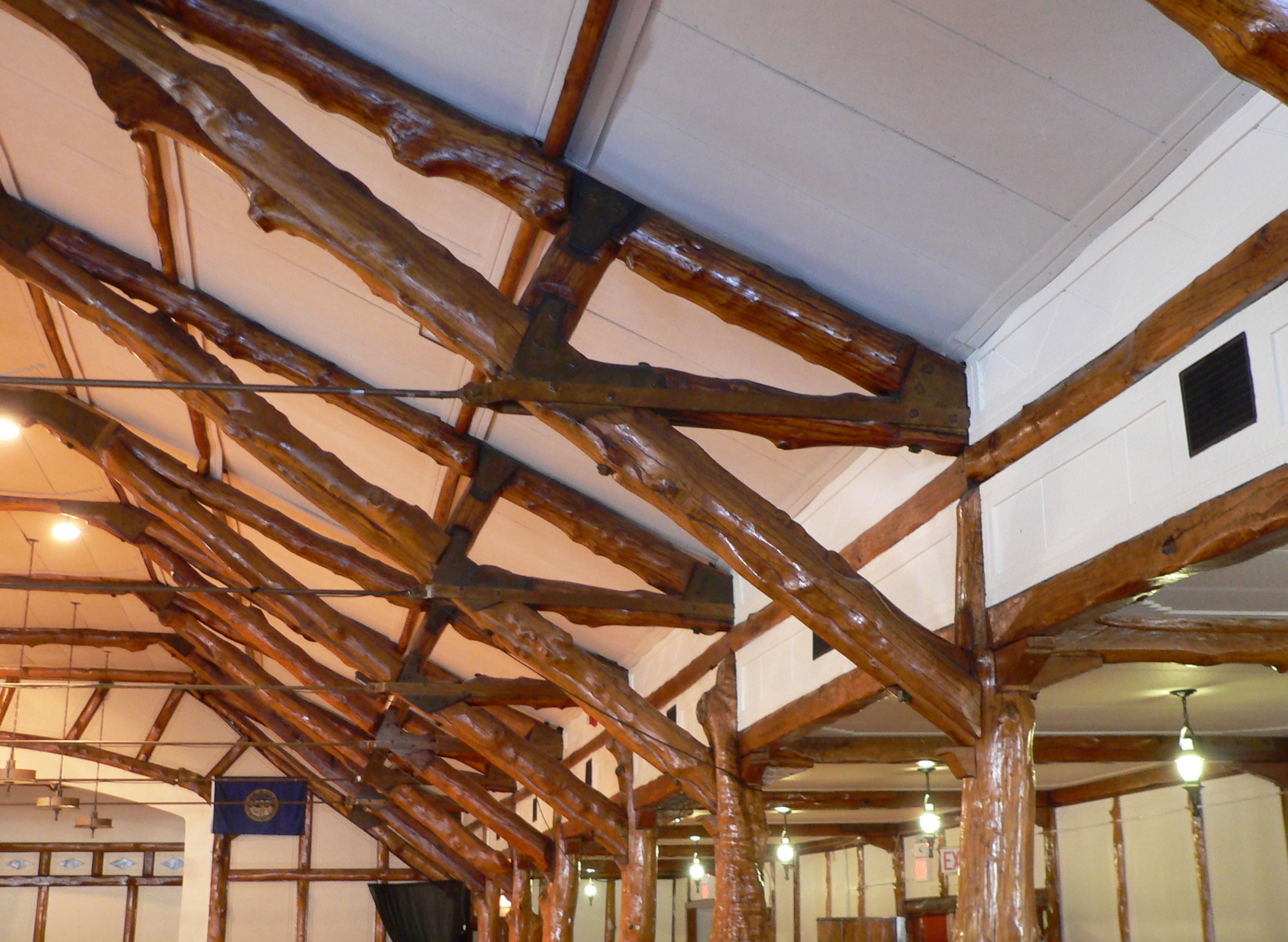
41°26′38″N 97°03′04″W / 41.443889°N 97.051111°WSchuyler 3 Oak Ballroom 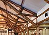
February 1, 1983 Colfax St.
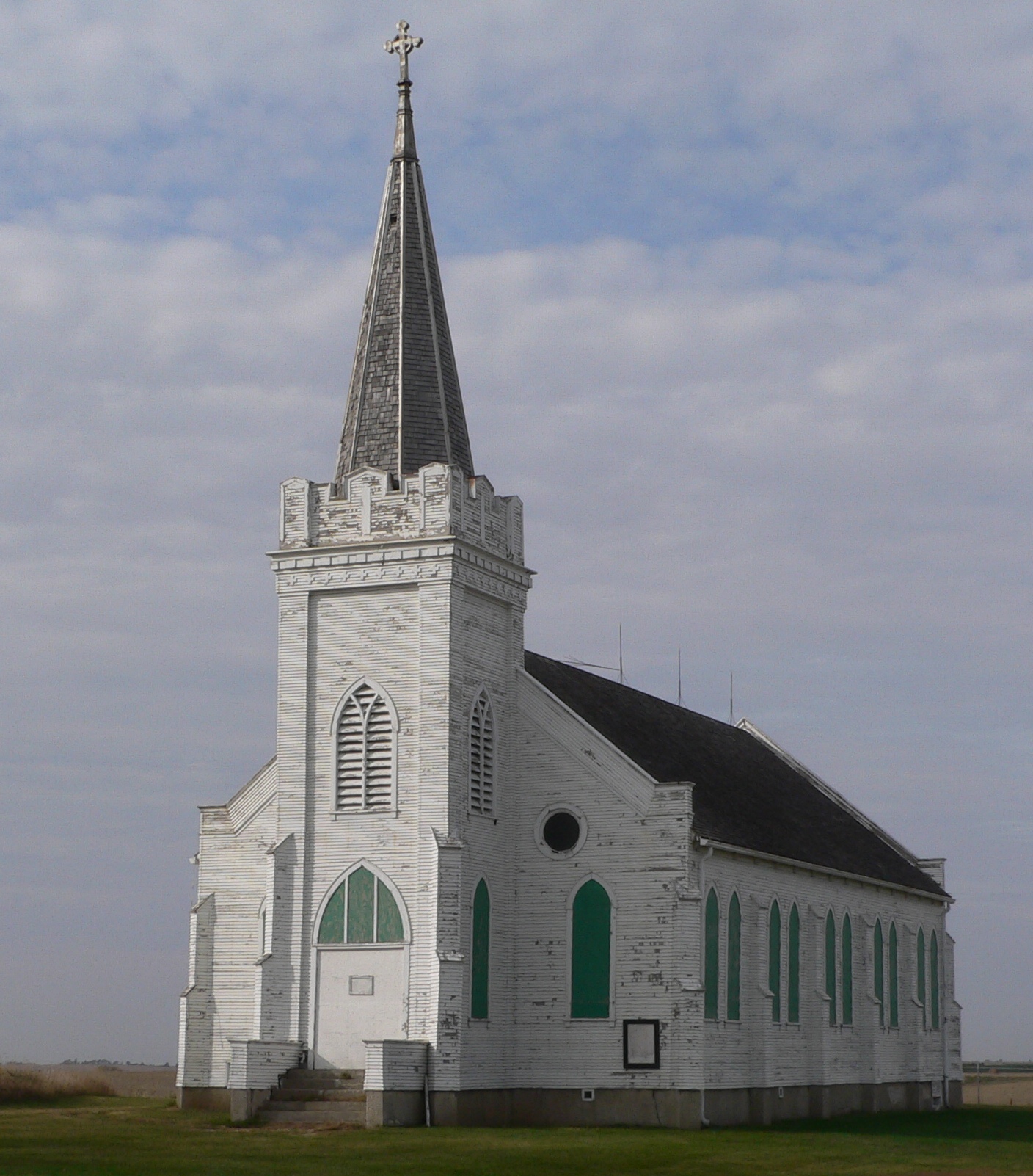
41°26′15″N 97°03′39″W / 41.4375°N 97.060833°WSchuyler 4 Our Lady of Perpetual Help Catholic Church & Cemetery 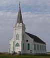
November 12, 1982 Southern side of Road N, 9 miles north and 5.5 miles west of Schuyler
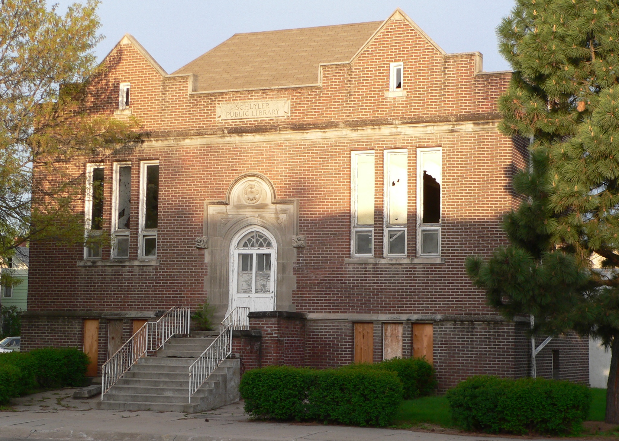
41°34′50.7″N 97°9′42.3″W / 41.58075°N 97.16175°W[4]Schuyler 5 Schuyler Carnegie Library 
November 29, 2001 1003 B St.
41°26′48″N 97°03′26″W / 41.446667°N 97.057222°WSchuyler 6 Schuyler City Hall 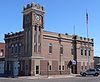
September 3, 1981 1020 A St.
41°26′50″N 97°03′29″W / 41.447222°N 97.058056°WSchuyler 7 Schuyler Site 
August 14, 1973 Address Restricted Schuyler 8 US Post Office-Schuyler 
May 11, 1992 119 E. 11th St.
41°26′50″N 97°03′31″W / 41.447222°N 97.058611°WSchuyler 9 Wolfe Archeological Site July 30, 1974 Address Restricted Schuyler 10 Z.C.B.J. Opera House 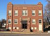
September 28, 1988 Fourth and Pine, Clarkson, Nebraska
41°43′26″N 97°07′21″W / 41.723889°N 97.1225°WClarkson 11 Zion Presbyterian Church January 7, 1988 5 miles southeast of Clarkson off Nebraska Highway 15
41°41′04″N 97°03′33″W / 41.684444°N 97.059167°WClarkson See also
- List of National Historic Landmarks in Nebraska
- National Register of Historic Places listings in Nebraska
References
- ^ The latitude and longitude information provided in this table was derived originally from the National Register Information System, which has been found to be fairly accurate for about 99% of listings. For about 1% of NRIS original coordinates, experience has shown that one or both coordinates are typos or otherwise extremely far off; some corrections may have been made. A more subtle problem causes many locations to be off by up to 150 yards, depending on location in the country: most NRIS coordinates were derived from tracing out latitude and longitudes off of USGS topographical quadrant maps created under the North American Datum of 1927, which differs from the current, highly accurate WGS84 GPS system used by Google maps. Chicago is about right, but NRIS longitudes in Washington are higher by about 4.5 seconds, and are lower by about 2.0 seconds in Maine. Latitudes differ by about 1.0 second in Florida. Some locations in this table may have been corrected to current GPS standards.
- ^ "National Register of Historic Places: Weekly List Actions". National Park Service, United States Department of the Interior. Retrieved on November 10, 2011.
- ^ Numbers represent an ordering by significant words. Various colorings, defined here, differentiate National Historic Landmark sites and National Register of Historic Places Districts from other NRHP buildings, structures, sites or objects.
- ^ Location derived from its NRHP nomination form; the NRIS lists the site as "Address Restricted"
U.S. National Register of Historic Places Topics Lists by states Alabama • Alaska • Arizona • Arkansas • California • Colorado • Connecticut • Delaware • Florida • Georgia • Hawaii • Idaho • Illinois • Indiana • Iowa • Kansas • Kentucky • Louisiana • Maine • Maryland • Massachusetts • Michigan • Minnesota • Mississippi • Missouri • Montana • Nebraska • Nevada • New Hampshire • New Jersey • New Mexico • New York • North Carolina • North Dakota • Ohio • Oklahoma • Oregon • Pennsylvania • Rhode Island • South Carolina • South Dakota • Tennessee • Texas • Utah • Vermont • Virginia • Washington • West Virginia • Wisconsin • WyomingLists by territories Lists by associated states Other Municipalities and communities of Colfax County, Nebraska Cities 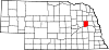
Villages Categories:- National Register of Historic Places in Nebraska by county
- Colfax County, Nebraska
-


Wikimedia Foundation. 2010.