- National Register of Historic Places listings in Caddo County, Oklahoma
-
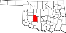 Location of Caddo County in Oklahoma
This is a list of the National Register of Historic Places listings in Caddo County, Oklahoma.
This is intended to be a complete list of the properties and districts on the National Register of Historic Places in Caddo County, Oklahoma, United States. The locations of National Register properties and districts for which the latitude and longitude coordinates are included below, may be seen in a Google map.[1]
There are 12 properties and districts listed on the National Register in the county.
-
- This National Park Service list is complete through NPS recent listings posted November 10, 2011.[2]
Current listings
[3] Landmark name [4] Image Date listed Location City or town Summary 1 Amphlett Brothers Drug and Jewelry Store 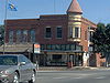
May 11, 1982 Evans and Coblake Aves.
34°53′35″N 98°21′55″W / 34.893056°N 98.365278°WApache 2 Anadarko Armory May 20, 1994 700 W. Oklahoma St.
35°04′24″N 98°15′14″W / 35.073333°N 98.253889°WAnadarko 3 Anadarko Downtown Historic District December 10, 1990 Roughly bounded by the Chicago, Rock Island and Pacific railroad line and E. 2nd and W. 3rd Sts.
35°04′32″N 98°14′36″W / 35.075556°N 98.243333°WAnadarko 4 Apache State Bank July 17, 1972 Evans and Coblake
34°53′35″N 98°21′57″W / 34.893056°N 98.365833°WApache 5 Bridgeport Hill-Hydro OK 66 Segment March 3, 2004 State Highway 66 from Hydro east to a spur of U.S. Route 281
35°32′29″N 98°24′43″W / 35.541389°N 98.411944°WHydro Extends into Canadian County 6 Caddo County Medicine Creek Archeological District March 28, 1995 Address Restricted Binger 7 First Baptist Church (Colored) December 11, 2007 Junction of E. Washington Ave. and NE. 5th St.
35°04′41″N 98°14′13″W / 35.078056°N 98.236944°WAnadarko 8 Fort Cobb Site March 1, 1973 1 mile east of Fort Cobb Fort Cobb 9 Provine Service Station July 17, 1997 0.5 miles east of the junction of Interstate 40 and State Highway 58
35°32′13″N 98°34′25″W / 35.536944°N 98.573611°WHydro 10 Randlett Park September 2, 2003 Washita River south to Central Boulevard and east to 7th St.
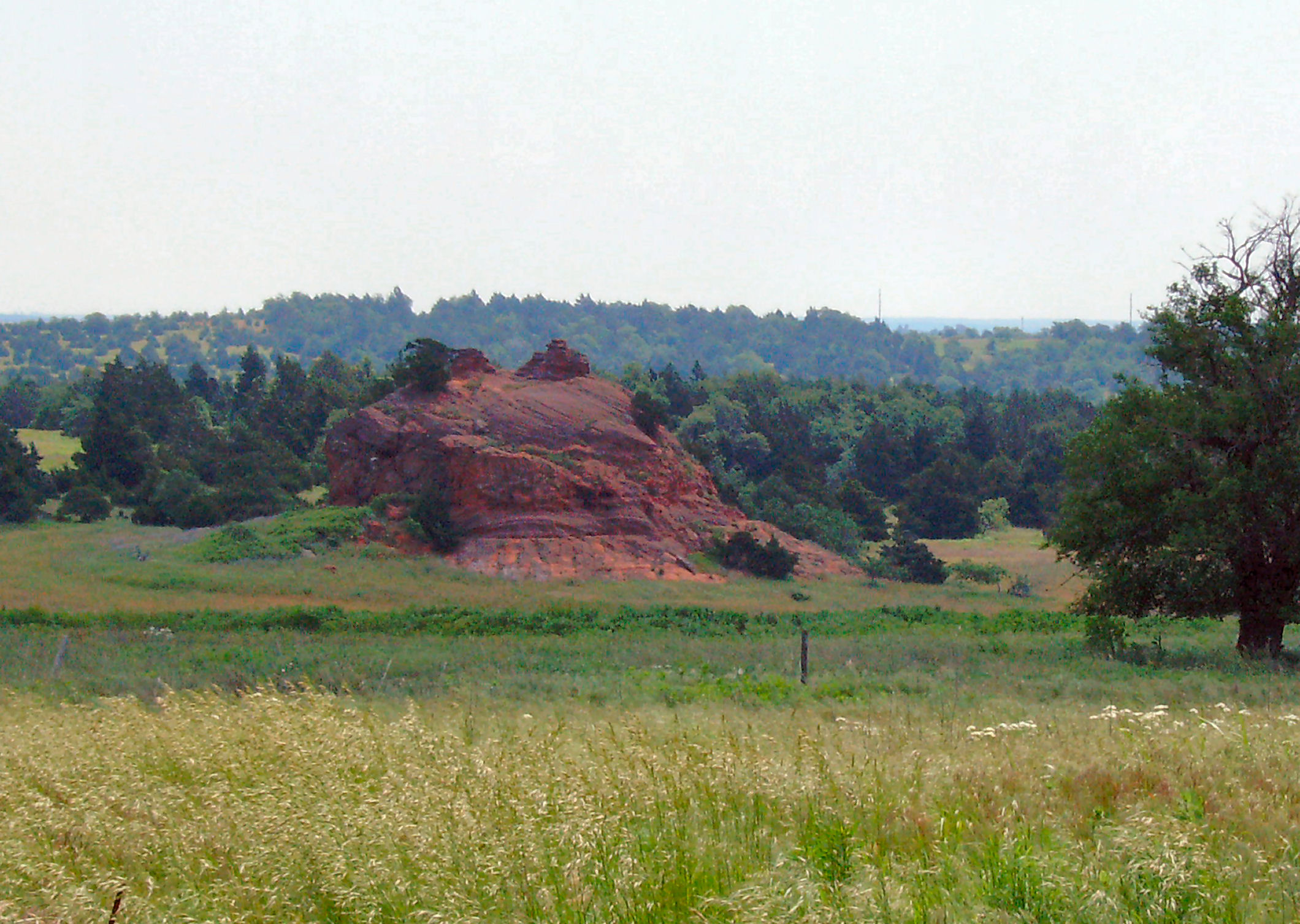
35°04′26″N 98°15′23″W / 35.073889°N 98.256389°WAnadarko 11 Rock Mary 
June 22, 1970 4 miles west of Hinton
35°27′35″N 98°25′32″W / 35.459722°N 98.425556°WHinton 12 Stevens Rock Shelter March 28, 1995 Address Restricted Gracemont See also
- List of National Historic Landmarks in Oklahoma
- National Register of Historic Places listings in Oklahoma
References
- ^ The latitude and longitude information provided in this table was derived originally from the National Register Information System, which has been found to be fairly accurate for about 99% of listings. For about 1% of NRIS original coordinates, experience has shown that one or both coordinates are typos or otherwise extremely far off; some corrections may have been made. A more subtle problem causes many locations to be off by up to 150 yards, depending on location in the country: most NRIS coordinates were derived from tracing out latitude and longitudes off of USGS topographical quadrant maps created under the North American Datum of 1927, which differs from the current, highly accurate WGS84 GPS system used by Google maps. Chicago is about right, but NRIS longitudes in Washington are higher by about 4.5 seconds, and are lower by about 2.0 seconds in Maine. Latitudes differ by about 1.0 second in Florida. Some locations in this table may have been corrected to current GPS standards.
- ^ "National Register of Historic Places: Weekly List Actions". National Park Service, United States Department of the Interior. Retrieved on November 10, 2011.
- ^ Numbers represent an ordering by significant words. Various colorings, defined here, differentiate National Historic Landmark sites and National Register of Historic Places Districts from other NRHP buildings, structures, sites or objects.
- ^ "National Register Information System". National Register of Historic Places. National Park Service. . http://nrhp.focus.nps.gov/natreg/docs/All_Data.html.
U.S. National Register of Historic Places Topics Lists by states Alabama • Alaska • Arizona • Arkansas • California • Colorado • Connecticut • Delaware • Florida • Georgia • Hawaii • Idaho • Illinois • Indiana • Iowa • Kansas • Kentucky • Louisiana • Maine • Maryland • Massachusetts • Michigan • Minnesota • Mississippi • Missouri • Montana • Nebraska • Nevada • New Hampshire • New Jersey • New Mexico • New York • North Carolina • North Dakota • Ohio • Oklahoma • Oregon • Pennsylvania • Rhode Island • South Carolina • South Dakota • Tennessee • Texas • Utah • Vermont • Virginia • Washington • West Virginia • Wisconsin • WyomingLists by territories Lists by associated states Other National Register of Historic Places in Caddo County, Oklahoma Anadarko Anadarko Armory · Anadarko Downtown Historic District · First Baptist Church (Colored) · Randlett Park

Apache Amphlett Brothers Drug & Jewelry Store · Apache State Bank
Binger Caddo County Medicine Creek Archaeological District
Bridgeport Fort Cobb Fort Cobb Site
Gracemont Stevens Rock Shelter
Hinton Hydro Provine Service Station
See also: National Register of Historic Places listings in Caddo County, Oklahoma and List of National Historic Landmarks in OklahomaCategories:- Caddo County, Oklahoma
- National Register of Historic Places in Oklahoma by county
-


Wikimedia Foundation. 2010.