- Minginish
-
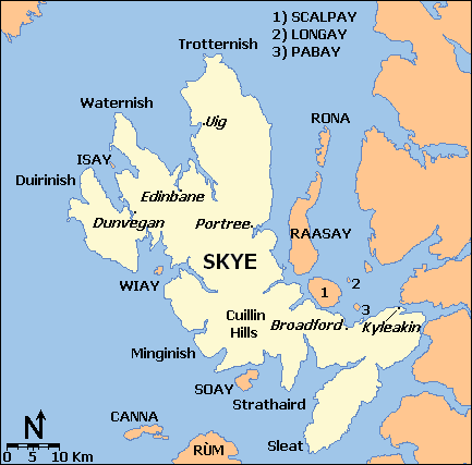
 Map of Skye showing Minginish
Minginish (Scottish Gaelic: Minginis) is a peninsula on the island of Skye in Scotland. It is situated in south central Skye, between Loch Scavaig and Glen Drynoch in the west and Loch Harport and Glen Sligachan in the south and east.[1] It includes most of the peaks of the Cuillin hills including Sgurr Alasdair, the highest point on the island at 992 metres (3,255 ft). The island of Soay lies offshore across the Soay Sound, with the Small Isles further south across the Cuillin Sound.
Much of the interior is uninhabited and the terrain is a series of hills and mountains dissected by steep-sided valleys such as Glen Brittle and Glen Eynort. To the east, Loch Coruisk, which has been painted by William Daniell and J.M.W. Turner amongst others and visited by Walter Scott.[2] is only accessible by boat or on foot via a track from Sligachan.
There are a number of small settlements in Minginish, principally along the south coast of Loch Harport, including Carbost, Drynoch and Fiskavaig. Eynort and Talisker are further south. Crofting is a mainstay of the economy and Talisker whisky is distilled in Carbost.
The Gaelic name Minginis means "main headland".[3]
See also
- Duirinish
- Sleat
- Strathaird
- Trotternish
- Waternish
Footnotes
- ^ "Minginis". Gazetteer for Scotland. http://www.scottish-places.info/features/featurefirst7446.html. Retrieved 25 November 2009.
- ^ Haswell-Smith, Hamish (2004). The Scottish Islands. Edinburgh: Canongate. pp. 177. ISBN 1841954543.
- ^ Iain Mac an Tàilleir. "Placenames" (PDF). Pàrlamaid na h-Alba. http://www.scottish.parliament.uk/vli/language/gaelic/pdfs/placenamesK-O.pdf. Retrieved 2007-07-23.
Coordinates: 57°15′N 6°19′W / 57.25°N 6.31°W
Traditional provinces and districts of Scotland Major districts (former counties, provincial lordships and rural deaneries) The Aird · Annandale · Angus · Argyll · Atholl · Boyne · Buchan · Badenoch · Breadalbane · Caithness · Carrick · Clydesdale (or Strathclyde) · Cowal · Cunningham · Desnes · Eskdale · Farines · Fife · Fothriff · Galloway · Garioch · Garmoran · The Glenkens · Gowrie · Kintyre · Knapdale · Kyle · Lauderdale · Lennox · Liddesdale · Lochaber · Lorn · Lothian · Mar · Mearns · Menteith · Merse · Moray · Nithsdale · The Rhinns · Ross (Easter and Wester) · Stormont · Strathavon · Strathbogie · Strathearn · Strathgryfe · Strathnaver · Strathspey · Sutherland · Teviotdale · Tweeddale
Minor districts Applecross · Appin · Ardgour · Ardmeanach · Ardnamurchan · Assynt · Avondale · Balquhidder · Benderloch · The Black Isle · Braemar · Coigach · Cromar · Cromdale · Douglasdale · Durness · Eddrachilles · Enzie · Ettrickdale · Ewesdale · Formartine · Gairloch · Glen Albyn · Glen Almond · Glen Cassley · Glen Clova · Glen Dochart · Glenelg · Glen Esk · Glengarry · Glen Lethnot · Glen Lyon · Glen Moriston · Glen Orchy · Glen Prosen · Glenshee · Glen Spean · Glen Urquhart · Gruinard · Howe of Fife · Howe of the Mearns · Kintail · Kintyre · Knoydart · Lochalsh · Loch Broom · Locheil · The Machars · Midmar · Moidart · Morar · Morven · Muir of Ord · Rannoch Moor · Rhinns of Kells · Strathallan · Strathardle · Strathbran · Strathbraan · Strathcarron (Forth) · Strathcarron (Oykel) · Strathconon · Strathdearn · Strathdeveron · Strathdee (Deeside) · Strathdon · Strathfarrar · Strath Gartney · Strathglass · Strathisla · Strathmore · Strath of Kildonan · Strath Oykel · Strath Tay · Strathyre · Sunart · Trossachs
Insular districts
For smaller islands, usually districts in their own right, see List of Scottish islandsBorder Areas Skye / An t-Eilean Sgitheanach Main settlements Crofting townships
and settlementsAchachork · Aird of Sleat · Ardvasar · Armadale · Ashaig · Bernisdale · Bornesketaig · Boreraig · Borreraig · Borrodale · Borve · Bracadale · Breakish · Brogaig · Bualintur · Camastianavaig · Camuscross · Carbost, Loch Harport · Carbost, Portree · Claigan · Colbost · Drumfearn · Drynoch · Dunan · Duntulm · Edinbane · Elgol · Ellishadder · Eynort · Eyre · Fasach · Feorlig · Ferindonald · Fiskavaig · Flashader · Flodigarry · Galltrigill · Garafad · Geary · Gedintailor · Gillen · Glendale · Halistra · Harlosh · Heaste · Isleornsay · Kensaleyre · Kilbride · Kilmarie · Kilmore · Kilmuir · Kilvaxter · Kingsburgh · Kylerhea · Lealt · Lower Breakish · Luib · Milovaig · Ollach · Ose · Peinachorran · Portnalong · Ramasaig · Roag · Sconser · Skeabost · Sligachan · Staffin · Stein · Struan · Suladale · Talisker · Tarskavaig · Teangue · Torrin · Totaig · Tote · Treaslane · Trumpan · Uigshader · Ullinish · Upper BreakishMountains and hills Am Basteir · Beinn na Caillich · Blà Bheinn · Bruach na Frìthe · Clach Glas · Glamaig · Healabhal Bheag · Sgurr a' Ghreadaidh · Sgurr a' Mhadaidh · Sgurr Mhic Choinnich · Sgurr na Banachdich · Sgurr nan Gillean · Sgurr Dearg · Marsco · Quiraing/Meall na Suiramach · Sgurr Alasdair · The StorrHistory Armadale Castle · Battle of the Braes · Battle of the Spoiling Dyke · Caisteal Maol · Corriechatachan · Dùn Ringill · Dunvegan Castle · Fairy Flag · Flora MacDonald · Sir Rory Mor's Horn · Rubha an DùnainLocal culture Peninsulas Surrounding islands Ascrib Islands · Crowlin Islands · Eilean Bàn · Eilean Fladday · Eilean Mòr · Eilean Tigh · Eilean Trodday · Fladda-chùain · Harlosh Island · Isay · Lampay · Longay · Mingay · Oronsay · Pabay · Raasay · Scalpay · Rona · Soay · Staffin Island · Tarner Island · WiayCategories:- Landforms of Skye
- Peninsulas of Scotland
- Highland geography stubs
Wikimedia Foundation. 2010.