- Duntulm
-
Coordinates: 57°41′N 6°20′W / 57.68°N 6.34°W
Duntulm Scottish Gaelic: Dùn Thuilm 
 Duntulm
Duntulm shown within the Isle of SkyeOS grid reference NG410739 Council area Highland Lieutenancy area Ross and Cromarty Country Scotland Sovereign state United Kingdom Post town PORTREE Postcode district IV51 Dialling code 01470 552 Police Northern Fire Highlands and Islands Ambulance Scottish EU Parliament Scotland UK Parliament Ross, Skye and Lochaber Scottish Parliament Ross, Skye and Inverness West List of places: UK • Scotland • 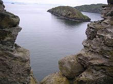 Tulm Island seen from Duntulm
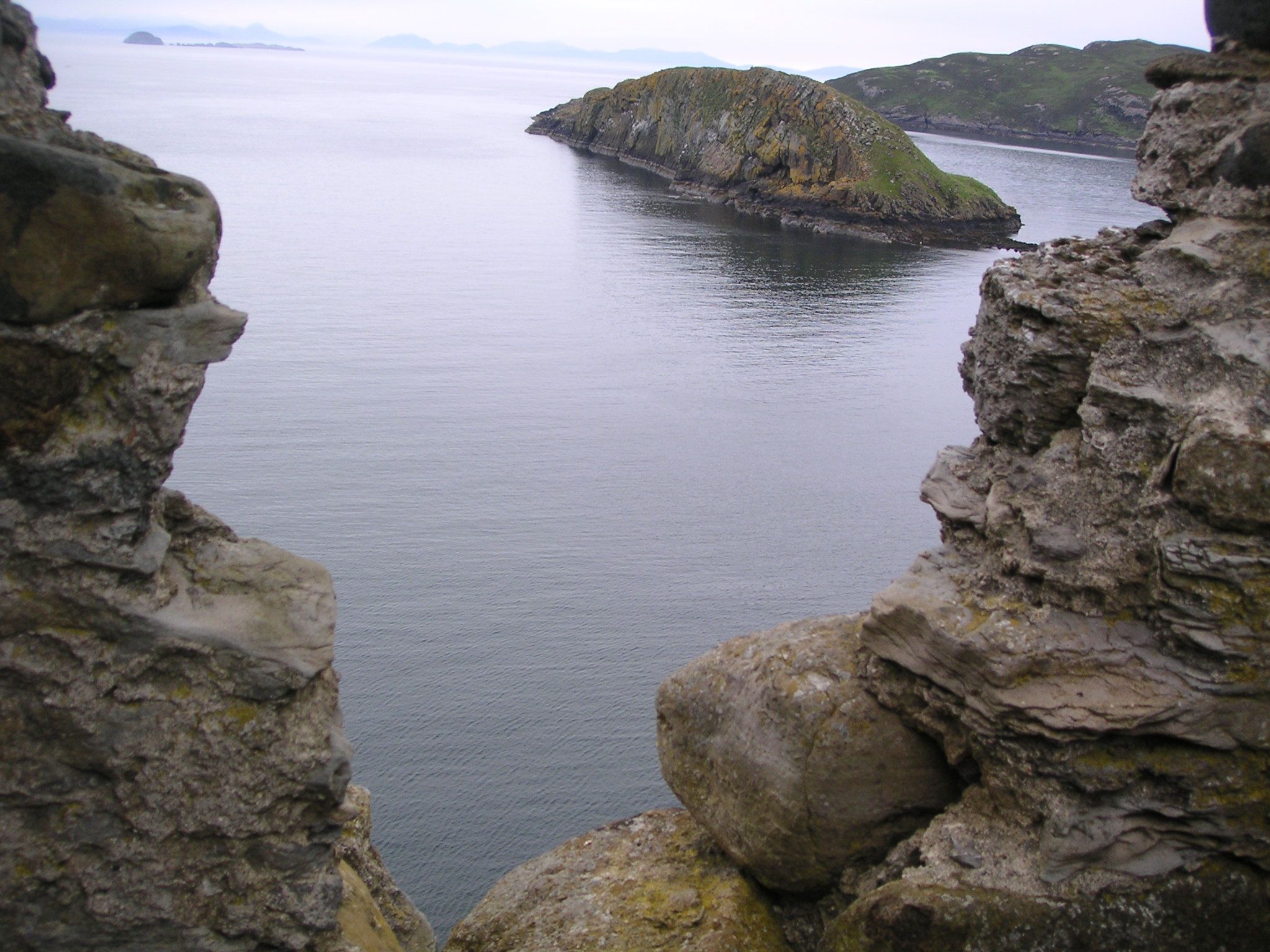
Duntulm (Scottish Gaelic: Dùn Thuilm) is a township on the most northerly point of the Trotternish peninsula of the Isle Of Skye made up of Shulista (north Duntulm), south Duntulm and Ghlumaig.
Duntulm was originally a Pictish fortress, forming one of a chain of duns or forts stretching along the north coast of the Isle of Skye. On the arrival of the Norsemen the fort became the residence of a powerful Viking leader who gave it the name David’s Fort.
Trotternish often changed hands. It was not until the 16th century that the Lords of Isles finally seized the territory and Donhall Gorm (Blue Donald) the chief, took up residence there and carried out considerable improvements to the fort. In 1730 the MacDonald’s moved away from Duntulm and stayed for a time at Monkstadt before building their new castle at Armadale.
The village is most notable for the coastal scenery coupled with the ruins of Duntulm Castle, which affords stunning views of the Outer Hebrides.
Duntulm does contain one hotel directly facing the castle and the sea. There are also the Duntulm Coastguard Cottages nearby, and the dispersed settlements in the area offer alternative accommodations. Single track road from Uig take you round to Staffin.
This north-west tip of Skye is remote but glorious and has earned praise from travellers and walkers for some time; the trek to Rubha Hunish.
Duntulm is home to a clach-ultaich, a lifting stone. It is said to weigh a ton.[1]
Footnotes
- ^ Dwelly, Edward (1911), Faclair Gàidhlig gu Beurla le Dealbhan/The Illustrated [Scottish] Gaelic-English Dictionary (4th ed.), Glasgow: MacLaren & Sons
Skye / An t-Eilean Sgitheanach Main settlements Crofting townships
and settlementsAchachork · Aird of Sleat · Ardvasar · Armadale · Ashaig · Bernisdale · Bornesketaig · Boreraig · Borreraig · Borrodale · Borve · Bracadale · Breakish · Brogaig · Bualintur · Camastianavaig · Camuscross · Carbost, Loch Harport · Carbost, Portree · Claigan · Colbost · Drumfearn · Drynoch · Dunan · Duntulm · Edinbane · Elgol · Ellishadder · Eynort · Eyre · Fasach · Feorlig · Ferindonald · Fiskavaig · Flashader · Flodigarry · Galltrigill · Garafad · Geary · Gedintailor · Gillen · Glendale · Halistra · Harlosh · Heaste · Isleornsay · Kensaleyre · Kilbride · Kilmarie · Kilmore · Kilmuir · Kilvaxter · Kingsburgh · Kylerhea · Lealt · Lower Breakish · Luib · Milovaig · Ollach · Ose · Peinachorran · Portnalong · Ramasaig · Roag · Sconser · Skeabost · Sligachan · Staffin · Stein · Struan · Suladale · Talisker · Tarskavaig · Teangue · Torrin · Totaig · Tote · Treaslane · Trumpan · Uigshader · Ullinish · Upper BreakishMountains and hills Am Basteir · Beinn na Caillich · Blà Bheinn · Bruach na Frìthe · Clach Glas · Glamaig · Healabhal Bheag · Sgurr a' Ghreadaidh · Sgurr a' Mhadaidh · Sgurr Mhic Choinnich · Sgurr na Banachdich · Sgurr nan Gillean · Sgurr Dearg · Marsco · Quiraing/Meall na Suiramach · Sgurr Alasdair · The StorrHistory Armadale Castle · Battle of the Braes · Battle of the Spoiling Dyke · Caisteal Maol · Corriechatachan · Dùn Ringill · Dunvegan Castle · Fairy Flag · Flora MacDonald · Sir Rory Mor's Horn · Rubha an DùnainLocal culture Peninsulas Surrounding islands Ascrib Islands · Crowlin Islands · Eilean Bàn · Eilean Fladday · Eilean Mòr · Eilean Tigh · Eilean Trodday · Fladda-chùain · Harlosh Island · Isay · Lampay · Longay · Mingay · Oronsay · Pabay · Raasay · Scalpay · Rona · Soay · Staffin Island · Tarner Island · WiayCategories:- Populated places in Skye
- Highland geography stubs

Wikimedia Foundation. 2010.