- Staffin
-
Coordinates: 57°37′55″N 6°13′07″W / 57.63194°N 6.21868°W
Staffin Scottish Gaelic: Stafain
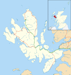
 Staffin shown within the Isle of Skye
OS grid reference NG483684 Council area Highland Country Scotland Sovereign state United Kingdom Post town Portree Postcode district IV51 9 Police Northern Fire Highlands and Islands Ambulance Scottish EU Parliament Scotland List of places: UK • Scotland • Staffin (Scottish Gaelic: Stafain) is a village (and district with a different name in Gaelic (Scottish Gaelic: An Taobh Sear)), lying at the head of Staffin Bay on the northeast coast of the Trotternish peninsula of the island of Skye. It is located on the A855 road about 17 miles (27 km) north of Portree. Nearby is the rock formation of the Quirang and Staffin Island lies just offshore. The village includes the areas of Ellishadder, Stenscholl, Garafad and Clachan and Brogaig lies immediately to the west at the centre of Staffin Bay. Also nearby are the crofting townships of Duntulm and Flodigarry.
The Kilmartin River runs northwards through the village. From where it reaches the sea a rocky shore leads east to a slipway at An Corran. Here a local resident found a slab bearing a dinosaur track, probably made by a small ornithopod. Experts subsequently found more dinosaur prints of up to 50 cm, the largest found in Scotland, made by a creature sililar to Megalosaurus. At about 160 million years old they are the youngest dinosaur remains to be found in Scotland.[1][2]
A Mesolithic hunter-gatherer site dating to the 7th millennium BC at An Corran is one of the oldest archaeological sites in Scotland. Its occupation is probably linked to that of the rock shelter at Sand, Applecross on the coast of Wester Ross.[3]
In the modern era this part of Skye retains a strong Gaelic identity with 61 per cent of the local population recorded as speaking the language in 2001.[4] In September 2010, Comunn na Gàidhlig named Staffin as their "Gaelic Community of the Year", in the first year this competition has ran.[5] Also in September 2010, Highland Council announced the launch of a consultation into a plan to convert the local primary into a Gaelic medium school. This would be the second such conversion in Scotland, after Bun-sgoil Shlèite. Only 5 out of the school's thirty pupils have English as their only language, with the remainder being bilingual English and Gaelic speakers.[6]
In 2011 it was reported that Staffin Island may be the last in Scotland where the old tradition of having cattle swim between grazings is still carried out. Crofter Iain MacDonald, who used to swim with the animals, now uses a boat to encourage them to swim from Staffin Island to Skye in early spring and back again in October.[7]
References
- ^ "Jurassic dinosaur footprints at An Corran". Scottish Geology. http://www.scottishgeology.com/outandabout/classic_sites/locations/ancorran.html. Retrieved 13 February 2011.
- ^ Clark, Neil. "Dinosaurs in Trotternish". staffin.net. Staffin Community Trust. http://www.staffin.net/Pdfs/Dinosaurs%20in%20Trotternish.pdf. Retrieved 13 February 2011.
- ^ "An Corran" Staffin Community Trust (Urras an Taobh Sear) Retrieved 15 March 2008.
- ^ Mac an Tàilleir, Iain (2004) 1901-2001 Gaelic in the Census (PowerPoint) Linguae Celticae. Retrieved 1 June 2008.
- ^ Staffin named as "Gaelic Community of the Year", Comunn na Gàidhlig
- ^ Ross, John (18 September 2010) "Second school set to replace English with Gaelic as classroom language". Edinburgh: The Scotsman. Retrieved 18 September 2010.
- ^ "Skye crofter 'last' to swim his cattle between grazings" (11 February 2011) BBC News. Retrieved 11 September 2010.
Skye / An t-Eilean Sgitheanach Main settlements Crofting townships
and settlementsAchachork · Aird of Sleat · Ardvasar · Armadale · Ashaig · Bernisdale · Bornesketaig · Boreraig · Borreraig · Borrodale · Borve · Bracadale · Breakish · Brogaig · Bualintur · Camastianavaig · Camuscross · Carbost, Loch Harport · Carbost, Portree · Claigan · Colbost · Drumfearn · Drynoch · Dunan · Duntulm · Edinbane · Elgol · Ellishadder · Eynort · Eyre · Fasach · Feorlig · Ferindonald · Fiskavaig · Flashader · Flodigarry · Galltrigill · Garafad · Geary · Gedintailor · Gillen · Glendale · Halistra · Harlosh · Heaste · Isleornsay · Kensaleyre · Kilbride · Kilmarie · Kilmore · Kilmuir · Kilvaxter · Kingsburgh · Kylerhea · Lealt · Lower Breakish · Luib · Milovaig · Ollach · Ose · Peinachorran · Portnalong · Ramasaig · Roag · Sconser · Skeabost · Sligachan · Staffin · Stein · Struan · Suladale · Talisker · Tarskavaig · Teangue · Torrin · Totaig · Tote · Treaslane · Trumpan · Uigshader · Ullinish · Upper BreakishMountains and hills Am Basteir · Beinn na Caillich · Blà Bheinn · Bruach na Frìthe · Clach Glas · Glamaig · Healabhal Bheag · Sgurr a' Ghreadaidh · Sgurr a' Mhadaidh · Sgurr Mhic Choinnich · Sgurr na Banachdich · Sgurr nan Gillean · Sgurr Dearg · Marsco · Quiraing/Meall na Suiramach · Sgurr Alasdair · The StorrHistory Armadale Castle · Battle of the Braes · Battle of the Spoiling Dyke · Caisteal Maol · Corriechatachan · Dùn Ringill · Dunvegan Castle · Fairy Flag · Flora MacDonald · Sir Rory Mor's Horn · Rubha an DùnainLocal culture Peninsulas Surrounding islands Ascrib Islands · Crowlin Islands · Eilean Bàn · Eilean Fladday · Eilean Mòr · Eilean Tigh · Eilean Trodday · Fladda-chùain · Harlosh Island · Isay · Lampay · Longay · Mingay · Oronsay · Pabay · Raasay · Scalpay · Rona · Soay · Staffin Island · Tarner Island · WiayCategories:- Populated places in Skye
Wikimedia Foundation. 2010.


