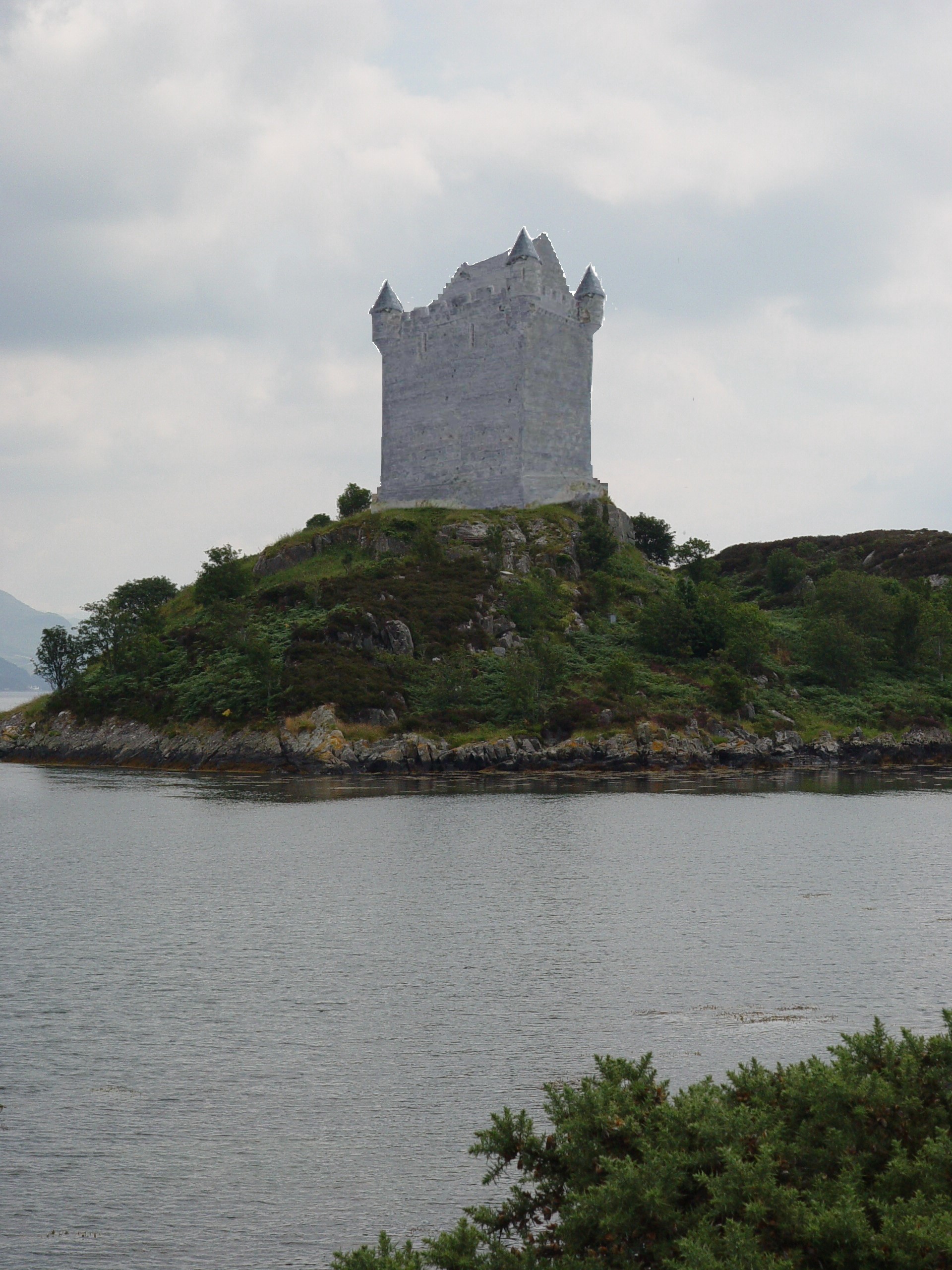
- Caisteal Maol
-
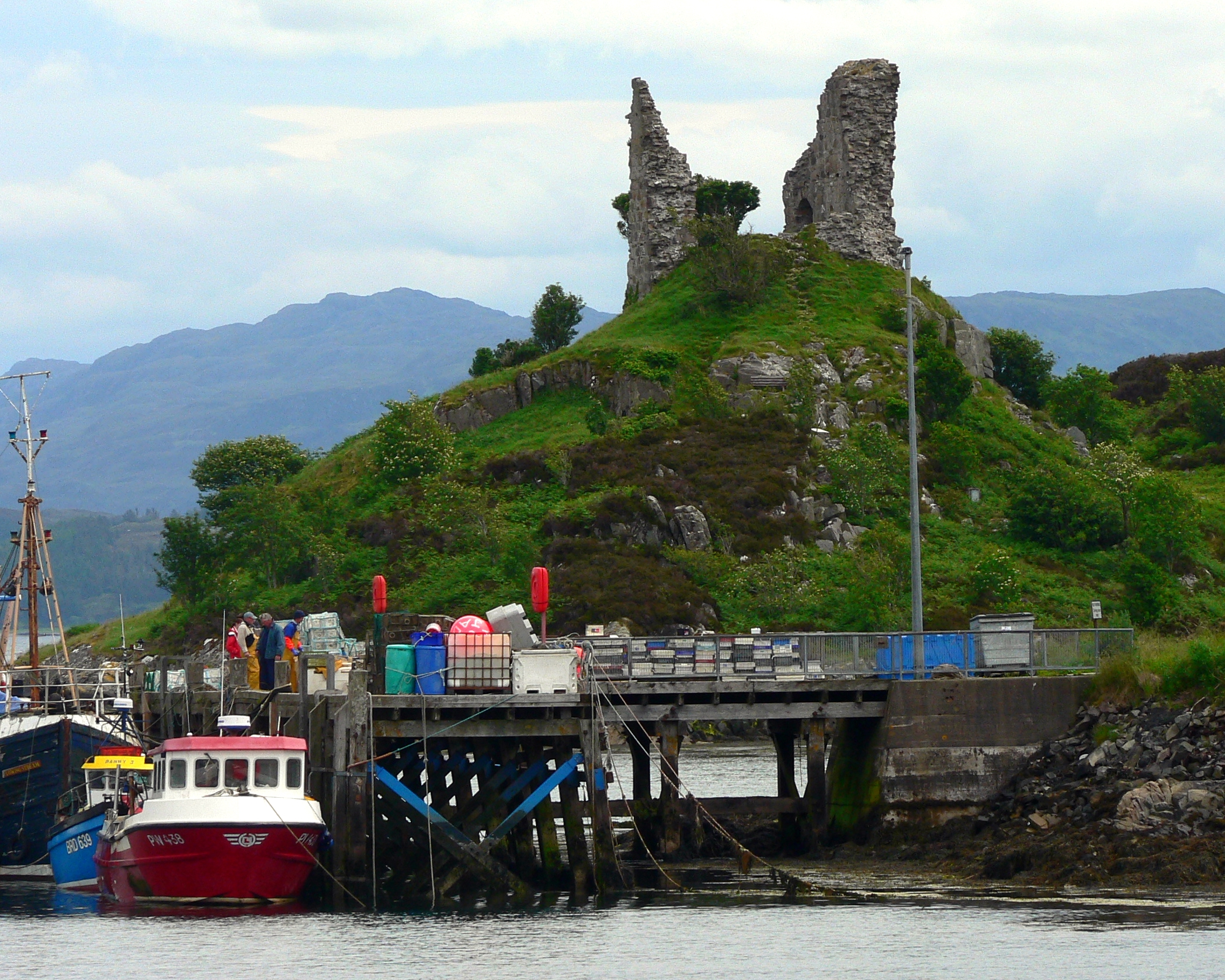
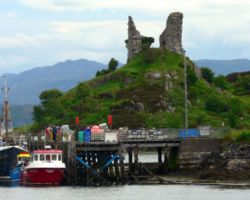 Caisteal Maol ruin
Caisteal Maol (Gaelic: Caisteal, 'Castle', Moal, 'bare') is a ruined castle located near the harbour of the village of Kyleakin, Isle of Skye, Scotland. It is also known as Castle Moil, Castle Moal, Dun Akyn, Dunakin Castle[1] Dun Haakon and Castle Dunakin[2].
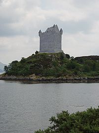 Recreation of the 16th century exterior
Contents
History
The castle, an ancient seat of the Mackinnon clan, was a fortress commanding the strait of Kyle Akin between Skye and the mainland, through which all ships had to pass or else attempt the stormy passage of The Minch. The present building dates back to the 15th century, but is traditionally reputed to be of much earlier origin.
According to that tradition, Alpín mac Echdach's great-grandson Findanus, the 4th MacKinnon chief, brought Dunakin into the clan around the year 900 by marrying a Norse princess nicknamed 'Saucy Mary'. Findanus and his bride ran a heavy chain across the sound and levied a toll on all shipping vessels.[3] The Princess lies buried on Beinn na Caillich on Skye, her face reputedly turned towards Norway.
Whatever the veracity of the castle's traditional history, there is good reason for supposing the existence of a connection of some kind with Norway. King Haakon IV is thought to have assembled his fleet of longships there before the Battle of Largs in 1263 (hence the name Kyleakin - Haakon's kyle). Haakon's defeat there effectively ended Norse domination of the islands.[4] Mediaeval and early modern documents also refer to the castle itself as Dunakin (Dun-Haakon), which is again strongly suggestive of a Norse connection.
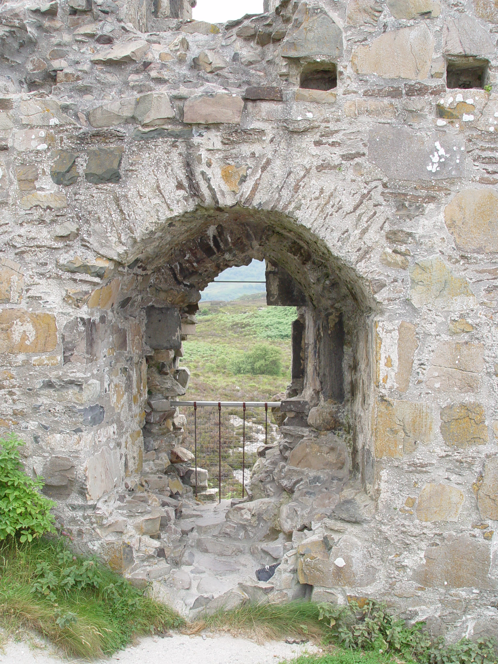
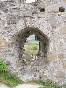 Interior view of the large window on the first level. The thickness of the walls is very apparent.
The present structure is of late 15th or early 16th century construction. This is supported by historical documents and carbon dating. In 1513, a meeting of chiefs was held here and they agreed to support Donald MacDonald as Lord of the Isles. The last occupant of the castle was Neill MacKinnon, nephew of 26th chief of the clan (c. 1601).[5].
Description
The castle occupies a headland above the village of Kyleakin facing the village of Kyle of Lochalsh across the strait. It is a simple rectangular keep of three stories. The unexplored basement level is filled with rubble and other debris and is believed to have contained the kitchen. The visitor today enters on the main level where the public dining space would have been. Stairs would have led up to the private apartments above.[5]
The castle is nearly completely ruined. In 1949 and 1989 parts of the ruins broke away in storms. The remaining ruins have been secured to prevent further deterioration.[6] No excavation of the ruins has been carried out, or is planned.
References
- ^ "Castle Moil, Kyleakin". UK Attraction. http://www.ukattraction.com/western-isles/castle-moil.htm. Retrieved 2008-08-21.
- ^ John D. Keyser. "Clan MacKinnon". http://www.ensignmessage.com/archives/highlanders2.html. Retrieved 2008-08-21.
- ^ The Genealogy of the Clan MacKinnon from Clan documents
- ^ "History of Kyle Akin". kyleakin.com. http://www.btinternet.com/~kyleakin/history/history.htm. Retrieved 2008-08-21.
- ^ a b On site informational sign from the Skye & Lochalsh District Council's Museums Service
- ^ "Caisteal Maol". Chatelaine's Scottish Castles. http://www.castles.org/Chatelaine/MAOL.HTM. Retrieved 2008-08-21.
Sources
Miket and Roberts, The Mediaeval Castles of Skye and Lochalsh (2nd edition, Birlinn Ltd, 2007)
External links
Coordinates: 57°16′19″N 5°43′15″W / 57.27194°N 5.72083°W
Skye / An t-Eilean Sgitheanach Main settlements Crofting townships
and settlementsAchachork · Aird of Sleat · Ardvasar · Armadale · Ashaig · Bernisdale · Bornesketaig · Boreraig · Borreraig · Borrodale · Borve · Bracadale · Breakish · Brogaig · Bualintur · Camastianavaig · Camuscross · Carbost, Loch Harport · Carbost, Portree · Claigan · Colbost · Drumfearn · Drynoch · Dunan · Duntulm · Edinbane · Elgol · Ellishadder · Eynort · Eyre · Fasach · Feorlig · Ferindonald · Fiskavaig · Flashader · Flodigarry · Galltrigill · Garafad · Geary · Gedintailor · Gillen · Glendale · Halistra · Harlosh · Heaste · Isleornsay · Kensaleyre · Kilbride · Kilmarie · Kilmore · Kilmuir · Kilvaxter · Kingsburgh · Kylerhea · Lealt · Lower Breakish · Luib · Milovaig · Ollach · Ose · Peinachorran · Portnalong · Ramasaig · Roag · Sconser · Skeabost · Sligachan · Staffin · Stein · Struan · Suladale · Talisker · Tarskavaig · Teangue · Torrin · Totaig · Tote · Treaslane · Trumpan · Uigshader · Ullinish · Upper BreakishMountains and hills Am Basteir · Beinn na Caillich · Blà Bheinn · Bruach na Frìthe · Clach Glas · Glamaig · Healabhal Bheag · Sgurr a' Ghreadaidh · Sgurr a' Mhadaidh · Sgurr Mhic Choinnich · Sgurr na Banachdich · Sgurr nan Gillean · Sgurr Dearg · Marsco · Quiraing/Meall na Suiramach · Sgurr Alasdair · The StorrHistory Armadale Castle · Battle of the Braes · Battle of the Spoiling Dyke · Caisteal Maol · Corriechatachan · Dùn Ringill · Dunvegan Castle · Fairy Flag · Flora MacDonald · Sir Rory Mor's Horn · Rubha an DùnainLocal culture Peninsulas Surrounding islands Ascrib Islands · Crowlin Islands · Eilean Bàn · Eilean Fladday · Eilean Mòr · Eilean Tigh · Eilean Trodday · Fladda-chùain · Harlosh Island · Isay · Lampay · Longay · Mingay · Oronsay · Pabay · Raasay · Scalpay · Rona · Soay · Staffin Island · Tarner Island · WiayCategories:- Skye
- Castles in Highland (council area)
- Category A listed buildings in Scotland
Wikimedia Foundation. 2010.