- Mejia Thermal Power Station
-
Mejia
Thermal Power StationLocation of Mejia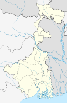

Thermal Power StationCountry India Location Durluvpur, Mejia, Bankura, West Bengal Coordinates 23°27′37″N 87°08′05″E / 23.46028°N 87.13472°ECoordinates: 23°27′37″N 87°08′05″E / 23.46028°N 87.13472°E Status Operational Commission date 1996 Owner(s) DVC Power station information Primary fuel coal-fired Generation units 4×220 MW(Unit 1-4) 2×250 MW (Unit 5 & 6)
2×500 MW (Unit 7 & 8)Power generation information Installed capacity 2430 MW Website
http://www.dvcindia.org/Mejia Thermal Power Station is located at 35 km from Durgapur city in West Bengal. The power plant is one of the coal based power plants of DVC. Commissioned on 1996, MTPS is the largest thermal power plant, in terms of generating capacity in the state of West Bengal as well as among other DVC power plants.
Power Plant
Mejia Thermal Power Station has an installed capacity of 2340 MW. The plant has 8 units under operation.[1]. The individual units has the generating capacity as follows:
Unit No. Generating Capacity Commissioned on U#1 220 MW 1996 U#2 220 MW 1998 U#3 220 MW 1999 U#4 220 MW 2005 U#5 250 MW 2008 U#6 250 MW 2009 U#7 500 MW 2010 U#8 500 MW 2010 Units 1 through 6 are collectively named MTPS- A, while the extension work of 2×500 MW Units 7 & 8 are called MTPS-B. All the units have BHEL make boilers, turbines and generators installed in them.
See also
- Chandrapura Thermal Power Station
- Bokaro Thermal Power Station B
- Durgapur Thermal Power Station
References
- ^ "Mejia Thermal Power Station". Damodar Valley Corporation.. http://www.dvcindia.org/Mejia.htm.
Electricity generation Concepts Availability factor · Baseload · Black start · Capacity factor · Demand factor · Demand management · EROEI · Grid storage · Intermittency · Load following · Nameplate capacity · Peak demand · Repowering · Spark spreadSources Technology Distribution Policies Carbon offset · Coal phase out · Ecotax · Energy subsidies · Feed-in tariff · Net metering · Pigovian tax · Renewable Energy Certificates · Renewable energy payments · Renewable energy policyCategories: Electric power distribution · Electricity economics · Power station technology · Portals: Energy · Sustainable development Power stations & organizations of West Bengal Power Plants Bakreshwar Thermal Power Station • Bandel Thermal Power Station • Durgapur Thermal Power Station • Farakka Super Thermal Power Station • Kolaghat Thermal Power Station • Mejia Thermal Power Station • Sagardighi Thermal Power Station • Santaldih Thermal Power StationOrganizations CESC Limited • Damodar Valley Corporation • National Thermal Power Corporation • West Bengal Power Development Corporation Limited • West Bengal State Electricity Board • West Bengal State Electricity Transmission CompanyBankura district topics General Bankura horse • Bargi • Bhadu • Bishnupur Gharana • Culture of Bankura district • Dharmathakur • Gajan • Geography of Bankura district • History of Bankura district • Jainism in Bengal • Kangsabati Project • Mejia Thermal Power Station • Piardoba AirfieldPeople Subdivisions Bankura Sadar • Bishnupur • KhatraTerritories Bardhamanbhukti • Dandabhukti • Dhalbhum • Jungle Mahals • Mallabhum • Rarh region • Samantabhum • TungbhumLocations
other than cities and townsBahulara • Dharapat • Dihar • Ekteswar • Harmasra • Jayrambati • Jhilimili • Mukutmanipur • Panchmura • Pakhanna • SonatapalMunicipalities Community development blocks Rivers Hills Transport Institutes of higher learning Lok Sabha constituencies Bankura • BishnupurVidhan Sabha constituencies Former Vidhan Sabha
constituenciesGangajalghati • IndpurSee also Cities and towns in Bankura district • People from Bankura district • Villages in Bankura district • Damodar ValleyOther districts Bardhaman • Birbhum • Cooch Behar • Dakshin Dinajpur • Darjeeling • Hooghly · Howrah • Jalpaiguri • Kolkata • Malda • Murshidabad • Nadia • North 24 Parganas • Paschim Medinipur • Purba Medinipur • Purulia • South 24 Parganas • Uttar DinajpurDamodar Basin Rivers Dams, barrages Geographical features Riparian districts Palamu • Hazaribagh • Koderma • Giridih • Ramgarh • Bokaro • Dhanbad • Purulia • Bardhaman • Bankura • Hooghly • Howrah • Paschim Medinipur • Purba MedinipurLanguages Coalfields South Karanpura Coalfield • North Karanpura Coalfield • Ramgarh Coalfield • West Bokaro Coalfield • East Bokaro Coalfield • Raniganj CoalfieldIndustries Bokaro Steel Plant • IISCO • Durgapur Steel Plant • Bokaro Thermal Power Station B • Santaldih Thermal Power Station • Durgapur Thermal Power Station • Mejia Thermal Power StationTransport Categories:- Coal-fired power stations in West Bengal

Wikimedia Foundation. 2010.