- Mundeswari River
-
Mundeswari River River Country India State West Bengal Source Damodar River 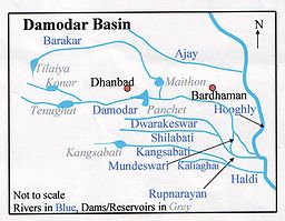
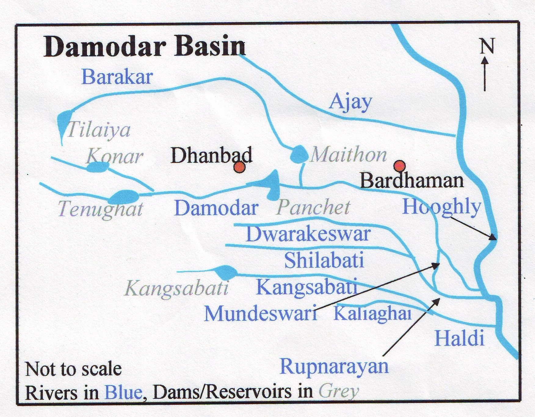
Mundeswari river is a small river in West Bengal which causes floods in Hooghly, Purba Medinipur and Howrah districts during the monsoons. Any discharge above 70,000 ft³/s downstream of Durgapur Barrage may cause flooding depending on the outfall condition of the Mundeswari at Harinkhola.[1] It has been suggested that the banks of rivers such as Mundeswari should be protected with embankments to prevent floods.[2]
Contents
History
The river is not mentioned in the 1910 district gazetteers, but it is mentioned in the 1994 Bardhaman District gazetteer.[3]
During the devastating floods of 1914, the Damodar River split in two. One part joined the Mundeswari and the main channel of water of the Damodar now flows into the Mundeswari, turning it into a major river.[3]
Geography
It originates as a canal from Srirampur, a village in Madabdihi at the police station in Raina II block of the Bardhaman district. It flows past Kaiti Chakbhura and enters the Hooghly District. It ultimately flows into the Rupnarayan River.[3]
References
- ^ "Flood management". Irrigation & Waterways Dept., Govt. of West Bengal. http://www.dvlp.com/temp/water_irrigation/flood_mgmt/index2.htm. Retrieved 2007-02-19.
- ^ Asim Roy, Basudeb Day. "Damodar Valley Project: Success and Failures, Myths and Reality". Documents and submissions. The World Commission of Dams. http://www.dams.org/kbase/submissions/showsub.php?rec=SOC003. Retrieved 2007-02-19.
- ^ a b c Chattopadhyay, Akkori, Bardhaman Jelar Itihas O Lok Sanskriti (History and Folk lore of Bardhaman District.), (Bengali), Vol I, p 33, Radical Impression. ISBN 81-85459-36-3
External links
See also
Rivers in and around Bengal Southeast Bangladesh Assam / Meghalaya /
TripuraBarak · Brahmaputra · Feni · Kangsha · Kushiyara · Manu · Meghna · Muhuri · Someshwari · Surma · Surma-Meghna · Titas / Haora · Gumti · KhowaiNorthern Bangladesh
North BengalAtrai · Balason · Bangali · Baral · Dharla · Dhepa · Gumani · Jaldhaka · Karatoya · Khong Khola · Mahananda · Mechi · Punarbhaba · Raidak or Wong Chhu · Rangeet · Tangon · Teesta · Torsa/Machu/Amo ChhuCentral Bangladesh Bangshi · Buriganga · Dhaleshwari · Gorai-Madhumati · Jamuna · Louhajang · Padma · Shitalakhya · TuragChotanagpur Ajay · Bakreshwar · Bansloi · Barakar · Brahmani · Damodar · Dwarka · Dwarakeswar · Gandheswari · Haldi · Hinglo · Kangsabati · Keleghai · Kopai · Kosai · Kunur · Mayurakshi · Mundeswari · Rasulpur · Rupnarayan · Sali · Shilabati · SubarnarekhaSouth Bengal
Ganges DeltaAdi Ganga · Baleshwar · Bidyadhari · Bura Gauranga · Churni · Gosaba · Hariabhanga · Hooghly · Ichamati · Jalangi · Kalindi · Matla · Muri Ganga · Pasur · Piyali · Raimangal · Saptamukhi · Saraswati · ThakuranRelated topics Beel · Country boats in Bangladesh · Chalan Beel · Ganges · Haor · Haors in Bangladesh · List of rivers of Bangladesh · of India · Waters of South Asia · Damodar Valley CorporationHydrology of surrounding areas Orissa • Jharkhand • Bihar • Nepal • Sikkim • Bhutan • North-east IndiaCategories:- Rivers of West Bengal
Wikimedia Foundation. 2010.