- Kangsabati River
Geobox River
name = Kangsabati River
native_name =
other_name =
other_name1 =
_river.jpg)
image_size =
image_caption = Kangsabati River nearMidnapore town
etymology =
country = India
country1 =
state = West Bengal
state1 =
region =
region1 =
district =
district1 =
city = Midnapore
city1 =
city2 =
landmark =
landmark1 =
landmark 2 =
length =
watershed =
discharge_location = Haldi River
discharge =
discharge_max =
discharge_min =
discharge1_location =
discharge1 =
source_name =
source_location = Jhalda
source_district =Purulia district
source_region = Chota Nagpur Plateau
source_state = West Bengal
source_country =
source_lat_d =
source_lat_m =
source_lat_s =
source_lat_NS =
source_long_d =
source_long_m =
source_long_s =
source_long_EW =
source_elevation =
source_length =
mouth_name =
mouth_location =
mouth_district =
mouth_region =
mouth_state =
mouth_country =
mouth_lat_d =
mouth_lat_m =
mouth_lat_s =
mouth_lat_NS =
mouth_long_d =
mouth_long_m =
mouth_long_s =
mouth_long_EW =
mouth_elevation =
tributary_left =
tributary_left1 =
tributary_right =
tributary_right1 =
free_name =
free_value =
map_size =
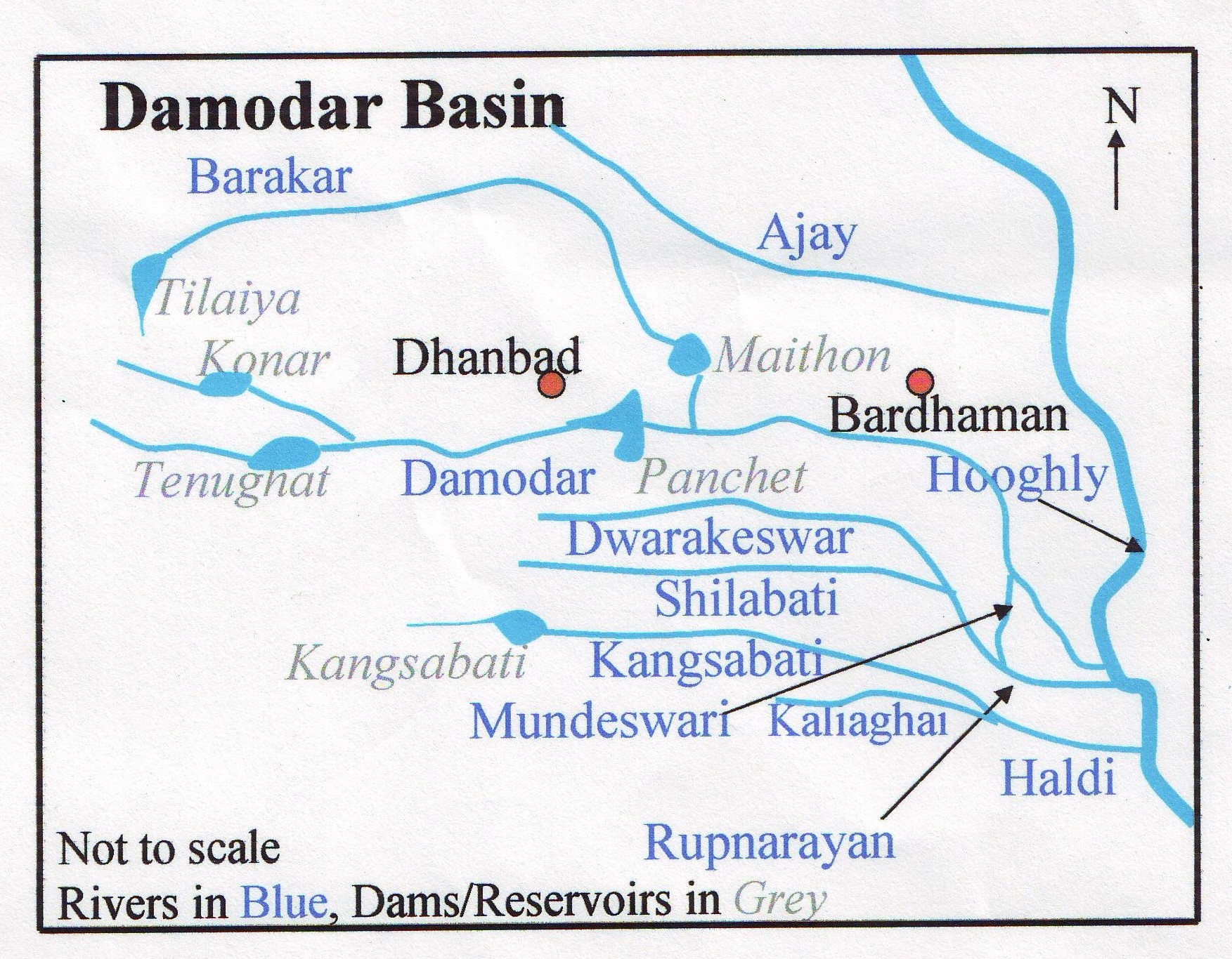
map_caption =The Kangsabati River system (also variously known as the Kasai and Cossye, and not to be confused with the
Kasai River inAfrica ), rises from theChota Nagpur plateau in the state ofJharkhand ,India and passes through the districts ofPurulia ,Bankura andPaschim Medinipur inWest Bengal before draining in theBay of Bengal .After rising near
Jhalda in the Chota Nagpur plateau inPurulia district , it passes byKhatra andRanibandh inBankura district , and then enters Paschim Medinipur in the Binpur area. It is joined by Bhairabbanki. At Keshpur the river splits into two. The northern branch flows through the Daspur area as Palarpai and joins theRupnarayan River . The other branch f;ows in a south-easterly direction and on joining the Kaliaghai River forms the Haldi River, which flows in to theHooghly River atHaldia . [Bandopadhyay, Dilip Kumar, "Bharater Nodi", p.68, Bharati Book Stall, 93 Mahatma Gandhi Road, Kolkata 700 997]Mukutmanipur ,Midnapore , andKharagpur are towns on or near the banks of this river.Kangsabati Project
The
Kangsabati Project was started in 1956 as part of the Indian Second Five-year Plan to provide water to 3,484.77 km² of land in the districts of Paschim Medinipur,Purba Medinipur , Bankura, and Hooghly. [ [http://www.dvlp.com/temp/water_irrigation/irrigation_sector/major/kangsabati.htm Irrigation & Waterways Dept - Irrigation Sector - Major Irrigation Projects - Kangasbati ] ] It involves irrigation land using water from the Kangsabati River, as well as the Shilabati and the Bhoirobbanki rivers.As part of the Project, a 38 m high and 10,098 m long
dam was constructed atKhatra . A anicut dam built on the Kangsabati River nearMidnapore in 1872 was also added to the operations of the project. [ [http://www.abasar.net/bk_main.asp?what=B00053 Bharatkosh ] ]References
ee also
Wikimedia Foundation. 2010.