- Manassas Air Force Station
-
Manassas Air Force Station 
Part of Air Defense Command (ADC) Type Air Force Station Coordinates 38°37′40″N 077°26′18″W / 38.62778°N 77.43833°W Built 1952 In use 1952-1965 Controlled by  United States Air Force
Garrison 647th Aircraft Control and Warning (later Radar) Squadron 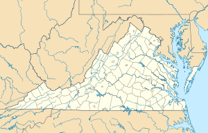
 Manassas AFSLocation of Manassas AFS, Virginia
Manassas Air Force Station (ADC ID: P-55 NORAD ID: Z-55) is a closed United States Air Force General Surveillance Radar station. It is located 7.4 miles (11.9 km) west of Dale City, Virginia. It was closed in 1965.
Contents
History
Manassas AFS was established as one of twenty-eight stations built as part of the second segment of the permanent Air Defense Command radar network. Prompted by the start of the Korean War, on July 11, 1950, the Secretary of the Air Force asked the Secretary of Defense for approval to expedite construction of the second segment of the permanent network. Receiving the Defense Secretary’s approval on July 21, the Air Force directed the Corps of Engineers to proceed with construction.
The 647th Aircraft Control and Warning Squadron began operating AN/FPS-3 and AN/CPS-4 radars at what was initially designated Quantico AFS in March 1952, due to it being situated at the northeast corner of the Quantico Marine Corps Base. It assumed coverage from the temporary "Lashup" site L-14 at Fort Meade, Maryland in 1955, and initially the station functioned as a Ground-Control Intercept (GCI) and warning station. As a GCI station, the squadron's role was to guide interceptor aircraft toward unidentified intruders picked up on the unit's radar scopes. The AN/FPS-3 remained active until 1962. In July 1957, the name of the station was officially changed to Manassas Air Force Station.
In 1958 AN/FPS-6A and AN/FPS-6B radars took over height-finder chores. During 1959 Manassas AFS joined the Semi Automatic Ground Environment (SAGE) system, initially feeding data to DC-04 at Fort Lee AFS, Virginia. After joining, the squadron was re-designated as the 647th Radar Squadron (SAGE) on 1 October 1959. The radar squadron provided information 24/7 the SAGE Direction Center where it was analyzed to determine range, direction altitude speed and whether or not aircraft were friendly or hostile.
Manassas AFS was upgraded to an AN/FPS-35 radar in 1961, but problems prevented operations. It became operational in 1962, and was tested to determine if it could detect missile launchings. The radar detected Polaris and Minuteman missile launches from Cape Canaveral on June 28, 1962. Additional tests revealed the AN/FPS-35 radar had marginal value for missile detection. The AN/FPS-3 was then retired. In 1963 an AN/FPS-26A replaced the AN/FPS-6A height-finder radar. On 31 July 1963, the site was redesignated as NORAD ID Z-55.
In addition to the main facility, Manassas operated several unmanned AN/FPS-14 Gap Filler sites
- Hermanville, MD (P-55B): 38°13′40″N 076°24′33″W / 38.22778°N 76.40917°W
- When Manassas AFS closed, the site became an annex of Fort Meade, MD and was redesignated "RP-54A".
- Hanover, PA (RP-55D): 39°51′28″N 076°56′52″W / 39.85778°N 76.94778°W
- Reassigned to Fort Meade, MD in December, 1960 and was redesignated "RP-54B".
- Thomas, WV (P-55F): 39°08′50″N 079°34′16″W / 39.14722°N 79.57111°W
- When Manassas AFS closed, the site became an annex of Oakdale AI, PA and was redesignated "RP-62G".
The site was removed from service on 25 June 1965. Reportedly, the FPS-35 radar sail was then sent to Fortuna AFS, North Dakota, to replace the one there which had been destroyed in a fierce wind storm a year earlier. The Manassas GATR site at Independent Hill, VA 38°37′35″N 077°27′20″W / 38.62639°N 77.45556°W was retained as site R-20 and manned by the 770th AC&W Squadron, Operating Location "A", and continued in operation until 1976.
Today, the former Manassas Air Force Station is an administrative and logistics center for the Prince William County School District. The area remains fenced and many of the former Air Force buildings are in use, along with the housing area. The large AN/FPS-35 search radar tower remains, as well as the foundations for the other towers, although the towers themselves were removed several years ago.
Air Force units and assignments
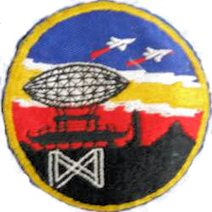
 Emblem of the 647th Radar Squadron
Units:
- 647th Aircraft Control and Warning Squadron, Assigned 1 April 1952 to Quantico AFS, VA
-
- Squadron was activated 1 January 1950 at Gravelly Point, Arlington, VA (not manned or equipped)
- Squadron was reassigned to Fort George G. Meade, MD, 1 January 1951 (not manned or equipped)
- Station re-designated Manassas AFS, VA, 1 July 1957
- Re-designated as 647th Radar Squadron (SAGE), 1 October 1959
- Discontinued 25 June 1965.
Assignments:
- 503d Aircraft Control and Warning Group, 1 January 1950
- 26th Air Division, 6 February 1952
- 4710th Defense Wing, 16 February 1953
- 85th Air Division, 1 March 1956
- Washington Air Defense Sector, 1 September 1958-25 June 1965
See also
- List of USAF Aerospace Defense Command General Surveillance Radar Stations
References
 This article incorporates public domain material from websites or documents of the Air Force Historical Research Agency.
- Winkler, David F. (1997), Searching the skies: the legacy of the United States Cold War defense radar program. Prepared for United States Air Force Headquarters Air Combat Command.
- A Handbook of Aerospace Defense Organization 1946 - 1980, by Lloyd H. Cornett and Mildred W. Johnson, Office of History, Aerospace Defense Center, Peterson Air Force Base, Colorado
- Information for Manassas AFS, VA
External links
Bases CONUSAdair · Beale · Bong (unbuilt) · Charleston · Davis-Monthan · Dobbins · Dover · Dow · Duluth · England · Ent · Ethan Allen · Fairfax · Fort Lee · Geiger · George · Glasgow · Grand Forks · Grenier · Griffiss · Gunter · Hamilton · Hancock · Homestead · Hurlburt · Imeson · K.I. Sawyer · Kincheloe · Kingsley · Kirtland · Larson · Luke · March · Malmstrom · McCoy · McChord · McClellan · McGhee Tyson · McGuire · Minneapolis-St. Paul · Minot · Mitchel · New Castle · Niagara Falls · Norton · O'Hare · Oklahoma City · Otis · Oxnard · Paine · Perrin · Peterson · Pittsburgh · Pope · Portland · Presque Isle · Richards-Gebaur · Selfridge · Seymour Johnson · Sioux City · Snelling · Stead · Stewart · Suffolk County · Tinker · Travis · Truax · Tyndall · Vandenburg · Webb · Westover · Willow Run · Wright-Patterson · Wurtsmith · Youngstown
OverseasErnest Harmon · Frobisher Bay · Goose Bay · Keflavik · Pepperrell · Thule · Topsham

Stations CONUSAlmaden · Charleston · Clear · Cross City · Benton · Empire · Mill Valley · Montauk · Mount Hebo · North Truro · Point Arena · Rye · Thomasville · Watertown
OverseasAlbrook
Air
Defense
unitsForcesAir
DivisionsSectorsAlbuquerque · Bangor · Boston · Chicago · Detroit · Duluth · Goose · Grand Forks · Great Falls · Iceland · Kansas City · Los Angeles · Minot · Montgomery · New York · Oklahoma City · Phoenix · Portland · Reno · Sault Sainte Marie · San Francisco · Seattle · Sioux City · Spokane · Stewart · Syracuse · Washington
WingsGroups1st · 4th · 10th · 14th · 15th · 23rd · 32nd · 33rd · 50th · 52nd · 53rd · 54th · 56th · 57th · 73rd · 78th · 79th · 81st · 82nd · 84th · 325th · 326th · 327th · 328th · 329th · 337th · 355th · 408th · 412th · 414th · 473rd · 475th · 476th · 478th · 500th · 501st · 502d · 503d · 507th · 514th · 515th · 516th · 517th · 518th · 519th · 520th · 521st · 525th · 527th · 528th · 529th · 530th · 533d · 534th · 564th · 566th · 567th · 568th · 575th · 678th · 701st · 4676th · 4700th · 4721st · 4722d · 4727th · 4728th · 4729th · 4730th · 4731st · 4732d · 4733d · 4734th · 4735th · 4756th
SquadronsAerospace Defense Command Fighter Squadrons · Aircraft Control and Warning Squadrons
Major
weapon
systemsElectronicFightersMissiles1 · 2 · 3 · 4 · 5
ShipsGuardian · Interceptor · Interdictor · Interpreter · Investigator · Locator · Lookout · Outpost · Pickett · Protector · Scanner · Searcher · Skywatcher · Tracer · Watchman · Vigil
Miscellaneous Air Defense Command Emblem Gallery (On Wikimedia Commons) · General Surveillance Radar StationsCategories:- SAGE sites
- Radar stations of the United States Air Force
- Closed facilities of the United States Air Force
- Military facilities in Virginia
- Aerospace Defense Command
- Stations of the United States Air Force

Wikimedia Foundation. 2010.