- Dale City, Virginia
-
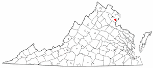
Dale City, Virginia — CDP — Motto: The friendliest little city around Location of Dale City, Virginia
Coordinates: 38°38′54″N 77°20′32″W / 38.64833°N 77.34222°WCoordinates: 38°38′54″N 77°20′32″W / 38.64833°N 77.34222°W Country United States State Virginia County Prince William Area - Total 15.0 sq mi (39.0 km2) - Land 15.0 sq mi (39.0 km2) - Water 0.0 sq mi (0.0 km2) Elevation 230 ft (70 m) Population (2006) - Total 63,616 - Density 4,241.1/sq mi (1,631.2/km2) Time zone Eastern (EST) (UTC-5) - Summer (DST) EDT (UTC-4) ZIP code 22193 Area code(s) 571, 703 FIPS code 51-21088[1] GNIS feature ID 1496866[2] Dale City is an unincorporated community in Prince William County, Virginia, United States. Recognized by the U.S. Census Bureau as a census designated place (CDP), the community had a total population of 63,616 according to the 2006 American Community Survey.
Contents
History
Dale City was the idea of a real estate developer Cecil Don Hylton. Many myths surround Hylton and his choice of names for the community. Many erroneously believe Hylton's middle name was "Dale". He actually chose the term because it aptly describes the "hills and dales" of the rolling Virginia Piedmont, where he developed the community. His company, Hylton Enterprises, began Dale City approximately 1 mile east of Interstate 95 and continued to build west towards Hoadly Rd (State Route 642).
Several places in Dale City are named after Hylton, such as C.D. Hylton High School and the Hylton Memorial Chapel. More recently, the Hylton Foundation underwrote a major new addition to Potomac Hospital in nearby Woodbridge, Virginia. As Dale City is nearing completion, Hylton companies have branched into new markets, especially real estate of existing houses. Hylton Realty now sells property in and near Dale City. Hylton Enterprise Inc manages some retail property and owns oddly shaped parcels throughout Dale City. These parcels were land that could not be built on or were proffered to the county. Andrew Leitch Park is one such parcel that has been given to the local Park Authority. Some residential construction does continue in the area by The Hylton Group.
Hylton began his career as a "huckster", a young man who sold farm goods and produce at the farmers' market in Washington, DC. He later began a sod business after several requests from his regular clients. He ran several dozen trucks and pioneered new technologies in the industry.
After the post-war housing boom, he moved into homebuilding. Throughout his career, he constructed apartments, commercial shopping centers, and over 22,000 homes. Along the way, he began his own sewer company, Dale Service Corp, Inc. (now Virginia American Water), as well as the first cable television companies in Prince William County.
Russell House and Store is a historic early 19th century group of buildings.
Communities
Each of the communities (often referred to as neighborhoods) ends in 'dale'. The streets along Dale Boulevard (generally) proceed alphabetically when followed from East to West starting from Gideon Blvd. and ending at Hoadly Rd.: Ashdale, Birchdale, Barksdale, Cherrydale, Cloverdale, Darbydale, Evansdale, Forestdale, Glendale, Hillendale, (I and J were skipped), Kerrydale, Kirkdale, Lindendale, Mapledale, Nottingdale, Oakdale, Princedale, Queensdale, Ridgedale, Silverdale, and Trentdale. Most street names in each neighborhood begin with the first letter of the neighborhood.
Attractions and culture
Dale City is near Potomac Mills Mall, the second largest shopping mall in Northern Virginia, and the largest outlet mall in the United States.
Across from the Nottingdale and next to the Mapledale communities is Andrew Leitch Park. This neighborhood park is home to Waterworks Waterpark. Some of the features at the water park include a beach pool entry, enclosed speed slide, circular open slide, three jungle walks, baby pool, beach volleyball, shade pavilions, and full-service concessions.
Geography
Dale City is located at 38°38′54″N 77°20′32″W / 38.64833°N 77.34222°W (38.648284, -77.342350)[3].
According to the United States Census Bureau, the CDP has a total area of 15.0 square miles (39.0 km²), all of it land.
Demographics
According to the U.S. census[1] American Community Survey of 2006, there were 63,616 people, 20,866 households, and 17,072 families residing in the CDP. The population density was 4,241.1 people per square mile (1,631.2/km²). There were 22,054 housing units at an average density of 1,470.3/sq mi (535/km²). The racial makeup of the CDP was 43.4% White, 21.06% African American, 0.2% Native American, 11.22% Asian, 0.45% Pacific Islander, 19.12% from other races, and 4.55% from two or more races. Hispanic or Latino of any race were 29.28% of the population. In addition, 31.3% of Dale City's population is foreign born.
There were 20,866 households out of which 47.8% had children under the age of 18 living with them, 58.7% were married couples living together, 16.3% had a female householder with no husband present, and 18.2% were non-families. 13.6% of all households were made up of individuals and 1.7% had someone living alone who was 65 years of age or older. The average household size was 3.05 and the average family size was 3.23.
In the CDP the population was spread out with 29.1% under the age of 18 and 4.1% who were 65 years of age or older. The median age was 31 years. For every 100 females there were 99.3 males. For every 100 females age 18 and over, there were 97.6 males.
The median income for a household in the CDP was $71,179, and the median income for a family was $72,021 (these figures had risen to $79,075 and $80,382 respectively as of a 2007 estimate[4]). Males had a median income of $50,920 versus $43,389 for females. The per capita income for the CDP was $26,864. About 3.3% of families and 4.8% of the population were below the poverty line, including 5.2% of those under age 18 and 17.6% of those age 65 or over.
Economy
The Consulate-General of El Salvador in Woodbridge is located at 14572 Potomac Mills Road in the Dale City CDP.[5][6]
References
http://www.pwcparks.org/Recreation/WaterWorksWaterpark/Features/tabid/187/Default.aspx
- ^ a b "American FactFinder". United States Census Bureau. http://factfinder.census.gov. Retrieved 2008-01-31.
- ^ "US Board on Geographic Names". United States Geological Survey. 2007-10-25. http://geonames.usgs.gov. Retrieved 2008-01-31.
- ^ "US Gazetteer files: 2010, 2000, and 1990". United States Census Bureau. 2011-02-12. http://www.census.gov/geo/www/gazetteer/gazette.html. Retrieved 2011-04-23.
- ^ http://factfinder.census.gov/servlet/ACSSAFFFacts?_event=Search&geo_id=16000US4970850&_geoContext=01000US%7C04000US49%7C16000US4970850&_street=&_county=dale+city&_cityTown=dale+city&_state=04000US51&_zip=&_lang=en&_sse=on&ActiveGeoDiv=geoSelect&_useEV=&pctxt=fph&pgsl=160&_submenuId=factsheet_1&ds_name=ACS_2007_3YR_SAFF&_ci_nbr=null&qr_name=null®=null%3Anull&_keyword=&_industry=
- ^ "Norte América." Consulate-General of El Salvador in Miami. Retrieved on February 1, 2009.
- ^ "Dale City CDP." United States Census Bureau. Retrieved on February 1, 2009.
External links
- Centerpoint Church Dale City Virginia
- Prince William County Government
- Dale City Volunteer Fire Department
Northern Virginia · Washington Metropolitan Area Administration Prince William Board of County Supervisors · Prince William County Public Schools · Prince William County Park Authority · Prince William County Service Authority · Prince William County Public Library · Prince William County Department of Fire and Rescue · Prince William County Police Department · Prince William County Sheriff's OfficeOrganizations Prince William Chamber of Commerce · Prince William Symphony OrchestraLandmarks National Museum of the Marine Corps · Marine Corps Base Quantico · Hylton Performing Arts Center · Manassas National Battlefield Park · Jiffy Lube Live · Old Dominion Speedway · Prince William Forest Park · Leesylvania State Park · Potomac MillsTransportation Culture BattlesEventsDale City 4th of July ParadeEducation Municipalities and communities of Prince William County, Virginia County seat: Manassas Towns 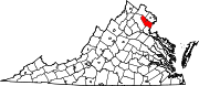
CDPs Buckhall | Bull Run | Bull Run Mountain Estates | Cherry Hill | County Center | Dale City | Gainesville | Independent Hill | Lake Ridge | Linton Hall | Loch Lomond | Marumsco | Montclair | Neabsco | Nokesville | Potomac Mills | Quantico Station‡ | Sudley | Triangle | West Gate | Woodbridge | Yorkshire
Unincorporated
communitiesAden | Agnewville | Antioch | Batestown | Bethel | Brentsville | Bristow | Buckland | Canova | Catharpin | Cornwell | Featherstone | Greenwich | Groveton | Hickory Ridge | Hoadly | Joplin | Kopp | Minnieville | Rixlew | Southbridge | Sudley Springs | Thoroughfare | Wellington
Footnotes ‡This populated place also has portions in an adjacent county or counties
Categories:- Unincorporated communities in Virginia
- Populated places in Prince William County, Virginia
- Census-designated places in Virginia
- Baltimore–Washington metropolitan area

Wikimedia Foundation. 2010.