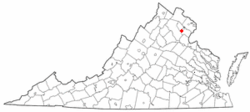
- Nokesville, Virginia
-
Nokesville, Virginia — CDP — Nickname(s): " Old Prince William" Location of Nokesville, Virginia Coordinates: 38°41′54″N 77°34′25″W / 38.69833°N 77.57361°WCoordinates: 38°41′54″N 77°34′25″W / 38.69833°N 77.57361°W Country United States State Virginia County Prince William Area – Total 9.5 sq mi (24.5 km2) – Land 9.5 sq mi (24.5 km2) – Water 0.0 sq mi (0.0 km2) Elevation 266 ft (81 m) Population (2000) – Total 1,236 – Density 130.5/sq mi (50.4/km2) Time zone Eastern (EST) (UTC-5) – Summer (DST) EDT (UTC-4) ZIP codes 20181-20182 Area code(s) 571, 703 FIPS code 51-56464[1] GNIS feature ID 1497047[2] Website https://sites.google.com/site/nokesvillevirginia/ Nokesville is a census-designated place (CDP) in Prince William County, Virginia, United States. The population was 1,236 at the 2000 census.
Contents
History
Nokesville is the center of a farming community with cattle and dairy farms; it became a town and intermediate stop on the Orange & Alexandria Railway in 1865. In the late 19th century–early 20th century, Nokesville was the location of a religious movement called the German Baptist Brethren, which became known as the Church of the Brethren. In the 1950s, it was cut off from passenger trains and remains a rural community today.
Nokesville consists of two schools and one currently under construction. The oldest school, Nokesville Elementary was built in 1929 to serve all grades until 1964 when it was lowered to K-5 with the construction of Brentsville District High School. In 2009, Prince William County approved a new school facility to be built in the outskirts of Nokesville called "Patriot High" to serve the rapidly growing Bristow area. It will open in 2011.
Geography
Nokesville is located at 38°41′54″N 77°34′25″W / 38.69833°N 77.57361°W (38.698350, -77.573656)[3].
According to the United States Census Bureau, the CDP has a total area of 9.5 square miles (24.5 km²), all of it land.
Nokesville is touched by Bristow, VA to the north, Catlett, VA to the west, Aden and Independent Hill, VA to the south and Canova, VA to the east. Most of Nokesville mostly consists of farms and wooded lands with its "town proper" between Aden Road and Nokesville Road (SR 28) on Fitzwater Drive which consists of a 7-eleven, Pizza and Steak restaurants, tractor sales business, auto body and a flower shop. The town is located in Prince William County's "Rural Crescent" which states that all new homes in Nokesville must have at least 10 acres of land to protect the spread-out life style from developers in the rapidly growing Gainesville and Bristow area.
Demographics
As of the census[1] of 2000, there were 1,236 people, 439 households, and 363 families residing in the CDP. The population density was 130.5 people per square mile (50.4/km²). There were 462 housing units at an average density of 48.8/sq mi (18.8/km²). The racial makeup of the CDP was 94.09% White, 3.72% African American, 0.08% Native American, 0.49% Asian, 0.08% Pacific Islander, 0.16% from other races, and 1.38% from two or more races. Hispanic or Latino of any race were 1.70% of the population.
There were 439 households out of which 33.0% had children under the age of 18 living with them, 67.9% were married couples living together, 10.0% had a female householder with no husband present, and 17.1% were non-families. 14.4% of all households were made up of individuals and 5.2% had someone living alone who was 65 years of age or older. The average household size was 2.82 and the average family size was 3.09.
In the CDP the population was spread out with 26.1% under the age of 18, 7.1% from 18 to 24, 26.0% from 25 to 44, 29.8% from 45 to 64, and 11.1% who were 65 years of age or older. The median age was 41 years. For every 100 females there were 101.0 males. For every 100 females age 18 and over, there were 98.3 males.
The median income for a household in the CDP was $63,793, and the median income for a family was $68,611. Males had a median income of $41,875 versus $27,188 for females. The per capita income for the CDP was $24,765. None of the families and 0.8% of the population were living below the poverty line, including no under eighteens and 5.2% of those over 64.
References
- ^ a b "American FactFinder". United States Census Bureau. http://factfinder.census.gov. Retrieved 2008-01-31.
- ^ "US Board on Geographic Names". United States Geological Survey. 2007-10-25. http://geonames.usgs.gov. Retrieved 2008-01-31.
- ^ "US Gazetteer files: 2010, 2000, and 1990". United States Census Bureau. 2011-02-12. http://www.census.gov/geo/www/gazetteer/gazette.html. Retrieved 2011-04-23.
External links
- [http://sites.google.com/site/nokesvillevirginia/
- Official Website of Prince William County
- Prince William Conservation Alliance
- Nokesville Business Association
- Nokesville Civic Association
- Nokesville Volunteer Fire and Rescue Department
Municipalities and communities of Prince William County, Virginia Towns CDPs Buckhall | Bull Run | Bull Run Mountain Estates | Cherry Hill | County Center | Dale City | Gainesville | Independent Hill | Lake Ridge | Linton Hall | Loch Lomond | Marumsco | Montclair | Neabsco | Nokesville | Potomac Mills | Quantico Station‡ | Sudley | Triangle | West Gate | Woodbridge | Yorkshire
Unincorporated
communitiesAden | Agnewville | Antioch | Batestown | Bethel | Brentsville | Bristow | Buckland | Canova | Catharpin | Cornwell | Featherstone | Greenwich | Groveton | Hickory Ridge | Hoadly | Joplin | Kopp | Minnieville | Rixlew | Southbridge | Sudley Springs | Thoroughfare | Wellington
Footnotes ‡This populated place also has portions in an adjacent county or counties
Categories:- Census-designated places in Virginia
- Unincorporated communities in Virginia
- Populated places in Prince William County, Virginia
- Populated places established in 1865
Wikimedia Foundation. 2010.


