- Montclair, Virginia
-
Montclair, Virginia — CDP — Location of Montclair, Virginia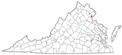
Coordinates: 38°36′57″N 77°20′35″W / 38.61583°N 77.34306°WCoordinates: 38°36′57″N 77°20′35″W / 38.61583°N 77.34306°W Country United States State Virginia County Prince William Area – Total 6.2 sq mi (16.0 km2) – Land 6.0 sq mi (15.6 km2) – Water 0.1 sq mi (0.3 km2) Elevation 125 ft (38 m) Population (2000) – Total 15,728 – Density 2,605.0/sq mi (1,005.8/km2) Time zone Eastern (EST) (UTC-5) – Summer (DST) EDT (UTC-4) ZIP code 22025 Area code(s) 571, 703 FIPS code 51-52658[1] GNIS feature ID 1867595[2] Montclair is a census-designated place (CDP) in Prince William County, Virginia, United States. The population was 15,728 at the 2000 census. Montclair is a residential community surrounding a man-made lake and golf course. Development began in the late 1960s and new home construction for the most part ended in the 1990s. Traditionally, residents of Montclair used the mailing address and ZIP code of Dumfries, although the town of Dumfries is several miles from Montclair. More recently, the United States Postal Service allowed residents to use "Montclair, VA" in their mailing address and on July 1, 2005, Montclair was given a separate ZIP code (22025).
Contents
Geography
Montclair is located at 38°36′57″N 77°20′35″W / 38.61583°N 77.34306°W (38.615881, -77.343042)[3].
According to the United States Census Bureau, the CDP has a total area of 6.2 square miles (16.0 km²), of which, 6.0 square miles (15.6 km²) of it is land and 0.1 square miles (0.3 km²) of it (2.11%) is water.
The heart of Montclair is Lake Montclair, which was created by damming the waters of Powell's Creek. The lake branches out in a forked pattern to accommodate the flow from storm drains. The lake is 25' deep off of Dolphin Beach, but potentially much deeper in the open water.
Demographics
As of the census[1] of 2000, there were 15,728 people, 5,084 households, and 4,326 families residing in the CDP. The population density was 2,605.0 people per square mile (1,005.4/km²). There were 5,184 housing units at an average density of 858.6/sq mi (331.4/km²). The racial makeup of the CDP was 77.63% White, 14.71% African American, 0.41% Native American, 3.02% Asian, 0.20% Pacific Islander, 1.08% from other races, and 2.94% from two or more races. Hispanic or Latino of any race were 4.51% of the population.
There were 5,084 households out of which 51.0% had children under the age of 18 living with them, 72.8% were married couples living together, 9.6% had a female householder with no husband present, and 14.9% were non-families. 11.0% of all households were made up of individuals and 1.4% had someone living alone who was 65 years of age or older. The average household size was 3.09 and the average family size was 3.35.
In the CDP the population was spread out with 32.4% under the age of 18, 6.9% from 18 to 24, 32.2% from 25 to 44, 25.2% from 45 to 64, and 3.4% who were 65 years of age or older. The median age was 34 years. For every 100 females there were 96.9 males. For every 100 females age 18 and over, there were 92.7 males.
The median income for a household in the CDP was $88,496, and the median income for a family was $92,028. Males had a median income of $60,410 versus $39,255 for females. The per capita income for the CDP was $30,711. About 2.3% of families and 2.6% of the population were below the poverty line, including 3.0% of those under age 18 and 6.7% of those age 65 or over.
Governance
Every year the Home Owner's Association, known as MPOA (Montclair Property Owner's Association), holds elections and confirms the newly elected Board at its annual meeting. MPOA governs the community making sure covenance is met, the lake is properly mainatained, and the needs of the community are looked after. Montclair also has a small security team that patrols the community in order to deter crime.
- Member of the Current Board (2009–2010):
- President - Catherine Kudrick
- Vice President - Brad Hancock
- Second Vice President - Tracy Hansen
- Secretary - Tim Jack
- Treasurer - Doug Taggart
- Precinct 1 - Bill McCombs
- Precinct 2 - Mark Roltsch
- Precinct 3 - Ned Greene
- Precinct 4 - Ray Boisvert
- Members at Large -
- Chris Casey
- Amy Frederick
References
- ^ a b "American FactFinder". United States Census Bureau. http://factfinder.census.gov. Retrieved 2008-01-31.
- ^ "US Board on Geographic Names". United States Geological Survey. 2007-10-25. http://geonames.usgs.gov. Retrieved 2008-01-31.
- ^ "US Gazetteer files: 2010, 2000, and 1990". United States Census Bureau. 2011-02-12. http://www.census.gov/geo/www/gazetteer/gazette.html. Retrieved 2011-04-23.
External links
- Prince William County Government
- Montclair Property Owners Association
- Montclair History
- The Montclair Post
- Free Montclair
- Prince William Conservation Alliance
Administration Prince William Board of County Supervisors · Prince William County Public Schools · Prince William County Park Authority · Prince William County Service Authority · Prince William County Public Library · Prince William County Department of Fire and Rescue · Prince William County Police Department · Prince William County Sheriff's OfficeOrganizations Prince William Chamber of Commerce · Prince William Symphony OrchestraLandmarks National Museum of the Marine Corps · Marine Corps Base Quantico · Hylton Performing Arts Center · Manassas National Battlefield Park · Jiffy Lube Live · Old Dominion Speedway · Prince William Forest Park · Leesylvania State Park · Potomac MillsTransportation Culture BattlesEventsDale City 4th of July ParadeEducation Municipalities and communities of Prince William County, Virginia Towns 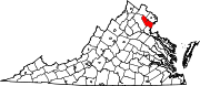
CDPs Buckhall | Bull Run | Bull Run Mountain Estates | Cherry Hill | County Center | Dale City | Gainesville | Independent Hill | Lake Ridge | Linton Hall | Loch Lomond | Marumsco | Montclair | Neabsco | Nokesville | Potomac Mills | Quantico Station‡ | Sudley | Triangle | West Gate | Woodbridge | Yorkshire
Unincorporated
communitiesAden | Agnewville | Antioch | Batestown | Bethel | Brentsville | Bristow | Buckland | Canova | Catharpin | Cornwell | Featherstone | Greenwich | Groveton | Hickory Ridge | Hoadly | Joplin | Kopp | Minnieville | Rixlew | Southbridge | Sudley Springs | Thoroughfare | Wellington
Footnotes ‡This populated place also has portions in an adjacent county or counties
Categories:- Populated places in Prince William County, Virginia
- Unincorporated communities in Virginia
- Census-designated places in Virginia
- Baltimore–Washington metropolitan area
- Member of the Current Board (2009–2010):


Wikimedia Foundation. 2010.