- Marumsco, Virginia
-
Marumsco — CDP — Location within the Commonwealth of Virginia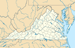
 Marumsco
Coordinates: 38°38′17″N 77°15′32″W / 38.63806°N 77.25889°WCoordinates: 38°38′17″N 77°15′32″W / 38.63806°N 77.25889°W Country United States State Virginia County Prince William Time zone Eastern (EST) (UTC-5) - Summer (DST) EDT (UTC-4) ZIP codes 22191 FIPS code 51-49792 GNIS feature ID 2629767 Marumsco is a census-designated place in Prince William County, Virginia. The population as of the 2010 Census was 35,036.[1] It consists of the major portion of what was Woodbridge CDP up to 2000, including the subdivisions of Marumsco Village, Marumsco Hills, Marumsco Acres and Marumsco Woods.
References
- ^ Virginia Trend Report 2: State and Complete Places (Sub-state 2010 Census Data). Missouri Census Data Center. Accessed 2011-06-08.
Municipalities and communities of Prince William County, Virginia County seat: Manassas Towns 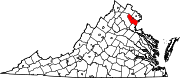
CDPs Buckhall | Bull Run | Bull Run Mountain Estates | Cherry Hill | County Center | Dale City | Gainesville | Independent Hill | Lake Ridge | Linton Hall | Loch Lomond | Marumsco | Montclair | Neabsco | Nokesville | Potomac Mills | Quantico Station‡ | Sudley | Triangle | West Gate | Woodbridge | Yorkshire
Unincorporated
communitiesAden | Agnewville | Antioch | Batestown | Bethel | Brentsville | Bristow | Buckland | Canova | Catharpin | Cornwell | Featherstone | Greenwich | Groveton | Hickory Ridge | Hoadly | Joplin | Kopp | Minnieville | Rixlew | Southbridge | Sudley Springs | Thoroughfare | Wellington
Footnotes ‡This populated place also has portions in an adjacent county or counties
Categories:- Populated places in Prince William County, Virginia
- Census-designated places in Virginia
- Northern Virginia geography stubs


Wikimedia Foundation. 2010.